Neighbourhoods of Allahabad
The Old Allahabad City, at the south of Prayagraj Junction Railway Station, consists of neighborhoods like Chowk, Johnstongunj, Dariyabad, Khuldabad etc.[1] and was in existence from the time of Akbar. Some magnificent structures erected in this era consist of the Khusro Bagh and the Allahabad Fort. In the north of Railway Station, the New Allahabad City consists of neighborhoods like Lukergunj, Civil Lines, Georgetown, Tagoretown, Bharadwaj Puram, Ashok Nagar, Mumfordgunj etc., which are relatively new and were built during the British rule.[2] These neighborhoods reflect British architecture like the All Saints Cathedral, Alfred Park and Allahabad High Court. Newer residential areas include neighborhoods like Kareli and suburbs like Naini and Jhunsi.
Alopibagh
Alopibagh is a locality/township of Allahabad, Uttar Pradesh, India. The locality is close to the Kumbh Mela area, the Sangam, the rivers Ganges and Yamuna, and one of the most ancient Hindu temples of India, the Alopi Devi Mandir, is also in this locality. Alopibagh is adjacent to Daraganj, the oldest suburb of Allahabad and the most important bathing Ghat on the bank of Ganges.
Bairahana
Bairahana is further divided into two localities:New Bairahana and the Old Bairahana. Near Bairahana chauraha is a medieval cemetery also called the "Gora Kabristan", where the dead bodies of British soldiers killed during 1857 revolt were buried.
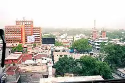
Benigunj
Benigunj is situated near to railways station.
Bharadwaj Puram
Bharadwaj Puram is a neighborhood in Allahabad in central part of the city. It is in between Tagore Town and Daraganj. It is near the major commercial centers of the city such as Katra and Civil Lines. There is a market within this locality on the Matiyara road which is very popular for shopping and dining options. There are several schools, hospitals, parks as well in this neighborhood.
Chowk
Chowk is the historic city centre of the Old Allahabad city. It is situated at southern part of Allahabad Municipal Council.1 Chowk serves as a traditional bazaar with The Grand Trunk Road running through the centre of it. Chowk is a historical point, where once stood the Neem tree where numerous freedom fighters were hanged in the first Indian War of Independence.
Civil Lines
Formerly known as Cannington[3] and Canning Town,[2] it is the central business district of Allahabad and is famous for its urban setting, gridiron plan[4] roads and high rise buildings. Built in 1857, under the supervision of Cuthbert Bensley Thornhill, it was the largest town-planning project carried out in India before the establishment of New Delhi.[2][4]
Georgetown
Georgetown is a neighborhood of Allahabad, India. It is a residential area in the central part of the city mainly occupied by the white collar workers, doctors and advocates. It also houses a large number of hospitals and clinics. Georgetown is famous for is affluent surroundings and apartments. It is bordered by Kamla Nehru Road in the west, Thornhill Road, MG Marg in the south and Tagoretown in the west. Notable landmarks located in and near the neighborhood are Alfred Park and Lowther Castle.
Lukergunj
Lukergunj is a posh residential area famous for its Victorian era bungalows and high-rise apartments. Lukergunj, well known for its clubbing culture, was once predominantly occupied by British and Anglo Indians. It is situated one kilometer south west from the Allahabad Railway Station.
Meerapur
Meerapur is an neighborhood/Locality in Allahabad. It is mainly famous for eateries as there are many sweet shops and markets for visitors. Old temples, mosques are the main attraction and symbolizes brotherhood. Meerapur is surrounded by River Yamuna from one side near Bargad Ghat.
Meergunj
This neighborhood is the infamously claimed red-light district of the city.[5] Apart from that it is also a densely populated residential area and a marketplace. It is located near Chowk.
Prayagraj
Prayagraj is one of the largest cities of the State of Uttar Pradesh in India. It encompasses a large area and is an inland peninsula surrounded by the rivers Ganges and Yamuna from three sides with only one side connected to the mainland. Along with a large number of areas within Prayagraj City, there are several satellite cities on the other side of the rivers Ganges and Yamuna, and are considered as satellite cities of Prayagraj. There are also a large number of Townships and Villages near Prayagraj City Within Prayagraj District. Posh pockets of the city include neighborhoods like Civil Lines, Cantonment or Allahabad Cantt, Kotwali, Dhoomanganj, Colonelganj, Mahaveer Puri, Shivkuti, Georgetown, Bharadwaj Puram, Kydgunj, and Attarsuiya.
South Malaka
South Malaka is a locality/township of Allahabad, Uttar Pradesh, India. It is close to the railway track connecting Allahabad to Varanasi and Gorakhpur. The other important institutions in the locality are Government Inter College and U.P.Government Central Library.
Suburbs of Allahabad
References
- "Uneasy calm prevails in old Allahabad areas". The Times of India. 19 August 2012. Retrieved 13 September 2013.
- Jonathan M. Bloom, Sheila Blai (2009). The Grove Encyclopedia of Islamic Art and Architecture, Volume 3. Oxford University Press. p. 57. ISBN 8125013830.
- Chatterton, Eyre. "A History of the Church of England in India". anglicanhistory.org. Retrieved 11 September 2013.
- Henry George Keene (1875). A Hand-book for Visitors to Lucknow: With Preliminary Notes on Allahabad and Cawnpore. J. Jetley. pp. 14–15. ISBN 8120615271.
- "Sex racket busted in Allahabad, 19 women detained". Zee News. 17 May 2012. Retrieved 13 September 2013.