Nenzel, Nebraska
Nenzel is a village in Cherry County, Nebraska, United States. The population was 20 at the 2010 census.
Nenzel, Nebraska | |
|---|---|
 | |
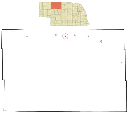 Location of Nenzel, Nebraska | |
| Coordinates: 42°55′37″N 101°6′6″W | |
| Country | United States |
| State | Nebraska |
| County | Cherry |
| Area | |
| • Total | 0.31 sq mi (0.81 km2) |
| • Land | 0.31 sq mi (0.81 km2) |
| • Water | 0.00 sq mi (0.00 km2) |
| Elevation | 3,114 ft (949 m) |
| Population | |
| • Total | 20 |
| • Estimate (2019)[3] | 19 |
| • Density | 61.09/sq mi (23.58/km2) |
| Time zone | UTC-7 (Mountain (MST)) |
| • Summer (DST) | UTC-6 (MDT) |
| ZIP code | 69219 |
| Area code(s) | 402 |
| FIPS code | 31-33985 |
| GNIS feature ID | 0831591[4] |
History
Nenzel was incorporated as a village in 1899.[5] It was named for George Nenzel, the original owner of the town site.[6][7]
Geography
Nenzel is located at 42°55′37″N 101°6′6″W (42.926906, -101.101766).[8]
According to the United States Census Bureau, the village has a total area of 0.31 square miles (0.80 km2), all land.[9]
Demographics
| Historical population | |||
|---|---|---|---|
| Census | Pop. | %± | |
| 1930 | 76 | — | |
| 1940 | 125 | 64.5% | |
| 1950 | 24 | −80.8% | |
| 1960 | 43 | 79.2% | |
| 1970 | 27 | −37.2% | |
| 1980 | 28 | 3.7% | |
| 1990 | 8 | −71.4% | |
| 2000 | 13 | 62.5% | |
| 2010 | 20 | 53.8% | |
| 2019 (est.) | 19 | [3] | −5.0% |
| U.S. Decennial Census[10] 2012 Estimate[11] | |||
2010 census
At the 2010 census there were 20 people, 7 households, and 5 families living in the village. The population density was 64.5 inhabitants per square mile (24.9/km2). There were 8 housing units at an average density of 25.8 per square mile (10.0/km2). The racial makeup of the village was 75.0% White and 25.0% Native American.[2] Of the 7 households 42.9% had children under the age of 18 living with them, 57.1% were married couples living together, 14.3% had a male householder with no wife present, and 28.6% were non-families. 28.6% of households were one person and 28.6% were one person aged 65 or older. The average household size was 2.86 and the average family size was 3.40.
The median age in the village was 31.5 years. 40% of residents were under the age of 18; 0.0% were between the ages of 18 and 24; 20% were from 25 to 44; 20% were from 45 to 64; and 20% were 65 or older. The gender makeup of the village was 45.0% male and 55.0% female.
2000 census
At the 2000 census, there were 13 people, 6 households, and 4 families living in the village. The population density was 41.7 inhabitants per square mile (16.1/km2). There were 6 housing units at an average density of 19.3 per square mile (7.5/km2). The racial makeup of the village was 100.00% White.
Of the 6 households 16.7% (1 household) had children under the age of 18 living with them, 66.7% (4 households) were married couples living together, and 33.3% (2 households) were non-families. 33.3% (2 households) of all households were one person and 16.7% (1 houseshold) had someone living alone who was 65 or older. The average household size was 2.17 and the average family size was 2.75.
The age distribution was 23.1% under the age of 18, 23.1% from 25 to 44, 23.1% from 45 to 64, and 30.8% 65 or older. The median age was 48 years. For every 100 females, there were 85.7 males. For every 100 females age 18 and over, there were 66.7 males.
The median household income was $53,750, and the median family income was $53,750. Males had a median income of $28,750 versus $26,250 for females. The per capita income for the village was $21,600. None of the population and none of the families were below the poverty line.
References
- "2019 U.S. Gazetteer Files". United States Census Bureau. Retrieved July 26, 2020.
- "U.S. Census website". United States Census Bureau. Retrieved 2012-06-24.
- "Population and Housing Unit Estimates". United States Census Bureau. May 24, 2020. Retrieved May 27, 2020.
- "US Board on Geographic Names". United States Geological Survey. 2007-10-25. Retrieved 2008-01-31.
- "Nenzel, Cherry County". Center for Advanced Land Management Information Technologies. University of Nebraska. Retrieved 2 August 2014.
- Fitzpatrick, Lillian L. (1960). Nebraska Place-Names. University of Nebraska Press. p. 39.
- Chicago and North Western Railway Company (1908). A History of the Origin of the Place Names Connected with the Chicago & North Western and Chicago, St. Paul, Minneapolis & Omaha Railways. p. 106.
- "US Gazetteer files: 2010, 2000, and 1990". United States Census Bureau. 2011-02-12. Retrieved 2011-04-23.
- "US Gazetteer files 2010". United States Census Bureau. Archived from the original on 2012-01-25. Retrieved 2012-06-24.
- United States Census Bureau. "Census of Population and Housing". Retrieved October 19, 2013.
- "Annual Estimates of the Resident Population: April 1, 2010 to July 1, 2012". Archived from the original on November 20, 2013. Retrieved October 19, 2013.
| Wikimedia Commons has media related to Nenzel, Nebraska. |
Municipalities and communities of Cherry County, Nebraska, United States | ||
|---|---|---|
| City | Map of Nebraska highlighting Cherry County | |
| Villages | ||
| CDP | ||
| Other unincorporated communities | ||
| Ghost towns | ||
| ||
