Ngor Okpala
Ngor Okpala is a Local Government Area of Imo State, Nigeria. Its headquarters is in the town of Umuneke Ngor.
Ngor Okpala | |
|---|---|
LGA | |
| Country | Nigeria |
| State | Imo State |
| Time zone | UTC+1 (WAT) |
It has an area of 561 km²; it has a population of 159,932 at the 2006 census. It is a notable place in Imo state because of the LGA's locational position. It connects Abia and Rivers states of Nigeria. It is the largest local government area in Imo State and one of the largest in Nigeria.
The postal code of the area is 460.[1] There are many Communities in Ngor Okpala They include: Umuowa, Obiangwu, Ntu, Alulu, Amala, Oburu, Obokwe, Eziama, Ohekelem, Nnorie, Umuhu, Ihite-Okwe, Obike, Elelem, Umuohiagu, Imerienwe, Nguru-Umuaro, Orishieze, Upe, Umuekwune, Logara, Umukabia-Ogodo and many others.
Imo Airport officially called Sam Mbakwe International Cargo Airport is situated in Ngor-Okpala with its busiest junction at Umuowa along Owerri-Aba road.
Ngor Okpala is one of the fastest developing local governments in Imo State. The LGA is blessed with natural and mineral resources which have not been fully tapped.
In Ngor Okpala is a popular town named Okpala. Okpala is one of the villages in Ama-Asaa, due to the popularity of the name it takes over the name 'Ama-Asaa', 'Okpala Junction'. Okpala the central of the seven villages has four kindred which include Amankwu, Amaube, Umuokereke, and Umuodah.
References
- "Post Offices- with map of LGA". NIPOST. Archived from the original on 2012-11-26. Retrieved 2009-10-20.
State capital: Owerri | ||
| Local Government Areas | 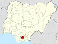 | |
Currently, there are a couple of new communities in Ngor okpala Local Government Area. These will have to be included in the communities as listed. There is Alatia Autonomous community and we also have the Ikem Autonomous community. The communities were carved out from Amala ancient kingdom.