Njaba
Njaba is a Local Government Area of Imo State, Nigeria. Its headquarters are in the town of Nnenasa.[1] It has an area of 84 km2 and a population of 143,485 at the 2006 census.[2] The 2011 density projection is 2,004.5 inhabitants/km2.[2] The postal code of the area is 474.[3]
Njaba
NJALGA | |
|---|---|
LGA | |
| Nickname(s): NJALGA | |
| Country | |
| State | Imo State |
| Area | |
| • Land | 32 sq mi (84 km2) |
| Population (2006) | |
| • Total | 143,485 |
| Time zone | UTC+1 (WAT) |
History
The name "NJABA" is an acronym formed from the initial letters of Njaba River. A river that originally springs from north-western part of Isu at Isunjaba town, and runs all the way to Oguta and then finally terminates into the famous Oguta Lake. NJALGA was part of the then Isu Local Government area created by the Civilian Government headed by Alhaji Shehu Shagari on May 27, 1980.[1] Developing towns and settlements in the Local Government Area include Umuaka, Amazano, Isiozi, Ugbelle, Achara, Ibelle, Okwudor, Nkume, Attah, Amucha, and Egwedu.[1]
Location and Boundaries
Njaba LGA is bounded by Oru East, Isu, Mbaitoli, Orlu and Nkwerre Local Government Areas.[2] Njaba Local Government Area (NJALGA), is located east of Oru East Local Government Area with Awo-Omamma as the nearest border town overlooking Okwudor. NJALGA via Okwudor shares its common boundary with Awo-omamma on the western axis. On the north and, north-east, it is bounded by Obor, Umutanze, Umudioka and Umuowa communities in Orlu LGA. NJALGA is bounded on the west and south-west by Amurie-Omanze and Ekwe Communities of Isu Local Government Area, while it shares its southern border with Orodo town of Mbaitoli Local Government area bordering Umuaka. Njaba River then demarcates Umuaka of NJALGA from Ekwe Community of Isu in the western borders.[1]
NJALGA, especially in the Umuaka and Okwudor communities, is almost located in a heavily re-enforced rain forest and valleyed area.[1]
References
- "Brief History Of Njaba Local Government". www.oocities.org. Retrieved May 22, 2016.
- "Imo (State): Njaba (Local Government Area)". www.citypopulation.de. Retrieved May 22, 2016.
- "Post Offices- with map of LGA". NIPOST. Archived from the original on October 7, 2009. Retrieved 2009-10-20.
State capital: Owerri | ||
| Local Government Areas | 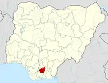 | |
