Nipmuck Trail
The Nipmuck Trail is a Blue-Blazed hiking trail "system" which meanders through 34.5 miles (55.5 km) of forests in northeast Connecticut. It is maintained by the Connecticut Forest and Park Association and is considered one of the Blue-Blazed hiking trails. There are two southern trail heads (two tines of a fork) in the south of the town of Mansfield, Connecticut. The southwestern terminus is at a road shoulder parking place on Puddin Lane, and the southeastern terminus is a DEEP parking lot on North Windham Road at the southeast corner of Mansfield Hollow State Park. The northern terminus is at the north end of Breakneck Pond along the Massachusetts border in Nipmuck State Forest. Camping permits may be obtained for up to five separate locations for backpacking.
| Nipmuck Trail | |
|---|---|
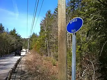 Nipmuck Trail sign on CT-171 outside Bigelow Hollow State Park. | |
| Length | 34.5 miles (55.5 km) [1] |
| Location | Tolland County, Connecticut, USA |
| Designation | CFPA Blue-Blazed Trail |
| Use | hiking, cross-country skiing, snowshoeing, fishing, geocaching, other |
| Hiking details | |
| Hazards | hunters, deer ticks, poison ivy |
For 9 miles (14 km) the Nipmuck Trail travels through the Yale-Myers Forest which is owned by Yale University. The trail also traverses 3.5 miles (5.6 km) of the University of Connecticut's East Campus (the protected Moss tract through the Fenton Forest).[2][3][4]
Trail description
The Nipmuck Trail is primarily used for hiking, backpacking, picnicking, and in the winter, snowshoeing.
Portions of the trail are suitable for, and are used for, cross-country skiing and geocaching. Site-specific activities enjoyed along the route include bird watching, hunting (very limited), fishing, horseback riding, bouldering and rock climbing (limited).
The mainline trail is blazed with blue rectangles. Trail descriptions are available from a number of commercial and non-commercial sources, and a complete guidebook is published by the Connecticut Forest and Park Association
Historic sites
There is a historic gristmill near the trail in Storrs, Connecticut. Across from this is the house where Wilbur Cross was born.
History
The Blue-Blazed Nipmuck Trail was created by the Connecticut Forest and Park Association.
Maintenance
The last week of March 2010 the Connecticut Forest and Park Association acquired the largest conservation easement in an agreement with the University of Connecticut for the 3.5 miles (5.6 km) section of the Nipmuck Trail which passes through University of Connecticut protected property (the Moss tract through the Fenton Forest).[2] Also on that date a number of conveyances between the University of Connecticut, CFPA, the Norcross Wildlife Foundation and the towns of Willington and Mansfield secured the preservation of 531 acres (2.15 km2) of land on four forested properties near or surrounding the Nipmuck Trail.[3][4]
Gallery
- Nipmuck Trail sign on CT-171 outside Bigelow Hollow State Park.
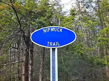 Nipmuck Trail sign on CT-171 outside Bigelow Hollow State Park.
 Natchaug Trail northern trailhead at intersection with Nipmuck Trail in Ashford, CT.
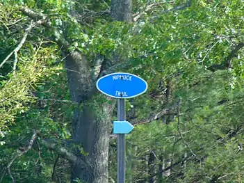 The trail in the Mansfield Hollow State Park in Mansfield, Connecticut.
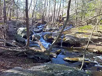 Pixie Falls in Natchaug State Forest in Ashford via side trail from Nipmuck Trail.
- Pixie Falls in Natchaug State Forest in Ashford via side trail from Nipmuck Trail.
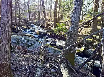
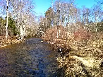 Fenton River along Nipmuck Trail just north of CT Route44 (U Conn Forest).
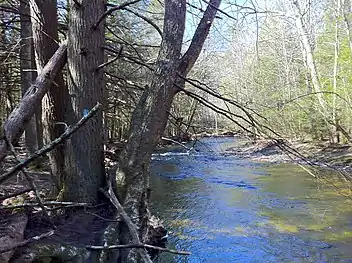 Fenton River along Nipmuck Trail just north of CT Route44 (U Conn Forest).
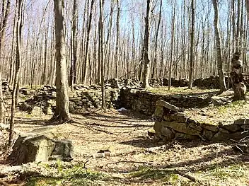 Old stone house foundations at intersection of Nipmuck Trail and forest road half way between CT Routes 44 and 74.
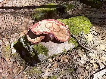 1' diameter fungus with peace sign on rock beside Nipmuck Trail in Yale-Myers Forest.
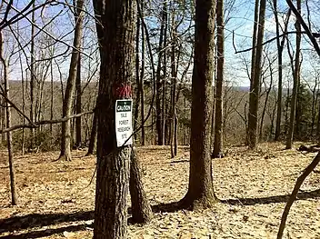 Yale-Myers Forest Research Site off Nipmuck Trail.
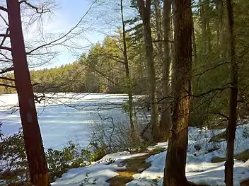 Southern Breakneck Pond on Nipmuck Trail facing north on the last day of winter.
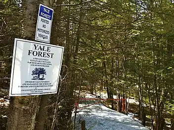 Yale-Myers Forest Signs and northern entrance to Nipmuck Trail on Bigelow Hollow Road AKA CT Route 197 near Bigelow Hollow State Park.
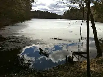 Sturbridge Massachusetts end of partially frozen Breakneck Pond facing south. Northern terminus of Nipmuck Trail.
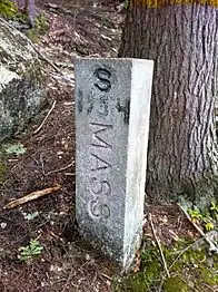 Massachusetts/Connecticut state line marker dated 1954 at northern end of Breakneck Pond facing south.
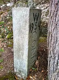 Connecticut/Massachusetts state line marker dated 1954 at northern end of Breakneck Pond facing north.
References
- Colson, Ann T. (2006). Connecticut Walk Book West (19th edition). Connecticut Forest and Park Association. ISBN 0-9619052-6-3.
- The Daily Campus April 1, 2010: UConn helps to preserve local forest
- UConn Today March 30, 2010: Deal Between Conservation Organizations, UConn, and Area Towns Protects 531 Acres in Eastern CT
- The Day March 28, 2010: Agreement protects forest, trails near UConn
- Connecticut Forest & Park Association Cited September 13, 2008.
Further reading
Books – Connecticut hiking []
- Colson, Ann T. (2005). Connecticut Walk Book East (19 ed.). Rockfall, Connecticut: Connecticut Forest and Park Association. pp. 1–261. ISBN 0961905255.
- Colson, Ann T. (2006). Connecticut Walk Book West (19 ed.). Rockfall, Connecticut: Connecticut Forest and Park Association. pp. 1–353. ISBN 0961905263.
- Emblidge, David (1998). Hikes in southern New England: Connecticut, Massachusetts, Vermont (1 ed.). Mechanicsburg, Pennsylvania: Stackpole Books. pp. 1–304. ISBN 0-8117-2669-X.
- Keyarts, Eugene (2002). Pietrzyk, Cindi Dale (ed.). Short Nature Walks: Connecticut Guide Book (7 ed.). Guilford, Connecticut: Falcon Publishing. pp. 1–192. ISBN 0-7627-2310-6.
- Laubach, Rene; Smith, Charles W. G. (2007). AMC's Best Day Hikes in Connecticut (1 ed.). Guilford, Connecticut: Appalachian Mountain Club Books. pp. 1–320. ISBN 1-934028-10-X.
- Ostertag, Rhonda; Ostertag, George (2002). Hiking Southern New England (2 ed.). Guilford, Connecticut: Falcon Publishing. pp. 1–336. ISBN 0-7627-2246-0.
Books – Connecticut history and geography []
- De Forest, John (1853). History of the Indians of Connecticut from the earliest known period to 1850. Hartford, Connecticut: Wm. Jas. Hamersley. pp. 1–509.
- Hayward, John (1857). New England Gazetteer: Containing Descriptions of the States, Counties, Cities and Towns of New England (2 ed.). Boston, Massachusetts: Otis Clapp. pp. 1–704.
- Trumbull, Benjamin (1797). A Complete History of Connecticut - Civil and Ecclesiastical. Volume I (1818 printing ed.). New Haven, Connecticut: Maltby, Goldsmith & Co. and Samuel Wadsworth. pp. 1–1166.
- Trumbull, Benjamin (1797). A Complete History of Connecticut - Civil and Ecclesiastical. Volume II (1818 printing ed.). New Haven, Connecticut: Maltby, Goldsmith & Co. and Samuel Wadsworth. pp. 1–1166.
External links
Specific to this trail:
- Connecticut Explorers Guide: Nipmuck Trail Overview Map
- Connecticut Explorers Guide: Nipmuck Trail Southern Trailheads Map
- Connecticut Explorers Guide: Nipmuck Trail Southern Trails Junction to RT 74 Map
Government Links:
Land and Conservation Trusts:
- Joshua's Tract Conservation and Historic Trust, Inc.
- Joshua's Tract/Tract Trails Walk Book
- Joshua's Tract/Trust Trail Maps
| ||