Norrie, Colorado
Norrie (also known as the Norrie Colony) is an unincorporated community and a census-designated place (CDP) located in and governed by Pitkin County, Colorado, United States. The population of the Norrie CDP was 7 at the United States Census 2010.[4] The Meredith post office (Zip Code 81642) serves the area.[3] The CDP is a part of the Glenwood Springs, CO Micropolitan Statistical Area.
Norrie, Colorado | |
|---|---|
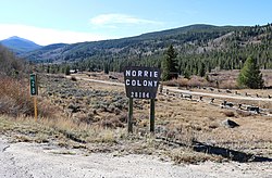 The entrance to Norrie along Frying Pan Road at mile marker 28. | |
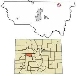 Location of the Norrie CDP in Pitkin County, Colorado. | |
 Norrie Location of the Norrie CDP in the United States. | |
| Coordinates: 39°19′41″N 106°39′23″W[1] | |
| Country | |
| State | |
| County | Pitkin County |
| Government | |
| • Type | unincorporated community |
| Area | |
| • Total | 0.188 sq mi (0.487 km2) |
| • Land | 0.188 sq mi (0.487 km2) |
| • Water | 0.000 sq mi (0.000 km2) |
| Elevation | 8,464 ft (2,580 m) |
| Population (2010) | |
| • Total | 7 |
| • Density | 37/sq mi (14/km2) |
| Time zone | UTC-7 (MST) |
| • Summer (DST) | UTC-6 (MDT) |
| ZIP Code[3] | Meredith 81642 |
| Area code(s) | 970 |
| GNIS feature[2] | Norrie CDP |
History
Norrie was originally settled in the late 1880s. It began as a camp for railroad workers building the Colorado Midland Railway route along the Fryingpan River. The workers harvested trees used in the railroad construction, and they made ice in the local ponds, ice used in the railroad's refrigerator cars. Now, many privately-owned summer cabins line the community's quiet streets.[5]
Geography
The Norrie CDP has an area of 120 acres (0.487 km2), all land.[1]
Demographics
The United States Census Bureau initially defined the Norrie CDP for the United States Census 2010.
| Year | Pop. | ±% |
|---|---|---|
| 2010 | 7 | — |
| 2020 | — | |
| Source: United States Census Bureau | ||
See also
- Outline of Colorado
- State of Colorado
- Colorado cities and towns
- Colorado counties
References
- "State of Colorado Census Designated Places - BAS20 - Data as of January 1, 2020". United States Census Bureau. Retrieved December 26, 2020.
- "U.S. Board on Geographic Names: Domestic Names". United States Geological Survey. Retrieved December 26, 2020.
- "Look Up a ZIP Code". United States Postal Service. Retrieved December 26, 2020.
- "2010: DEC Summary File 1". United States Census Bureau. Retrieved December 26, 2020.
- "Fryingpan Valley and Ruedi Reservoir visitor's guide" (PDF). Roaring Fork Conservancy. Retrieved 2020-10-23.
External links
Municipalities and communities of Pitkin County, Colorado, United States | ||
|---|---|---|
| City | 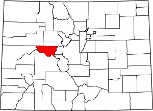 Map of Colorado highlighting Pitkin County | |
| Towns | ||
| CDPs | ||
| Unincorporated communities | ||
| Ghost towns | ||
| Footnotes | ‡This populated place also has portions in an adjacent county or counties | |
| ||