Norwegian National Road 13
National Road 13 (Norwegian: Riksvei 13) is a national road which runs from the town of Stavanger in Rogaland county to the village of Sogndalsfjøra in Vestland county. The route is 449.9 kilometers (279.6 mi) long and runs south–north through Rogaland and Vestland counties, following a more inland path than the European route E39 highway.
| |
|---|---|
| Bokmål: Riksvei 13 Nynorsk: Riksveg 13 | |
 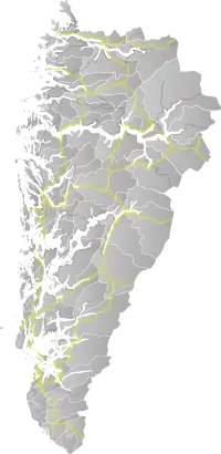 Location in Western Norway. The map is not updated. | |
| Route information | |
| Length | 450 km (280 mi) |
| Major junctions | |
| South end | Stavanger, Rogaland |
| North end | Sogndalsfjøra, Vestland |
| Highway system | |
| National Roads in Norway | |

Prior to 2019, the northern terminus of the road was at the village of Balestrand, but in 2019, the section of Norwegian County Road 55 from Balestrand to Sogndalsfjøra was added to this road. In 2020, a new tunnel was opened between Stavanger and Tau, Ryfylke Tunnel, the world's deepest public road tunnel. National Road 13 was then rerouted through this tunnel, making it end in Stavanger instead of Sandnes. The road between Tau and Sandnes which has a ferry crossing (Oanes to Lauvika across the Høgsfjorden) was changed to county roads.
Route description
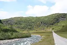
From the village of Balestrand to the town of Førde, the route continues north as County Road 13. The route has two ferry crossings: Vangsnes to Dragsviki (across the Sognefjorden), and Nesvik to Hjelmelandsvågen (across the Jøsenfjorden). Parts of the road have been designated as National Tourist Routes.[1]
There are several tunnels on this highway; the longest of which are the Ryfylke Tunnel (14.4-kilometre (8.9 mi)), Hundvåg Tunnel, Tunsberg Tunnel, Vallavik Tunnel, and Fresvik Tunnel. The Hardanger Bridge was completed in 2013, and it carries this highway across the large Hardangerfjorden.
There are signposted concurrencies with the European route E134 between Horda and Skare, and the European route E16 between Vossevangen and Vinje. The E134 concurrency adds the Røldal and Horda spiral tunnels to the total.
References
| Wikimedia Commons has media related to Riksveg 13. |
- "Nasjonal turistveg Ryfylke" (in Norwegian). Norwegian Public Roads Administration. Archived from the original on 5 October 2011. Retrieved 5 October 2011.
|  | |