Norwich Over the Water
Norwich Over the Water or the Silver Triangle is the name given to a district located in the north city centre of Norwich, England, that spreads outwards from the city centre towards Sprowston. The term "Silver Triangle" has also been used to refer to the large expanse of Victorian terraced north of Magdalen Street, after the city's other Victorian district, the Golden Triangle. Magdalen Street is a busy, cosmopolitan street home to many independent businesses, pubs and churches.
| Norwich Over the Water | |
|---|---|
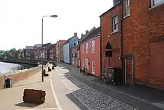
 Quayside by the River Wensum, Norwich | |
 Norwich Over the Water Location within Norfolk | |
| OS grid reference | TG231093 |
| Metropolitan borough | |
| Metropolitan county | |
| Region | |
| Country | England |
| Sovereign state | United Kingdom |
| Post town | NORWICH |
| Postcode district | NR3 |
| Dialling code | 01603 |
| Police | Norfolk |
| Fire | Norfolk |
| Ambulance | East of England |
| UK Parliament | |
Description
The district lies within the borders of the ancient roads into Norwich, St Augustine's Street, across to Constitution Hill and Silver Road (where the area gets its name) meeting at Magdalen Street into the northern Wensum Street area of the city. The majority of the buildings along Magdalen Street date back to the Tudor and Georgian period. As the road follows out past the flyover and into Magdalen Road, the surrounding streets are Victorian terraces and town houses, built between the 1890s and early 1900s.
In the 18th and 19th century, as Norwich expanded the ancient area of Bull Close was gradually urbanised. Rows of back-to-back cottages were built in the Cowgate area, north of Barrack Street. This was followed in the Victorian era by more grand houses, especially along Silver Road and Waterloo Road. The district quickly became home to the working class population of Norwich, with the Steward & Patteson Brewery nearby. Two of the city's parks, Waterloo Park and Sewell Park, are located in or around the area, including Mousehold Heath which is nearby.
The residential area has a cosmopolitan mix of students from Norwich University of the Arts, young professionals, and families. The area is characterised by its terrace housing and an array of pubs and parks.
History
Anglo-Saxon period
According to archaeological evidence, Norwich Over the Water was settled very early on in the city's history. Saxon burial remains and funerary items were found on the district's Eade Road, indicating that the area was the site of an inhumation cemetery and cremations. It is believed to be part of a larger cemetery; however, further archaeological excavation has been unable to find additional remains or substantiate the cemetery's exact size.
Archaeological evidence also indicates that, being an Anglo-Saxon settlement and major trading area, Norwich Over the Water was defended against attack on three sides. Excavations have unearthed part of a defensive structure starting in the St George's Street area and extending northward toward Anglia Square.
According to the Anglo-Saxon Chronicle, Sweyn Forkbeard, King of Denmark, attacked Norwich in 1004 CE. The city was sacked and burned. Once rebuilt, many of the town's churches (now long demolished) took names which referred to this attack. For example, a church named St Margaret Combust once stood close to Magdalen Gates on the site of Throckmorton Yard; another, called St Mary Unbrent (Unburnt), stood opposite Gurney Court.
When the town was rebuilt, the area south of the river was first developed. After the city walls were built in 1290 CE, the area north of the river gradually became known as Norwich Over the Water. During the Tudor period, the name "Norwich Over the Water" was used in records used for the calculation of taxes and other official documents.
19th century
The area continued to be known as Norwich Over the Water until the expansion of the city past Magpie Road and Bull Close Road in the nineteenth century. After that, with outlying areas becoming part of the city, Norwich Over the Water gradually became part of the city centre. In 1832, electoral reforms finally ended over 500 years of the name's official usage.
1965-1973
Many grand buildings, from Tudor to Georgian, were demolished and cleared around the main streets in the North part of the city centre St George's Street, Pitt Street and Calvert Street to make way for the inner ring road, and the Anglia Square shopping centre.
Parishes and churches
.jpg.webp)
Norwich Over the Water contains a number of churches, many with long histories:
- St Augustine's Church, located on the east side of Gildencroft.
- St Clement's Church
- St Edmund's Church: Located on Fishergate, St Edmund's was founded during the reign of William I. Still standing are a nave, chancel, south aisle, and tower with one bell. The nave's arches are nearly flat, its subarches carried on shafts with moulded caps.
- St George's Church, Colegate: The only medieval church in Norwich Over the Water still used regularly for worship.[1]
- St James's Church: Located in Cowgate, St James includes Pockthorpe in its parish. It was a well-endowed rectory till 1201, when it was appropriated to the Cathedral Priory.
- St Martin at Oak: Located in St Martins Lane, to the south of St Crispins Road.
- St Mary at Coslany
- St Michael Coslany
- St Saviour's Church, on Magdalen Street. This is a small structure, with a square tower containing two bells. It has some modern monuments. The font is an octagonal panelled basin, supported by four shafts resting on lions' heads and carried through ogee canopies with pinnacles between.
Lost churches
Historic churches in the area which no longer survive include:
- St Margaret Combust: Also referred to as Sancta Margareta uni sepulientur suspensi, it stood 100 metres inside Magdalen Gate or Fybriggate, and was used as a burial ground for those hanged at the gallows outside. The church was demolished in 1547. The site was partially excavated in the 1980s prior to the construction and development of Throckmorton Yard, formerly the site of the Norfolk and Norwich Blind Institute. Excavations show the extent of the poverty in the area, but also indicate that the poor communities in the area provided support to those with severe congenital disorders and other diseases into relative old age. Examination of exhumed remains found evidence of individuals who were much older than would be expected given the period's average lifespan.
- St Olave's Church: Once located on the edge of Pitt Street and what is now Magdalen Street Flyover, St Olave's was closed in 1534 and demolished two years later.
- All Saint's Fybriggate: Demolished in 1550, this church once stood on the corner of Cowgate and Magdalen Streets.
- St Mary Unbrent: This church, which stood on the corner of Golden Dog Lane and Magdalen Street, was demolished in 1546.
- St Botolph's Church: Demolished in 1548, St Botolph's was once located at the junction of Magdalen Street and Botolph Street (now under Anglia Square). This area became known as Stump Cross after the remains of a medieval cross which stood there.
- St John Colegate: Located on a site now occupied by the Octagon Chapel, St John Colegate remained as an anchorite until its demolition in 1540.
- St Margaret Newbrigge: Once stood on a site to the north of Norwich playhouse in St Georges Street, abandoned after 1368.
- St Paul's Church: This church once stood in St Paul's Square/Plain, off Barrack Street. It had a round tower, whose upper portion was octagonal. The tower was rebuilt around 1819 of white brick with stone coping. It was designed chiefly in the perpendicular style, including a north aisle, and a parclose at the east end, but did have some decorated windows. The church was burnt out on the night of 27 June 1942 during a World War II air raid in World War II, leaving only the tower and outer walls standing. The church was repaired after the war, but was demolished in 1970 to make way for the flyover which formed part of the inner ring road. The site of the tower and graveyard is now a children's play area and park. The name 'St Paul' survives today in the area around the site of the church, and on a new church in Hellesdon.
Pubs
Starting at the beginning of Magdalen Street, the area once had over 40 public houses. Over the years many have closed or been demolished, and only 18 are still serving.
- The Miss Chief
- The Ribs of Beef
- The Kings Arms
- The Plasterers Arms
- The Bluebell
- The Leopard
- The Artichoke
- The Cottage
- The Marlborough Arms
- The Robin Hood
- The Stanley
- The Whalebone
- The Dyers Arms
- The Fat Cat Brewery Tap
- The Rosebery
- The Prince of Denmark
- The Duke of Wellington
- The Angel Gardens
Notable parts of the area
Magdalen Street has been the area's main street used for shopping for hundreds of years. It served as a route through the Anglo-Saxon burgh or defended area, and as the principal road from the southern part of Norwich to the North. There have been bridges across the river for over 1000 years.
In 1959, the Civic Trust helped to improve the area's building frontages, unkempt areas, and cluttered traffic signs as part of an experiment in civic design. On 8 May 1959, Rt. Hon. Duncan Sandys, M. P., President of the Civic Trust, led five hundred delegates from all over the country on an inspection tour. It was the first of its kind and would become famous throughout the world. After this experiment, similar pilot schemes were launched in Burslem, Windsor, and Haddington.
- Silver Triangle
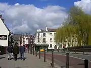
 Bridge over the River Wensum, the Mischief Tavern is on the left.
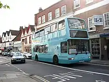
 Bus in Magdalen Street, The Kings Head public house can be seen in the distance.
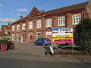
 Former Tram Depot, Silver Road.
Notable people
- Sir John Fastolf KG (1378–1459): Though his primary property was at Caister-on-Sea, Fastolf did own a house in Cowgate Norwich, opposite St James Church (now the Norwich Puppet Theatre). The house became a public attraction, but was demolished in the 1930s.
- Matthew Parker (1504–1575): Parker served as the Archbishop of Canterbury.
- Thomas Anguish (died 1617): Anguish became a freeman of the city in 1573. He also served as sheriff and Speaker of the Council. In 1611 he was elected mayor, after which he held a pageant and fireworks display outside his house. The fireworks display exploded accidentally, and 33 people were crushed to death running from the explosion. Before his death in 1617, Anguish made provisions in his will to help the poor children of Norwich, allotting about £5000 (valued at more than £8.5 million today). He gave the city corporation property in Fishergate to be used as a hospital, which opened in 1621. King Charles granted the hospital a charter in 1628, and demanded that it be called the Children's Hospital in the City of Norwich of the Foundation of King Charles. The hospital initially admitted only boys; girls were admitted some years later. In 1864, a girls' house was opened for girls in Lakenham. The building in Fishergate was demolished in the 1930s.
- Luke Hansard (1752–1828): Publisher of the record of Parliament.
- Amelia Opie (1769–1853): A writer, Opie was born at 3 Snailgate, later renamed Calvert Street.
- William Crotch (5 July 1775 – 29 December 1847): Crotch was a composer, organist, and artist.
- Elizabeth Fry (1780–1845): Fry was an advocate for prison reform. She was born in Gurney Court, off Magdalen Street.
- Harriet Martineau (1802–1876): Writer and social reformer, Martineau, like Fry, was also born in Gurney Court, off Magdalen Street.
- George Brody (1866–1912): A fish porter, Brody lived in Saw Mills Yard on Oak Street. During the great floods of August 1912, he saved several women and children from the flood waters, but lost his footing and was swept away. He left a wife with a physical disability and an aged mother. The Lord Mayor sent a floral tribute with a card saying "From the Lord Mayor and Lady Mayoress of Norwich as a mark of deep sympathy, and as a tribute of respect to a true hero, who gave his life in a noble endeavour to save the lives of others." His funeral at Norwich Cemetery was widely attended with displays of considerable public sympathy. After Brody's death, a local artist, Mr Ovens, proposed that a statue should be made of Brody and produced a model. However, the status was never constructed. Brody is honoured by a poem by Ben Norton.
Local men at the battle of Trafalgar
Ten men from Norwich Over the Water served with the Royal Marines at the Battle of Trafalgar:
- Private John Brady, age 16, from St Edmund's parish
- Sergeant James Secker, age 24; Private William Bishop, age 26; Private John Miller, age 16; and Private William Simmonds, age 32, all from St Martin's at Oak
- 2nd Lieutenant Armiger Watts Hubbard, age 22; Private Peter Turgle, age 44; and Drummer George Whitfield Carlton, age 17, all from St Augustine's parish
- Private Thomas Pound, age 29, from St Michael at Coslany (St Miles)
- Sergeant Lavender Whall (Hall), age 25, from St James parish
Military records do not show servicemen who provided just "Norwich," rather than their parish, as their addresses. Consequently, there could be others from the area not listed here.
Norwich over the Water groups
In the 1970s, led by the Rev Jack Burton, a group formed to advocate for the improvement of Norwich Over the Water. The group campaigned against the local council's threats to the Colegate area. They achieved considerable influence and managed to moderate some of the council's plans.
In 2002, a second Norwich Over the Water group was formed by Paul Scruton and David Bethell. The group fielded candidates in the local council elections, under the auspices of the Norwich Over the Water Party – which was separate from, but associated with, the Norwich Over the Water group. The group gained permission from the Rev Burton to adopt the emblem that the first group had used in the 1970s.
Since 2002, the group has produced many leaflets and promotional items advertising the area's business and history.
References
- "A Short History of St George Colegate" (PDF). A Church Near You. Archbishops' Council. Retrieved 8 December 2015.
Sources
- Hudson, Rev. William (1891). The Wards of the City of Norwich.
- Banger, Joan (1974). Norwich at War. Norwich: Wensum Books. ISBN 0-903619-16-4.
- Civic Trust (1961). Magdalen Street, Norwich: An experiment in civic design 1958–59.
- Groves, Dr Nicholas (2010). The Medieval Churches of the City of Norwich. East Publishing. ISBN 978-0-9560385-1-7.
