O'Neill Municipal Airport
The O'Neill Municipal Airport (IATA: ONL, ICAO: KONL, FAA LID: ONL) (John L. Baker Field) is two miles northwest of O'Neill, in Holt County, Nebraska. It is owned by the O'Neill Airport Authority.[1] The FAA's National Plan of Integrated Airport Systems for 2009–2013 categorized it as a general aviation facility.[2]
O'Neill Municipal Airport John L. Baker Field | |||||||||||
|---|---|---|---|---|---|---|---|---|---|---|---|
| Summary | |||||||||||
| Airport type | Public | ||||||||||
| Owner | O'Neill Airport Authority | ||||||||||
| Serves | O'Neill, Nebraska | ||||||||||
| Elevation AMSL | 2,031 ft / 619 m | ||||||||||
| Coordinates | 42°28′10″N 098°41′14″W | ||||||||||
| Map | |||||||||||
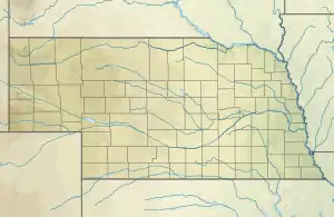
 ONL Location of airport in Nebraska / United States  ONL ONL (the United States) | |||||||||||
| Runways | |||||||||||
| |||||||||||
| Statistics (2009) | |||||||||||
| |||||||||||
The field is named after John L. Baker, a native of O'Neil who was a fighter pilot in the Korean War, the United States Department of Justice's first air-crash attorney, counsel to the United States Senate, and the Federal Aviation Administration as Assistant Systems Administrator for General Aviation. He also served as president of both the AOPA and International Council of Aircraft Owner and Pilot Associations (IAOPA), the latter of which saw him represent 37 countries in the ICAO.[3]
Facilities
O'Neill Municipal covers 316 acres (128 ha) at an elevation of 2,031 feet (619 m). It has 2 runways. 13/31 is 4,408 by 75 feet (1,344 x 23 m) concrete.[1] 04/22 is 3,200 by 60 feet (975 x 18 m).
In the year ending April 24, 2018, the airport averaged 20 aircraft operations per day: 99% general aviation and <1% military. 27 aircraft were then based at the airport: 25 single-engine and 2 multi-engine.[1]
References
- FAA Airport Form 5010 for ONL PDF. Federal Aviation Administration. Effective 3 June 2010.
- National Plan of Integrated Airport Systems for 2009–2013: Appendix A: Part 4 (PDF, 1.61 MB) Archived 2011-06-06 at the Wayback Machine. Federal Aviation Administration. Updated 15 October 2008.
- http://www.avweb.com/news/profiles/182608-1.html
External links
- O'Neill (ONL) at Nebraska Department of Aeronautics
- Aerial photo as of 21 April 2000 from USGS The National Map
- FAA Terminal Procedures for ONL, effective January 28, 2021
- Resources for this airport:
- FAA airport information for ONL
- AirNav airport information for KONL
- ASN accident history for ONL
- FlightAware airport information and live flight tracker
- NOAA/NWS weather observations: current, past three days
- SkyVector aeronautical chart, Terminal Procedures