Ober-Hilbersheim
Ober-Hilbersheim is an Ortsgemeinde – a municipality belonging to a Verbandsgemeinde, a kind of collective municipality – in the Mainz-Bingen district in Rhineland-Palatinate, Germany.
Ober-Hilbersheim | |
|---|---|
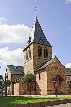 Church of Saint Joseph | |
 Coat of arms | |
Location of Ober-Hilbersheim within Mainz-Bingen district 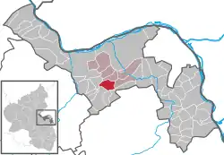 | |
 Ober-Hilbersheim  Ober-Hilbersheim | |
| Coordinates: 49°53′59″N 8°01′44″E | |
| Country | Germany |
| State | Rhineland-Palatinate |
| District | Mainz-Bingen |
| Municipal assoc. | Gau-Algesheim |
| Government | |
| • Mayor | Heiko Schmuck |
| Area | |
| • Total | 7.38 km2 (2.85 sq mi) |
| Elevation | 254 m (833 ft) |
| Population (2019-12-31)[1] | |
| • Total | 985 |
| • Density | 130/km2 (350/sq mi) |
| Time zone | UTC+01:00 (CET) |
| • Summer (DST) | UTC+02:00 (CEST) |
| Postal codes | 55437 |
| Dialling codes | 06728 |
| Vehicle registration | MZ |
| Website | www.ober-hilbersheim.de |
Geography
Location
The municipality lies southwest of Mainz on the Welzbach and is an agriculturally based community. The winegrowing centre belongs to the Verbandsgemeinde of Gau-Algesheim, whose seat is in the like-named town.
History
In 1108, Ober-Hilbersheim had its first documentary mention as Hilbridisheim.
Politics
Municipal council
The council is made up of 12 council members who were elected in a municipal election held on 13 June 2004 by majority vote.
Coat of arms
The municipality's arms might be described thus: Azure a horse's head couped at the neck Or langued gules.
Culture and sightseeing
Regular events
- The Ober-Hilbersheim Wine and Art Fair takes place early every July.
- The Ober-Hilbersheim Christmas Market is held on the second weekend in Advent.
Economy and infrastructure
Transport
The municipality is crossed by the L 415 state road. The Autobahnen A 60, A 61 and A 63 can be reached by car in 10 to 20 minutes.
Education
- Municipal kindergarten
References
- "Bevölkerungsstand 2019, Kreise, Gemeinden, Verbandsgemeinden". Statistisches Landesamt Rheinland-Pfalz (in German). 2020.
Further reading
Schmuck, Heiko: Ober-Hilbersheim. Illustrierte Dokumentation eines rheinhessischen Dorfes im 19. und 20. Jahrhundert. Horb am Neckar 1999.
External links
| Wikimedia Commons has media related to Ober-Hilbersheim. |
- Municipality’s official webpage (in German)
- Homepage of Bürgerinitiative Umwelt und Gesundheit Ober-Hilbersheim e.V. (“Ober-Hilbersheim Environment and Health Citizens’ Initiative”) and information page about Ober-Hilbersheim (in German)
| Authority control |
|---|