Olamaboro
Olamaboro is a Local Government Area in the southeast of Kogi State, Nigeria, bordering Enugu State and Benue State. Its headquarters are in the town of Okpo.
Olamaboro
ibe | |
|---|---|
LGA | |
| Nickname(s): miztus | |
 Olamaboro Location in Nigeria | |
| Coordinates: 7°11′N 7°34′E | |
| Country | |
| State | Kogi State |
| Area | |
| • Total | 1,132 km2 (437 sq mi) |
| Population (2006 census) | |
| • Total | 160,152 |
| Time zone | UTC+1 (WAT) |
| 3-digit postal code prefix | 270 |
| ISO 3166 code | NG.KO.OL |
| EMAGABA | |
It has an area of 1,132 km2 and a population of 160,152 at the 2006 census.[1]
The postal code of the area is 270.[2]
References
- HASC, population, area and Headquarters Statoids
- "Post Offices- with map of LGA". NIPOST. Archived from the original on 2012-11-26. Retrieved 2009-10-20.
State capital: Lokoja | ||
| Local Government Areas | 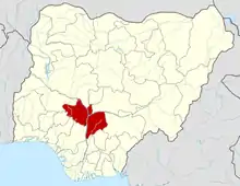 | |
This article is issued from Wikipedia. The text is licensed under Creative Commons - Attribution - Sharealike. Additional terms may apply for the media files.
