Ofu, Nigeria
Ofu is a Local Government Area in the central part of Kogi State, Federal Republic of Nigeria, the Niger River forming its western boundary. Its headquarters are in the town of Ogwoawo (or Ugwalawo or Gwalawo) to the south of the area at7°14′09″N 6°55′32″E.
Ofu | |
|---|---|
LGA | |
 Ofu Location in Nigeria | |
| Coordinates: 7°20′N 7°05′E | |
| Country | |
| State | Kogi State |
| Area | |
| • Total | 1,680 km2 (650 sq mi) |
| Population (2006 census) | |
| • Total | 192,169 |
| Time zone | UTC+1 (WAT) |
| 3-digit postal code prefix | 271 |
| ISO 3166 code | NG.KO.OF |
The northeasterly line of equal latitude and longitude passes through the LGA.
It has an area of 1,680 km2 and a population of 192,169 at the 2006 census.[1]
The postal code of the area is 271.[2]
References
- HASC, population, area and Headquarters Statoids
- "Post Offices- with map of LGA". NIPOST. Archived from the original on October 7, 2009. Retrieved 2009-10-20.
State capital: Lokoja | ||
| Local Government Areas | 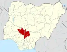 | |
This article is issued from Wikipedia. The text is licensed under Creative Commons - Attribution - Sharealike. Additional terms may apply for the media files.