Osnabrock, North Dakota
Osnabrock is a city in Cavalier County, North Dakota, United States. The population was 134 at the 2010 census.[5] Osnabrock was founded in 1882 and incorporated as a village in 1903. It was named after Osnabruck, Ontario, the home town of its first postmaster, James T. Anderson.[6] (Osnabruck was itself named after the city of Osnabrück in northwest Germany.)
Osnabrock, North Dakota | |
|---|---|
 First State Bank - Osnabrock | |
 Location of Osnabrock, North Dakota | |
| Coordinates: 48°40′8″N 98°8′55″W | |
| Country | United States |
| State | North Dakota |
| County | Cavalier |
| Area | |
| • Total | 0.30 sq mi (0.78 km2) |
| • Land | 0.30 sq mi (0.78 km2) |
| • Water | 0.00 sq mi (0.00 km2) |
| Elevation | 1,621 ft (494 m) |
| Population | |
| • Total | 134 |
| • Estimate (2019)[3] | 118 |
| • Density | 393.33/sq mi (151.75/km2) |
| Time zone | UTC-6 (Central (CST)) |
| • Summer (DST) | UTC-5 (CDT) |
| ZIP code | 58269 |
| Area code(s) | 701 |
| FIPS code | 38-60100 |
| GNIS feature ID | 1030583[4] |
Geography
Osnabrock is located at 48°40′8″N 98°8′55″W (48.668987, -98.148682).[7]
According to the United States Census Bureau, the city has a total area of 0.30 square miles (0.78 km2), all land.[8]
Demographics
| Historical population | |||
|---|---|---|---|
| Census | Pop. | %± | |
| 1910 | 253 | — | |
| 1920 | 310 | 22.5% | |
| 1930 | 244 | −21.3% | |
| 1940 | 269 | 10.2% | |
| 1950 | 284 | 5.6% | |
| 1960 | 289 | 1.8% | |
| 1970 | 255 | −11.8% | |
| 1980 | 222 | −12.9% | |
| 1990 | 214 | −3.6% | |
| 2000 | 174 | −18.7% | |
| 2010 | 134 | −23.0% | |
| 2019 (est.) | 118 | [3] | −11.9% |
| U.S. Decennial Census[9] 2018 Estimate[10] | |||
2010 census
As of the census[2] of 2010, there were 134 people, 51 households, and 36 families residing in the city. The population density was 446.7 inhabitants per square mile (172.5/km2). There were 73 housing units at an average density of 243.3 per square mile (93.9/km2). The racial makeup of the city was 96.3% White, 2.2% Native American, and 1.5% from two or more races. Hispanic or Latino of any race were 0.7% of the population.
There were 51 households, of which 11.8% had children under the age of 18 living with them, 62.7% were married couples living together, 5.9% had a female householder with no husband present, 2.0% had a male householder with no wife present, and 29.4% were non-families. 27.5% of all households were made up of individuals, and 11.7% had someone living alone who was 65 years of age or older. The average household size was 2.12 and the average family size was 2.56.
The median age in the city was 61 years. 10.4% of residents were under the age of 18; 5.3% were between the ages of 18 and 24; 15.7% were from 25 to 44; 24% were from 45 to 64; and 44.8% were 65 years of age or older. The gender makeup of the city was 49.3% male and 50.7% female.
2000 census
As of the census of 2000, there were 174 people, 64 households, and 40 families residing in the city. The population density was 592.2 people per square mile (231.7/km2). There were 85 housing units at an average density of 289.3 per square mile (113.2/km2). The racial makeup of the city was 95.98% White, 2.30% Native American, and 1.72% from two or more races. Hispanic or Latino of any race were 3.45% of the population.

There were 64 households, out of which 28.1% had children under the age of 18 living with them, 53.1% were married couples living together, 3.1% had a female householder with no husband present, and 37.5% were non-families. 35.9% of all households were made up of individuals, and 20.3% had someone living alone who was 65 years of age or older. The average household size was 2.23 and the average family size was 2.95.
In the city, the population was spread out, with 21.3% under the age of 18, 8.0% from 18 to 24, 14.9% from 25 to 44, 21.3% from 45 to 64, and 34.5% who were 65 years of age or older. The median age was 50 years. For every 100 females, there were 95.5 males. For every 100 females age 18 and over, there were 98.6 males.
The median income for a household in the city was $43,438, and the median income for a family was $50,938. Males had a median income of $28,750 versus $20,000 for females. The per capita income for the city was $14,254. About 2.7% of families and 6.8% of the population were below the poverty line, including 10.6% of those under the age of eighteen and 12.1% of those 65 or over.
References
- "2019 U.S. Gazetteer Files". United States Census Bureau. Retrieved July 27, 2020.
- "U.S. Census website". United States Census Bureau. Retrieved June 14, 2012.
- "Population and Housing Unit Estimates". United States Census Bureau. May 24, 2020. Retrieved May 27, 2020.
- "US Board on Geographic Names". United States Geological Survey. October 25, 2007. Retrieved January 31, 2008.
- "2010 Census Redistricting Data (Public Law 94-171) Summary File". American FactFinder. United States Census Bureau. Retrieved May 2, 2011.
- Williams, Mary Ann Barnes (1966). Origins of North Dakota Place Names. Bismarck, ND: Bismarck Tribune. Retrieved June 28, 2017.
- "US Gazetteer files: 2010, 2000, and 1990". United States Census Bureau. February 12, 2011. Retrieved April 23, 2011.
- "US Gazetteer files 2010". United States Census Bureau. Archived from the original on January 25, 2012. Retrieved June 14, 2012.
- United States Census Bureau. "Census of Population and Housing". Retrieved August 5, 2013.
- "Population Estimates". United States Census Bureau. Retrieved September 11, 2019.
Municipalities and communities of Cavalier County, North Dakota, United States | ||
|---|---|---|
| Cities | 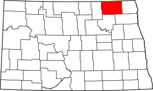 Map of North Dakota highlighting Cavalier County | |
| Townships |
| |
| Unincorporated communities |
| |
| Indian reservation | ||
| Footnotes | ‡This populated place also has portions in an adjacent county or counties | |
| ||