Ostrovnoye, Chukotka Autonomous Okrug
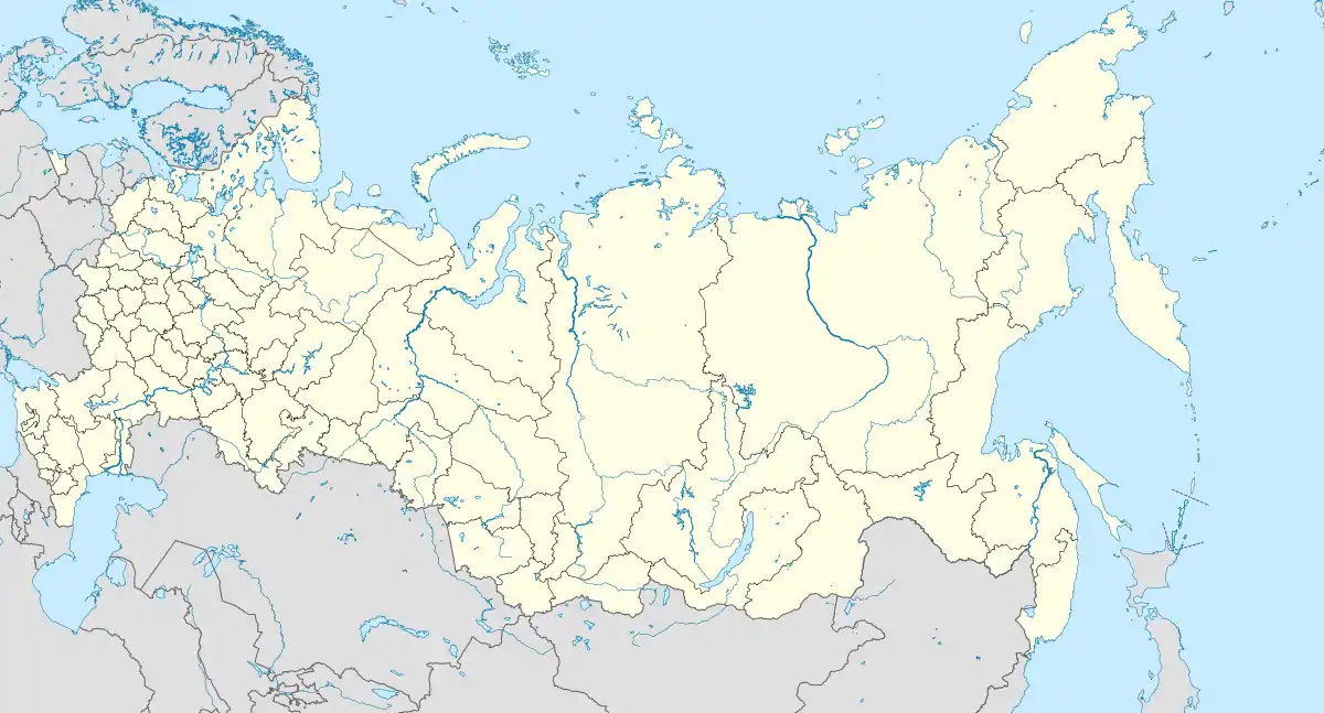
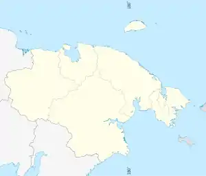
Ostrovnoye (Russian: Островно́е) is a rural locality (a selo) in Bilibinsky District of Chukotka Autonomous Okrug, Russia, located on the banks of the Maly Anyuy River about 40 kilometers (25 mi) upstream from Anyuysk and about 179 kilometers (111 mi) from the administrative center of the district, Bilibino[2] and 690 kilometers (430 mi) from Anadyr. Population: 379 (2010 est.), of which 317 were indigenous peoples. Population: 384 (2010 Census);[3] [4] Municipally, Ostrovnoye is subordinated to Bilibinsky Municipal District and is incorporated as Ostrovnoye Rural Settlement.[6]
Ostrovnoye
Островное | |
|---|---|
Location of Ostrovnoye 
| |
 Ostrovnoye Location of Ostrovnoye  Ostrovnoye Ostrovnoye (Chukotka Autonomous Okrug) | |
| Coordinates: 68°03′N 164°09′E | |
| Country | Russia |
| Federal subject | Chukotka Autonomous Okrug[1] |
| Administrative district | Bilibinsky District[1] |
| Founded | 1930[2] |
| Area | |
| • Total | 1.54 km2 (0.59 sq mi) |
| Population | |
| • Total | 384 |
| • Estimate (January 2018)[5] | 376 |
| • Density | 250/km2 (650/sq mi) |
| • Municipal district | Bilibinsky Municipal District[6] |
| • Rural settlement | Ostrovnoye Rural Settlement[6] |
| • Capital of | Ostrovnoye Rural Settlement[6] |
| Time zone | UTC+12 (MSK+9 |
| Postal code(s)[8] | 689465 |
| Dialing code(s) | +7 42738[9] |
| OKTMO ID | 77609433101 |
History
Ostrovnoye is a historical locality in the region, as it was the site of an ostrog built as Russians began to explore and lay claim to the region,[10] and was the site of trade fairs between Russians and natives.[11] The ruins of the Ostrog are still visible not far from the village.[11] Since the beginning of the 18th century Russian explorers began active exploration of Kolyma and Chukotka, and the settlements they established were essentially fortresses, among them Anyuysky Ostrog, where the Anyuysk Fair was held, the largest in Chutkotka. The Ostrog was situated on an island in the Lesser Anyuy. However, because of constant spring flooding of the river the fair was repeatedly postponed until 1848 after a flood, which destroyed most of the island and the Ostrog itself, the settlement was moved to the left bank, 10 km downstream. However, the locals traditionally called this fortress "Island" and so that was the name that was assigned to the modern village, standing on the site of the former Ostrog.[12]
In December 1930, the National district of Chukotka was established, consisting of Anadyrsky (Russian: Анадырский), Chukotsky (Чукотский), Markovsky (Марковский), Chaunsky (Чаунский), Eastern Tundra (Восточной Тундры, which was to become Bilibinsky District) and Western Tundra (Западной тундры) districts.[13] Ostrovnoye was appointed as the first administrative centre of the new Eastern Tundra district with authority over six separate selsoviets, namely: Greater Yenyuisky (Russian: Больше-Энюйский), Lesser Yenyuisky (Мало-Энюйский), Oloysky (Олойский), Oloychansky (Олойчанский), Ostrovnovsky (Островновский) and Pogyndinsky (Погындинский).[13]
The village was the site of the first Chukchi collective farm, "Turvaurgyn" (Russian: Турваургин, literally "New Life" in Chukchi), which was later reorganised into a farm called Ostrovnoye. By 1934, the village was equipped with a hospital bakery and radio transmitter.
Demographics
Based on a 2006 estimate, the population of Ostrovnoye was 420, of which 340 were indigenous peoples. This is an increase from the 2005 population of 355 according to an environmental impact report on the Kupol Gold Project.[14]
The population as of the beginning of January 2012 was 379,[2] mainly Chukchi,[15] representing a slight reduction on the 2010 official census record, of whom 183 were male and 201 female.
As of January 2012, the ethnic make up of the village was as following:
| Indigenous people | Number in the locality | Percentage of population |
|---|---|---|
| Chukchi |
250 |
66% |
| Russians and Other nationalities |
62 |
16% |
| Evens |
46 |
12% |
| Nenets |
19 |
1% |
| Others |
2 |
<1% |
| Total |
379 |
100% |
Source:[2]
Note: "Other nationalities" includes Ukrainians amongst others, "Others" are of unknown nationality, the ethnic breakdown provided by the official Bilibinsky District website does not equal the total population provided by the same source.
The head of the village is Yuri Vasilyevich Snitko.[2]
Climate
Ostrovnoye has a subarctic climate (Koppen Dfc) [16] with very cold, dry winters, and very mild, somewhat wetter summers.
| Climate data for Ostrovnoye | |||||||||||||
|---|---|---|---|---|---|---|---|---|---|---|---|---|---|
| Month | Jan | Feb | Mar | Apr | May | Jun | Jul | Aug | Sep | Oct | Nov | Dec | Year |
| Record high °C (°F) | 5.3 (41.5) |
2.7 (36.9) |
5.9 (42.6) |
9.4 (48.9) |
25.5 (77.9) |
33.2 (91.8) |
35.1 (95.2) |
32.7 (90.9) |
24.6 (76.3) |
14.9 (58.8) |
6.5 (43.7) |
7.6 (45.7) |
35.1 (95.2) |
| Average high °C (°F) | −29.7 (−21.5) |
−28.3 (−18.9) |
−18.5 (−1.3) |
−6.6 (20.1) |
6.3 (43.3) |
17.9 (64.2) |
19.8 (67.6) |
15.5 (59.9) |
6.9 (44.4) |
−7.6 (18.3) |
−21.7 (−7.1) |
−28.7 (−19.7) |
−6.2 (20.8) |
| Daily mean °C (°F) | −33.9 (−29.0) |
−32.8 (−27.0) |
−25.3 (−13.5) |
−13.5 (7.7) |
1.1 (34.0) |
11.8 (53.2) |
13.6 (56.5) |
9.5 (49.1) |
2.2 (36.0) |
−11.4 (11.5) |
−25.6 (−14.1) |
−32.6 (−26.7) |
−11.4 (11.5) |
| Average low °C (°F) | −38.3 (−36.9) |
−37.4 (−35.3) |
−31.4 (−24.5) |
−21.0 (−5.8) |
−4.8 (23.4) |
5.5 (41.9) |
7.1 (44.8) |
3.6 (38.5) |
−2.1 (28.2) |
−15.4 (4.3) |
−29.9 (−21.8) |
−36.8 (−34.2) |
−16.7 (1.9) |
| Record low °C (°F) | −57.8 (−72.0) |
−57.5 (−71.5) |
−54.4 (−65.9) |
−43.8 (−46.8) |
−34.9 (−30.8) |
−8.2 (17.2) |
−5.7 (21.7) |
−8.4 (16.9) |
−21.6 (−6.9) |
−39.1 (−38.4) |
−49.6 (−57.3) |
−56.8 (−70.2) |
−57.8 (−72.0) |
| Average precipitation mm (inches) | 14.8 (0.58) |
10.4 (0.41) |
7.8 (0.31) |
5.9 (0.23) |
9.3 (0.37) |
22.5 (0.89) |
38.6 (1.52) |
36.1 (1.42) |
23.9 (0.94) |
18.2 (0.72) |
16.3 (0.64) |
13.6 (0.54) |
217.4 (8.56) |
| Average precipitation days | 15.1 | 11.9 | 10.2 | 7.7 | 7.0 | 9.1 | 11.4 | 12.4 | 11.9 | 16.0 | 14.2 | 13.3 | 140.2 |
| Source: climatebase.ru (1936-2012)[17] | |||||||||||||
References
Notes
- Law #33-OZ, Article 13.2
- Urban and Rural Settlements Bilibinski District Official Website. Retrieved April 15, 2012. (in Russian)
- Russian Federal State Statistics Service (2011). "Всероссийская перепись населения 2010 года. Том 1" [2010 All-Russian Population Census, vol. 1]. Всероссийская перепись населения 2010 года [2010 All-Russia Population Census] (in Russian). Federal State Statistics Service.
- The results of the 2010 Census are given for Ostrovnoye Rural Settlement, a municipal formation of Bilibinsky Municipal District. According to Law #148-OZ, Ostrovnoye is the only inhabited locality on the territory of Ostrovnoye Rural Settlement.
- Office of the Federal State Statistics Service for Khabarovsk Krai, Magadan Oblast, Jewish Autonomous Oblast and Chukotka Autonomous Okrug. Численность населения Чукотского автономного округа по муниципальным образованиям на 1 января 2018 года Archived August 31, 2019, at the Wayback Machine (in Russian)
- Law #43, Article 7
- "Об исчислении времени". Официальный интернет-портал правовой информации (in Russian). June 3, 2011. Retrieved January 19, 2019.
- Почта России. Информационно-вычислительный центр ОАСУ РПО. (Russian Post). Поиск объектов почтовой связи (Postal Objects Search) (in Russian)
- Ministry of Justice of the Russian Federation Archived February 8, 2012, at the Wayback Machine Bilibinsky Municipal District (in Russian)
- Strogoff et al., pp. 103–104
- Ostrovnoye Archived October 29, 2013, at the Wayback Machine - Chukotka Electoral Commission
- Русские крепости в сибирском Заполярье Russian fortresses in the Siberian Arctic - E.A. Opolovnikova
- Общие сведения о районе - Историческая справка General Information About the Area - Historical Reference, Official Bilibinsky District website (in Russian)
- Bema Gold Corporation, p. 87
- Dallman, Map 3.6
- McKnight and Hess, pp.232-5
- "Ostrovnoye,Chukotka,Russia". Retrieved October 8, 2012.
Sources
- Bema Gold Corporation, Environmental Impact Assessment, Kupol Gold Project, Far East Russia June 2005
- Dallmann, W.K. Indigenous Peoples of the north of the Russian Federation, Map 3.6, Chukotskiy Avtonomyy Okrug. 1997.
- Дума Чукотского автономного округа. Закон №33-ОЗ от 30 июня 1998 г. «Об административно-территориальном устройстве Чукотского автономного округа», в ред. Закона №55-ОЗ от 9 июня 2012 г. «О внесении изменений в Закон Чукотского автономного округа "Об административно-территориальном устройстве Чукотского автономного округа"». Вступил в силу по истечении десяти дней со дня его официального опубликования. Опубликован: "Ведомости", №7 (28), 14 мая 1999 г. (Duma of Chukotka Autonomous Okrug. Law #33-OZ of June 30, 1998 On the Administrative-Territorial Structure of Chukotka Autonomous Okrug, as amended by the Law #55-OZ of June 9, 2012 On Amending the Law of Chukotka Autonomous Okrug "On the Administrative-Territorial Structure of Chukotka Autonomous Okrug". Effective as of after ten days from the day of the official publication.).
- Дума Чукотского автономного округа. Закон №43-ОЗ от 29 ноября 2004 г. «О статусе, границах и административных центрах муниципальных образований на территории Билибинского района Чукотского автономного округа», в ред. Закона №88-ОЗ от 20 октября 2010 г «О преобразовании путём объединения поселений на территории Билибинского муниципального района и внесении изменений в Закон Чукотского автономного округа "О статусе, границах и административных центрах муниципальных образований на территории Билибинского района Чукотского автономного округа"». Вступил в силу через десять дней со дня официального опубликования. Опубликован: "Ведомости", №31/1 (178/1), 10 декабря 2004 г. (Duma of Chukotka Autonomous Okrug. Law #43-OZ of November 29, 2004 On the Status, Borders, and Administrative Centers of the Municipal Formations on the Territory of Bilibinsky District of Chukotka Autonomous Okrug, as amended by the Law #88-OZ of October 20, 2010 On the Transformation (Merger) of the Settlements on the Territory of Bilibinsky Municipal District and Amending the Law of Chukotka Autonomous Okrug "On the Status, Borders, and Administrative Centers of the Municipal Formations on the Territory of Bilibinsky District of Chukotka Autonomous Okrug". Effective as of the day ten days after the official publication date.).
- McKnight, Tom L; Hess, Darrel (2000). "Climate Zones and Types". Physical Geography: A Landscape Appreciation. Upper Saddle River, NJ: Prentice Hall. ISBN 0-13-020263-0.
- Strogoff, M, Brochet, P-C and Auzias, D. Petit Futé: Chukotka, "Avant-Garde" Publishing House, 2006.
