Pali, Raigad
Pali is a census town in Raigad District in the Indian state of Maharashtra.
Pali, Raigad | |
|---|---|
city | |
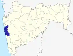
 Pali, Raigad Location in Maharashtra, India | |
| Coordinates: 18.541384°N 73.219965°E | |
| Country | |
| State | Maharashtra |
| District | Raigad |
| Elevation | 207 m (679 ft) |
| Population (2001) | |
| • Total | 8,167 |
| Languages | |
| • Official | Marathi |
| Time zone | UTC+5:30 (IST) |
Geography
Pali is located at 18.541384°N 73.219965°E. It has an average elevation of 207 metres (679 feet).
Trekking
There are two trekking destinations close to Pali. One is right there in the village. It is a fort called Sarasgad (सरसगड) from era of Chhatrapati Shivaji Maharaj.[1] There is another one from same era called Sudhagad (सुधागड) which is about 10 km away. It has a temple at the top which a place of local pilgrimage. The goddess is called 'Bhorai' (भोराई). Another place for trekking is 'Varadayini Mandir' (वरदायिनी) which is about 7 km from Pali.
Demographics
As of 2001 India census,[2] Pali had a population of 8167. Males constitute 51% of the population and females 49%. Pali has an average literacy rate of 78%, higher than the national average of 59.5%: male literacy is 82%, and female literacy is 74%. In Pali, 12% of the population is under 6 years of age.
Religious value
Pali is home to Shri Ballaleshwar, one of the eight 'Ashtavinayakas' in Maharashtra. See Ballaleswar Pali, Raigad or Ashtawinayaka.
References
- ""ऐतिहासिक सुधागड-पाली"". Saamana Daily Marathi Newspaper. Retrieved 11 November 2018.
- "Census of India 2001: Data from the 2001 Census, including cities, villages and towns (Provisional)". Census Commission of India. Archived from the original on 16 June 2004. Retrieved 1 November 2008.