Palo Alto, Pennsylvania
Palo Alto is a borough in Schuylkill County, Pennsylvania, United States. The population was 1,032 at the 2010 census. The borough stretches along the south bank of the Schuylkill River. Bacon Street is the main street of town. The borough shares Pottsville's ZIP Code, telephone exchanges, and school district. The borough maintains its own fire department and police department.
Palo Alto, Pennsylvania | |
|---|---|
Borough | |
 War Memorial in Palo Alto. | |
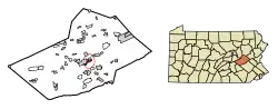 Location of Palo Alto in Schuylkill County, Pennsylvania. | |
 Palo Alto Location in Pennsylvania  Palo Alto Palo Alto (the United States) | |
| Coordinates: 40°41′16″N 76°10′16″W | |
| Country | United States |
| State | Pennsylvania |
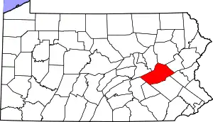
| County | Schuylkill |
| Settled | 1844 |
| Incorporated | 1854 |
| Government | |
| • Type | Borough Council |
| Area | |
| • Total | 1.04 sq mi (2.70 km2) |
| • Land | 1.04 sq mi (2.70 km2) |
| • Water | 0.00 sq mi (0.00 km2) |
| Population (2010) | |
| • Total | 1,032 |
| • Estimate (2019)[2] | 978 |
| • Density | 936.78/sq mi (361.58/km2) |
| Time zone | UTC-5 (Eastern (EST)) |
| • Summer (DST) | UTC-4 (EDT) |
| Zip code | 17901 |
| Area code(s) | 570 |
| FIPS code | 42-57752 |
| Website | http://www.paloaltopa.com/ |
Geography
Palo Alto is located at 40°41′16″N 76°10′16″W.[3]
According to the United States Census Bureau, the borough has a total area of 1.1 square miles (2.8 km2), all of it land.
Demographics
| Historical population | |||
|---|---|---|---|
| Census | Pop. | %± | |
| 1860 | 1,108 | — | |
| 1870 | 1,740 | 57.0% | |
| 1880 | 1,588 | −8.7% | |
| 1890 | 1,424 | −10.3% | |
| 1900 | 1,707 | 19.9% | |
| 1910 | 1,873 | 9.7% | |
| 1920 | 1,667 | −11.0% | |
| 1930 | 1,908 | 14.5% | |
| 1940 | 1,934 | 1.4% | |
| 1950 | 1,767 | −8.6% | |
| 1960 | 1,445 | −18.2% | |
| 1970 | 1,428 | −1.2% | |
| 1980 | 1,321 | −7.5% | |
| 1990 | 1,192 | −9.8% | |
| 2000 | 1,052 | −11.7% | |
| 2010 | 1,032 | −1.9% | |
| 2019 (est.) | 978 | [2] | −5.2% |
| Sources:[4][5][6] | |||
As of the census[5] of 2000, there were 1,052 people, 444 households, and 306 families living in the borough. The population density was 995.9 people per square mile (383.2/km2). There were 478 housing units at an average density of 452.5 per square mile (174.1/km2). The racial makeup of the borough was 98.86% White, 0.10% African American, 0.29% Asian, and 0.76% from two or more races.
There were 444 households, out of which 25.7% had children under the age of 18 living with them, 55.2% were married couples living together, 10.4% had a female householder with no husband present, and 30.9% were non-families. 26.4% of all households were made up of individuals, and 14.0% had someone living alone who was 65 years of age or older. The average household size was 2.37 and the average family size was 2.88.
In the borough the population was spread out, with 18.7% under the age of 18, 8.0% from 18 to 24, 27.1% from 25 to 44, 25.4% from 45 to 64, and 20.8% who were 65 years of age or older. The median age was 42 years. For every 100 females there were 91.3 males. For every 100 females age 18 and over, there were 89.2 males.
The median income for a household in the borough was $35,729, and the median income for a family was $41,667. Males had a median income of $30,449 versus $21,042 for females. The per capita income for the borough was $16,806. About 3.5% of families and 6.9% of the population were below the poverty line, including 4.3% of those under age 18 and 13.2% of those age 65 or over.
Notable people
Eddie Delker, baseball player.
Gallery
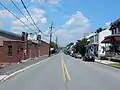 Bacon Street.
 Palo Alto Borough Hall.
 Citizens Fire Co.
 View from Charles Street.
 House on Fox Street.
References
- "2019 U.S. Gazetteer Files". United States Census Bureau. Retrieved July 28, 2020.
- "Population and Housing Unit Estimates". United States Census Bureau. May 24, 2020. Retrieved May 27, 2020.
- "US Gazetteer files: 2010, 2000, and 1990". United States Census Bureau. 2011-02-12. Retrieved 2011-04-23.
- "Census of Population and Housing". U.S. Census Bureau. Retrieved 11 December 2013.
- "U.S. Census website". United States Census Bureau. Retrieved 2008-01-31.
- "Incorporated Places and Minor Civil Divisions Datasets: Subcounty Resident Population Estimates: April 1, 2010 to July 1, 2012". Population Estimates. U.S. Census Bureau. Archived from the original on 11 June 2013. Retrieved 11 December 2013.
| Wikimedia Commons has media related to Palo Alto, Pennsylvania. |
| Authority control |
|---|