Paoli Township, Orange County, Indiana
Paoli Township is one of ten townships in Orange County, Indiana, United States. As of the 2010 census, its population was 6,031 and it contained 2,679 housing units.[1]
Paoli Township | |
|---|---|
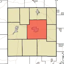 Location in Orange County | |
| Coordinates: 38°33′21″N 86°27′31″W | |
| Country | |
| State | |
| County | Orange |
| Government | |
| • Type | Indiana township |
| Area | |
| • Total | 63.37 sq mi (164.1 km2) |
| • Land | 63.25 sq mi (163.8 km2) |
| • Water | 0.12 sq mi (0.3 km2) 0.19% |
| Elevation | 686 ft (209 m) |
| Population (2010) | |
| • Total | 6,031 |
| • Density | 95.4/sq mi (36.8/km2) |
| Time zone | UTC-5 (Eastern (EST)) |
| • Summer (DST) | UTC-4 (EDT) |
| ZIP codes | 47452, 47454, 47469 |
| Area code(s) | 812, 930 |
| GNIS feature ID | 453705 |
History
Thomas Elwood Lindley House and Newberry Friends Meeting House are listed on the National Register of Historic Places.[2]
Geography
According to the 2010 census, the township has a total area of 63.37 square miles (164.1 km2), of which 63.25 square miles (163.8 km2) (or 99.81%) is land and 0.12 square miles (0.31 km2) (or 0.19%) is water.[1]
Cities, towns, villages
Unincorporated towns
- Chambersburg at 38.518112°N 86.392207°W
- Lost River at 38.606999°N 86.451377°W
- Stampers Creek at 38.558389°N 86.383319°W
- Syria at 38.586167°N 86.401653°W
- Turleys at 38.570888°N 86.520545°W
- Woodlawn Grove at 38.578111°N 86.458043°W
(This list is based on USGS data and may include former settlements.)
Cemeteries
The township contains these four cemeteries: Lewis, Paoli Community, Scott and Springer.
Major highways
Airports and landing strips
- Paoli Municipal Airport
Education
- Paoli Community School Corporation
- Throop Elementary School (Grades K-6)
- Paoli Junior Senior High School (Grades 7-12)
Paoli Township residents may obtain a free library card from the Paoli Public Library in the Town of Paoli.[3]
Political districts
- Indiana's 9th congressional district
- State House District 62
- State Senate District 44
References
- "Paoli Township, Orange County, Indiana". Geographic Names Information System. United States Geological Survey. Retrieved 2009-10-17.
- United States Census Bureau 2008 TIGER/Line Shapefiles
- IndianaMap
- "Population, Housing Units, Area, and Density: 2010 - County -- County Subdivision and Place -- 2010 Census Summary File 1". United States Census. Archived from the original on 2020-02-12. Retrieved 2013-05-10.
- "National Register Information System". National Register of Historic Places. National Park Service. July 9, 2010.
- "Getting a Library Card". Paoli Public Library. Retrieved 14 March 2018.
External links
- Indiana Township Association
- United Township Association of Indiana
- City-Data.com page for Paoli Township
Places adjacent to Paoli Township, Orange County, Indiana | |
|---|---|
Municipalities and communities of Orange County, Indiana, United States | ||
|---|---|---|
| Towns | Map of Indiana highlighting Orange County | |
| Townships | ||
| Unincorporated communities |
| |
| Footnotes | ‡This populated place also has portions in an adjacent county or counties | |
| ||