Patumahoe
Patumahoe is a small town of Auckland, New Zealand. It is in the Franklin Ward of Auckland Council.
Patumahoe | |
|---|---|
| |
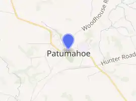
| Coordinates: 37.187°S 174.828°E | |
| Country | |
| Region | Auckland Region |
| Territorial authority | Auckland Council |
| Ward | Franklin Ward |
| Board | Franklin Local Board |
| Population (June 2020)[1] | |
| • Total | 1,270 |
| Postcode(s) | 2679 |
| Area code(s) | 09 |
The name means to strike or kill with a patu made of wood from māhoe.[2]
Demographics
| Year | Pop. | ±% p.a. |
|---|---|---|
| 2006 | 1,578 | — |
| 2013 | 1,719 | +1.23% |
| 2018 | 2,334 | +6.31% |
| Source: [3] | ||
The town population was 1,270 as of June 2020.[1]
The statistical area of Patumahoe, which at 34 square kilometres is larger than the town, had a population of 2,334 at the 2018 New Zealand census, an increase of 615 people (35.8%) since the 2013 census, and an increase of 756 people (47.9%) since the 2006 census. There were 765 households. There were 1,170 males and 1,164 females, giving a sex ratio of 1.01 males per female. The median age was 39.3 years, with 519 people (22.2%) aged under 15 years, 381 (16.3%) aged 15 to 29, 1,146 (49.1%) aged 30 to 64, and 288 (12.3%) aged 65 or older.
Ethnicities were 91.0% European/Pākehā, 10.5% Māori, 3.2% Pacific peoples, 4.9% Asian, and 2.7% other ethnicities (totals add to more than 100% since people could identify with multiple ethnicities).
The proportion of people born overseas was 18.6%, compared with 27.1% nationally.
Although some people objected to giving their religion, 56.3% had no religion, 33.7% were Christian, 0.9% were Hindu, 0.6% were Muslim, 0.5% were Buddhist and 1.8% had other religions.
Of those at least 15 years old, 351 (19.3%) people had a bachelor or higher degree, and 279 (15.4%) people had no formal qualifications. The median income was $46,300. The employment status of those at least 15 was that 1,083 (59.7%) people were employed full-time, 273 (15.0%) were part-time, and 42 (2.3%) were unemployed.[3]
Education
Patumahoe School is a coeducational full primary school (years 1–8) with a roll of 282 as of March 2020.[4][5] The school was founded in 1866.[6]
Notable locations
- St Bride's Church, 32 Findlay Road Mauku, an Anglican church built in 1861.[7]
- Wright's Watergardens, 128 Mauku Road, Patumahoe, a private garden based around Mauku Waterfall and an old quarry, open to the public.[8]
- Patumahoe war memorial domain, 19 Patumahoe Road, sports grounds and a World War 2 memorial.[9]
References
- "Population estimate tables - NZ.Stat". Statistics New Zealand. Retrieved 22 October 2020.
- "Patamahoe". Ministry for Culture and Heritage. Retrieved 24 September 2020.
- "Statistical area 1 dataset for 2018 Census". Statistics New Zealand. March 2020. Patumahoe (163800). 2018 Census place summary: Patumahoe
- "New Zealand Schools Directory". New Zealand Ministry of Education. Retrieved 26 April 2020.
- Education Counts: Patumahoe Primary School
- "Welcome to Patumahoe Primary School". Retrieved 24 September 2020.
- "St Bride's Church (Anglican)24 September 2020". Register of Historic Places. Heritage New Zealand.
- "Wrights Watergardens - Patumahoe". Citizens Advice Bureau. Retrieved 24 September 2020.
- "Patumahoe War Memorial Domain". Ministry for Culture and Heritage. Retrieved 24 September 2020.
