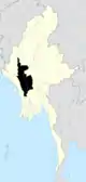
Pauk Township
Pauk Township is a township of Pakokku District in Magway Division of Burma (Myanmar). The principal town and administrative seat is Pauk.
Pauk Township | |
|---|---|
 Pauk Township | |
| Coordinates: 21°27′N 94°28′E | |
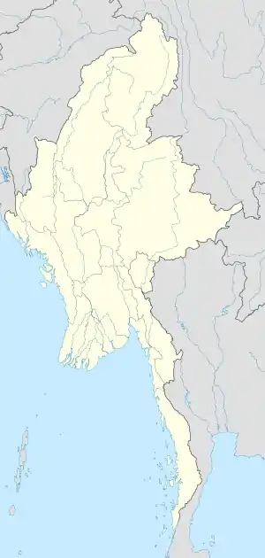
| Country | |
| Division | Magway Division |
| District | Pakokku District |
| Capital | Pauk |
| Area | |
| • Total | 580 sq mi (1,490 km2) |
| Time zone | UTC+6:30 (MST) |
The township lies between 21° 10' and 21° 49' north latitude and 94° 18' and 94° 44' east longitude.[1] It has an area of 1,490 sq.mi.[1] The principal river is the Kyaw River along the banks of which rice is grown.[1]
The Burmese government has denied that chemical weapons are produced at the military facility there.[2]
Borders
Pauk Township is bordered[3] by:
- Seikphyu Township, to the south,
- Saw Township, to the west,
- Tilin Township, to the northwest,
- Gangaw Township and Pale Township of Sagaing Division, to the north,
- Myaing Township, to the east, and
- Pakokku Township, to the southeast.
Notes
- Imperial gazetteer of India: provincial series, Volume 11 page 31
- Arterbury, John (13 July 2014). "Military facility hides secrets from the world". www.bangkokpost.com. Bangkok Post. Retrieved 13 July 2014.
- "Myanmar States/Divisions & Townships Overview Map" Myanmar Information Management Unit (MIMU)
External links
- "Pauk Google Satellite Map" map of administrative area with listing of principal settlements, from Maplandia
- "Map of Pauk Township"
Capital: Pauk | |
|
Capital: Magway | ||
| Gangaw District |
|   |
| Magway District | ||
| Minbu District | ||
| Pakokku District | ||
| Thayet District |
| |
| Main cities and towns | ||
This article is issued from Wikipedia. The text is licensed under Creative Commons - Attribution - Sharealike. Additional terms may apply for the media files.