Pelham, Ontario
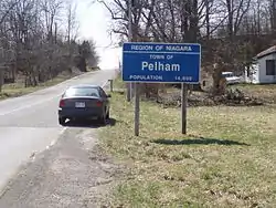
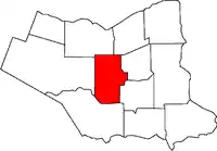
The Town of Pelham (2016 population 17,110) is located in the centre of Niagara Region in Ontario, Canada.
Pelham | |
|---|---|
| Town of Pelham | |
 | |
 | |
 Pelham | |
| Coordinates: 43°02′N 79°20′W | |
| Country | |
| Province | |
| Region | Niagara |
| Formed | 1970 |
| Government | |
| • Mayor | Marvin Junkin |
| • Federal riding | Niagara West—Glanbrook |
| • Prov. riding | Niagara West—Glanbrook |
| Area | |
| • Land | 126.43 km2 (48.81 sq mi) |
| Population (2016)[1] | |
| • Total | 17,110 |
| • Density | 135.3/km2 (350/sq mi) |
| Time zone | UTC-5 (EST) |
| • Summer (DST) | UTC-4 (EDT) |
| Postal Code | L0S |
| Area code(s) | 905, 289, 365 |
| Website | www.pelham.ca |

The town's southern boundary is formed by the Welland River, a meandering waterway that flows into the Niagara River. To the west is the township of West Lincoln, to the east the city of Welland and the city of Thorold, and to the north the city of St. Catharines and the town of Lincoln. North Pelham contains the picturesque Short Hills (see attractions). Two important creeks have their headwaters within Pelham; Coyle Creek, which flows south into the Welland River, and Twelve Mile creek, a spring-fed stream that flows north into Lake Ontario.
History
Pelham Township was part of the original Welland County since the late 1780s. The Town of Pelham (est. 1970) derived its name from Pelham Township which was so named by John Graves Simcoe in the 1790s. Simcoe gave names to the Townships of Niagara that were created to provide land for Loyalist refugees, disbanded troops former rangers and others after the British defeat in the Revolutionary War (which ended in 1783) . At the beginning, the townships were only numbered and not named. The policy of Simcoe was to adopt township names from England. Pelham was named after the Pelham family though it unsure which particular Pelham family member it is attributed to - either Henry Fiennes Pelham-Clinton (nephew to 2 Prime Ministers and considered powerful and influential), or Charles Anderson Pelham (a quiet MP who spoke only once in 26 years in the House of Commons). But in fact it turns out that it was named after early landowner Joshua Pell's family manor in Westchester County, New York—Pelham Manor—lost by the Loyalist Pells during the American Revolution (Pell went first in exile to Nova Scotia in 1783, before later being granted lands in the Niagara area after direct appeal to George III.).[2]
In 1922, the Village of Fonthill became a separate municipality[3] by petitioning for land from the Township of Pelham and the Township of Thorold.
From the top of the Fonthill Kame Delta hill, a unique topographical feature, (Ontario Geological Society 1970) and ANSI protected site (Area of Natural Scientific Interest - ANSI) on a clear day it is possible to see Toronto, Hamilton and western New York state. At one time a ski tow was installed on the north side of the Kame Delta Hill on what is now Lookout Point Golf and Country Club, but it was a commercial failure and no longer operates.
In 1970, while creating the Niagara Region and amalgamating other cities and towns, the Provincial Government amalgamated the Village of Fonthill and the Township of Pelham covering 126.42 square kilometres. This integration brought together a mix of farming (agriculture) and growing commercialism.
Attractions
The Comfort Maple Tree is estimated to be Canada's oldest surviving Sugar Maple tree, approximately 500 years old. Named after the Comfort family on whose land the tree was located and the Comfort family deeded the area of the tree to the Niagara Peninsula Conservation authority. It has been designated a Conservation site for its biological and historical significance. The Comfort Maple is located in the village of North Pelham.
Short Hills Provincial Park, located along the northern border of Pelham, is a wildlife preserve of 6.6 square kilometres. It once consisted of a valley filled with sedimentary deposits and glacial till, until Twelve Mile Creek sliced through, forming the "Short Hills." In addition there is also St. John's Conservation area, which has a fish pond and a set of trails.
Pelham is a good location for avid golfers, having a steadily growing number of golf courses. The town's oldest course, Lookout Point Golf and Country Club, was founded in 1922 by a group of Welland businessmen. (Its name has been shortened to Lookout Point Country Club.)
Notable people from Pelham
Dorothy Wetherald Rungeling, C.M. spent 106 years in this town excelling as an aviator, instructor, musician, Councillor, mentor, author and notable centenarian. She had a rich life of adventure including Women's air racing and motorcycling. Her honour's include Membership in the Order of Canada, a commemorative postage stamp issue, and the renaming of the local airport after her.
Steve Bauer grew up in Fenwick winning a silver medal at the 1984 Olympics in cycling and later became a professional cyclist. He wore the yellow jersey at the Tour de France during several years of racing in France in the 1980s. There is a series of walking and biking trails throughout the municipality which are named after him.
World Golf Hall of Fame inductee Marlene Streit also grew up in Pelham, belonged to the Lookout Point Golf and Country Club, and has a park in the Town's core named after her.
CTV's morning show Canada AM's weather and sports man, Jeff Hutcheson currently lives in Fenwick.
Former NHL enforcer Matt Johnson was raised and lived in Fenwick, although his birthplace is listed as Welland as this is where the local hospital is located.
Natalie Mastracci, Silver Medalist for rowing at the 2012 Olympic Games went to St. Alexander School in Fonthill, Ontario
Lacrosse player Mike Accursi is from Pelham.
Government
The Town is divided into three wards, each of which elects two councillors to sit on Town Council for a period of four years. The Mayor is elected separately, also serves on the Council of the Niagara Region, and (since 2006) also serves a term of four years.
Mayors of the Town of Pelham:
1970-1976: Harold Black
1976-1978: John Weldon
1978-1988: Eric Bergenstein
1988-1994: Marty Collins
1994-2003: Ralph Beamer
2003-2006: Ron Leavens
2006-2018: Dave Augustyn
2018-2022: Marvin Junkin
Additionally, since 2003, a regional councillor is elected to represent Pelham at the Regional Municipality of Niagara.
Regional Councillors of the Town of Pelham:
2003-2018: Brian Baty
2018-2022: Diana Huson
Demographics
| Year | Pop. | ±% |
|---|---|---|
| 1971 | 9,997 | — |
| 1981 | 11,104 | +11.1% |
| 1991 | 13,328 | +20.0% |
| 2001 | 15,272 | +14.6% |
| 2006 | 16,155 | +5.8% |
| 2011 | 16,598 | +2.7% |
| 2016 | 17,110 | +3.1% |
| [4] | ||
According to the Canada 2016 Census:
- Population: 17,110
- Percentage Change (2011-2016): + 3.1%
- Dwellings: 6,596
- Area: 126.43 km2
- Population density: 135.3/km2
Sports and recreation
Pelham's sports include:

Climate
The city has a warm-summer humid continental climate (Köppen: Dfb), due to the absence of a UHI to heat as in cities of latitudes equal or more to the north as Hamilton or Niagara Falls (in Dfa zone), but approaching this climatic category [5]
| Climate data for Ridgeville, elevation: 236.2 m or 775 ft, 1981-2010 normals, extremes 1950-2006 | |||||||||||||
|---|---|---|---|---|---|---|---|---|---|---|---|---|---|
| Month | Jan | Feb | Mar | Apr | May | Jun | Jul | Aug | Sep | Oct | Nov | Dec | Year |
| Record high °C (°F) | 17.0 (62.6) |
19.5 (67.1) |
26.0 (78.8) |
32.0 (89.6) |
33.0 (91.4) |
33.0 (91.4) |
35.5 (95.9) |
35.0 (95.0) |
33.9 (93.0) |
29.4 (84.9) |
25.0 (77.0) |
20.0 (68.0) |
35.5 (95.9) |
| Average high °C (°F) | −1.3 (29.7) |
0.0 (32.0) |
4.5 (40.1) |
11.8 (53.2) |
18.5 (65.3) |
23.4 (74.1) |
26.0 (78.8) |
25.0 (77.0) |
20.9 (69.6) |
14.1 (57.4) |
7.8 (46.0) |
1.7 (35.1) |
12.7 (54.9) |
| Daily mean °C (°F) | −4.4 (24.1) |
−3.3 (26.1) |
0.7 (33.3) |
7.3 (45.1) |
13.6 (56.5) |
18.9 (66.0) |
21.7 (71.1) |
20.9 (69.6) |
16.9 (62.4) |
10.5 (50.9) |
4.7 (40.5) |
−1.2 (29.8) |
8.9 (47.9) |
| Average low °C (°F) | −7.5 (18.5) |
−6.7 (19.9) |
−3.1 (26.4) |
2.7 (36.9) |
8.6 (47.5) |
14.3 (57.7) |
17.4 (63.3) |
16.7 (62.1) |
12.9 (55.2) |
6.9 (44.4) |
1.6 (34.9) |
−4.0 (24.8) |
5.0 (41.0) |
| Record low °C (°F) | −25.5 (−13.9) |
−24.4 (−11.9) |
−21.0 (−5.8) |
−11.7 (10.9) |
−3.5 (25.7) |
2.8 (37.0) |
5.0 (41.0) |
5.0 (41.0) |
1.1 (34.0) |
−3.9 (25.0) |
−12.2 (10.0) |
−26.0 (−14.8) |
−26.0 (−14.8) |
| Average precipitation mm (inches) | 67.1 (2.64) |
53.6 (2.11) |
64.2 (2.53) |
77.7 (3.06) |
89.2 (3.51) |
84.7 (3.33) |
83.6 (3.29) |
77.6 (3.06) |
92.6 (3.65) |
86.3 (3.40) |
90.7 (3.57) |
78.9 (3.11) |
946.2 (37.26) |
| Average rainfall mm (inches) | 32.7 (1.29) |
30.9 (1.22) |
45.2 (1.78) |
72.3 (2.85) |
88.7 (3.49) |
84.7 (3.33) |
83.6 (3.29) |
77.6 (3.06) |
92.6 (3.65) |
86.1 (3.39) |
80.7 (3.18) |
53.6 (2.11) |
828.7 (32.64) |
| Average snowfall cm (inches) | 34.3 (13.5) |
24.0 (9.4) |
19.0 (7.5) |
5.4 (2.1) |
0.5 (0.2) |
0.0 (0.0) |
0.0 (0.0) |
0.0 (0.0) |
0.0 (0.0) |
0.2 (0.1) |
6.6 (2.6) |
25.3 (10.0) |
115.3 (45.4) |
| Average precipitation days (≥ 0.2 mm) | 11.6 | 8.4 | 10.1 | 11.6 | 12.0 | 10.5 | 9.9 | 9.4 | 9.9 | 11.4 | 11.7 | 11.7 | 128.2 |
| Average rainy days (≥ 0.2 mm) | 5.2 | 4.1 | 7.4 | 10.9 | 12.0 | 10.5 | 9.9 | 9.4 | 9.9 | 11.4 | 10.4 | 7.4 | 108.5 |
| Average snowy days (≥ 0.2 cm) | 6.8 | 4.8 | 3.4 | 1.2 | 0.08 | 0.0 | 0.0 | 0.0 | 0.0 | 0.04 | 1.6 | 5.4 | 23.32 |
| Source: Environment Canada[6] | |||||||||||||
Communities
- Effingham
- Fenwick
- Fonthill
- North Pelham
- Pelham Centre
- Pelham Corners
- Ridgeville
References
- 2016 Census Profile
- Alun Hughes, The Naming of Niagara's Townships; Brock University 2013 copyright
- "Pelham Heritage Masterplan 2012" (PDF).
- Statistics Canada: 1996, 2001, 2006, 2011, 2016 census
- "Pelham climate: Average Temperature, weather by month, Pelham weather averages - Climate-Data.org". en.climate-data.org. Retrieved 2019-05-22.
- "Ridgeville - Canadian Climate Normals 1981-2010 Station Data". 1981 to 2010 Canadian Climate Normals. Environment Canada. March 21, 209. Climate ID: 6137161. Retrieved May 22, 2019.
External links
Places adjacent to Pelham, Ontario | |
|---|---|