Pertunmaa
Pertunmaa (Finnish: [ˈpe̞rt̪umˌmɑː]) is a municipality of Finland located in the Southern Savonia region. The municipality has a population of 1,687 (31 July 2020)[6] and covers an area of 454.20 square kilometres (175.37 sq mi) of which 79.7 km2 (30.8 sq mi) is water.[1] The population density is 4.5 inhabitants per square kilometre (12/sq mi).
Pertunmaa | |
|---|---|
Municipality | |
| Pertunmaan kunta Pertunmaa kommun | |
 Pertunmaa Church | |
 Coat of arms | |
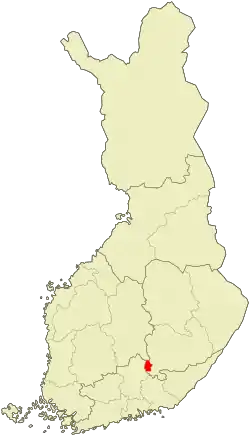 Location of Pertunmaa in Finland | |
| Coordinates: 61°30′10″N 026°28′45″E | |
| Country | |
| Region | Southern Savonia |
| Sub-region | Mikkeli sub-region |
| Charter | 1926 |
| Government | |
| • Municipal manager | Juha Torniainen |
| Area (2018-01-01)[1] | |
| • Total | 454.20 km2 (175.37 sq mi) |
| • Land | 374.48 km2 (144.59 sq mi) |
| • Water | 79.7 km2 (30.8 sq mi) |
| Area rank | 207th largest in Finland |
| Population (2020-07-31)[2] | |
| • Total | 1,687 |
| • Rank | 274th largest in Finland |
| • Density | 4.5/km2 (12/sq mi) |
| Population by native language | |
| • Finnish | 98.9% (official) |
| • Swedish | 0.2% |
| • Others | 0.9% |
| Population by age | |
| • 0 to 14 | 13.6% |
| • 15 to 64 | 58.7% |
| • 65 or older | 27.7% |
| Time zone | UTC+02:00 (EET) |
| • Summer (DST) | UTC+03:00 (EEST) |
| Municipal tax rate[5] | 20% |
| Website | www.pertunmaa.fi |
Neighbour municipalities are Hartola, Heinola, Hirvensalmi, Mäntyharju and Joutsa. Pertunmaa became an independent municipality in 1926 when it was separated from Mäntyharju. Hartola's old wooden church was moved to Pertunmaa and it was inaugurated in 1927.
The language of the municipality is Finnish.
Culture
It's said that Pertunmaa's culture is mixed with these regions, Southern Savonia and Päijänne Tavastia.
Itä-Häme newspaper is published also in Pertunmaa.
In the 1980s, blodpalt called Kisko, and Rieska breads baked from rye flour, cream and sour cream, which are baked with cabbage leaves, were named Pertunmaa's traditional dishes.[7]
Villages
Pertunmaa's church village (Pertunmaan kirkonkylä) and Kuortti are both the most largest and populated main villages of municipality.
Other smaller villages are Hartosenpää, Hölttä, Joutsjärvi, Karankamäki, Kuhajärvi, Kälkyttä, Lihavanpää, Mansikkamäki, Nipuli and Ruorasmäki.
Notable people
- Jari Leppä, the Minister of Agriculture and Forestry
- Maila Paloheimo, a teacher and writer
- Vesa Törnroos, a sports shooter
- Kari Uotila, a politician
Gallery
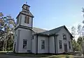 Pertunmaa Church
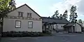 Pertunmaa Comprehensive School
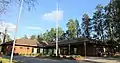 Pertunmaa Health Center
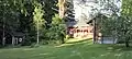 A local museum Vanha-Rantala
_-_Museotie_1%252C_Vanha-Rantalan_talomuseon_pihapiiri_-_Pertunmaa_-_1.jpg.webp) Kuusela Memorial Stone
Kuusela Memorial Stone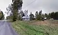 Mansikkamäki village
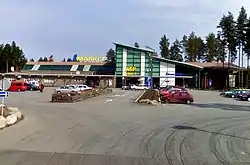 ABC Kuortti, a filling station, restaurant and rest stop along the Highway 5
References
- "Area of Finnish Municipalities 1.1.2018" (PDF). National Land Survey of Finland. Retrieved 30 January 2018.
- "Suomen virallinen tilasto (SVT): Väestön ennakkotilasto [verkkojulkaisu]. Heinäkuu 2020" (in Finnish). Statistics Finland. Retrieved 13 September 2020.
- "Population according to language and the number of foreigners and land area km2 by area as of 31 December 2008". Statistics Finland's PX-Web databases. Statistics Finland. Retrieved 29 March 2009.
- "Population according to age and gender by area as of 31 December 2008". Statistics Finland's PX-Web databases. Statistics Finland. Retrieved 28 April 2009.
- "List of municipal and parish tax rates in 2011". Tax Administration of Finland. 29 November 2010. Retrieved 13 March 2011.
- "VÄESTÖTIETOJÄRJESTELMÄ REKISTERITILANNE 31.1.2012" (in Finnish and Swedish). Population Register Center of Finland. Archived from the original on 3 October 2013. Retrieved 11 February 2014.
- Kolmonen, Jaakko (1988). Kotomaamme ruoka-aitta: Suomen, Karjalan ja Petsamon pitäjäruoat (in Finnish). Helsinki: Patakolmonen. pp. 122–123. ISBN 951-96047-3-1.
External links
![]() Media related to Pertunmaa at Wikimedia Commons
Media related to Pertunmaa at Wikimedia Commons
- Municipality of Pertunmaa – Official website, english, finnish and russian languages
| Municipalities |  | |
|---|---|---|
| Former municipalities |
| |