Phu Wiang District
Phu Wiang (Thai: ภูเวียง, pronounced [pʰūː wīa̯ŋ]) is a district (amphoe) in the northwestern part of Khon Kaen Province, northeastern Thailand.
Phu Wiang
ภูเวียง | |
|---|---|
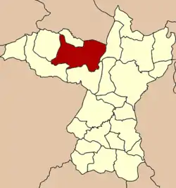 District location in Khon Kaen Province | |
| Coordinates: 16°39′16″N 102°22′37″E | |
| Country | Thailand |
| Province | Khon Kaen |
| Seat | Phu Wiang |
| Area | |
| • Total | 621.6 km2 (240.0 sq mi) |
| Population (2008) | |
| • Total | 71,597 |
| • Density | 115.1/km2 (298/sq mi) |
| Time zone | UTC+7 (ICT) |
| Postal code | 40150 |
| Geocode | 4016 |
Geography
Neighboring districts are (from the northeast clockwise): Ubolratana, Nong Ruea, Chum Phae, Wiang Kao, Nong Na Kham of Khon Kaen Province and Non Sang of Nong Bua Lamphu Province.
A prehistoric Iron Age archaeological site, None Nok Tha (โนนนกทา) is in the district, as is the Phu Wiang National Park.[1]
Administration
The district is divided into 11 subdistricts (tambons), which are further subdivided into 114 villages (mubans). Phu Wiang is a subdistrict municipality (thesaban tambon) and covers parts of tambon Phu Wiang. There are a further 11 tambon administrative organizations (TAO).
| No. | Name | Thai | Villages | Pop.[2] |
|---|---|---|---|---|
| 1. | Ban Ruea | บ้านเรือ | 9 | 3,736 |
| 4. | Wa Thong | หว้าทอง | 8 | 5,234 |
| 5. | Kut Khon Kaen | กุดขอนแก่น | 15 | 9,178 |
| 6. | Na Chum Saeng | นาชุมแสง | 12 | 6,568 |
| 7. | Na Wa | นาหว้า | 11 | 8,145 |
| 10. | Nong Kung Thanasan | หนองกุงธนสาร | 16 | 9,297 |
| 12. | Nong Kung Soen | หนองกุงเซิน | 9 | 6,073 |
| 13. | Song Pueai | สงเปือย | 11 | 6,467 |
| 14. | Thung Chomphu | ทุ่งชมพู | 8 | 4,495 |
| 16. | Din Dam | ดินดำ | 7 | 4,691 |
| 17. | Phu Wiang | ภูเวียง | 8 | 7,713 |
Missing numbers are tambons which now form the districts Wiang Kao and Nong Na Kham.
References
- "Phu Wiang National Park". Department of National Parks (DNP). Archived from the original on 2010-01-23. Retrieved 11 May 2019.
- "Population statistics 2008". Department of Provincial Administration. Archived from the original on 2009-06-04.
External links
- amphoe.com (Thai)
