Nong Bua Lamphu Province
Nong Bua Lamphu (Thai: หนองบัวลำภู, RTGS: Nong Bua Lam Phu, pronounced [nɔ̌ːŋ būa̯ lām pʰūː]) is one of Thailand's seventy-seven provinces (changwat) lies in upper northeastern Thailand also called Isan. Neighbouring provinces are (from north clockwise) Udon Thani, Khon Kaen, and Loei.
Nong Bua Lamphu
หนองบัวลำภู | |
|---|---|
 Erawan Caves | |
 Flag  Seal | |
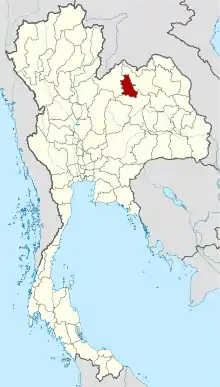 Map of Thailand highlighting Nong Bua Lam Phu Province | |
| Country | Thailand |
| Capital | Nong Bua Lam Phu |
| Government | |
| • Governor | Somchat Jongsupawisalakit (since October 2019)[1] |
| Area | |
| • Total | 3,859 km2 (1,490 sq mi) |
| Area rank | Ranked 55th |
| Population (2018)[3] | |
| • Total | 512,117 |
| • Rank | Ranked 53rd |
| • Density | 133/km2 (340/sq mi) |
| • Density rank | Ranked 33rd |
| Human Achievement Index | |
| • HAI (2017) | 0.5857 "average" Ranked 39th |
| Time zone | UTC+7 (ICT) |
| Postal code | 39xxx |
| Calling code | 042 |
| ISO 3166 code | TH-39 |
| Website | www |
Geography
Nong Bua Lam Phu is in the heart of the Khorat Plateau.
Paleontological remains
Chalawan, an extinct genus of crocodylin, is known solely from its holotype collected in the early-1980s from a road-cut near the town of Nong Bua Lam Phu, in the upper part of the Phu Kradung Formation. This single specimen is the most well preserved vertebrate fossil that has been found from the formation. It contains a single species, Chalawan thailandicus.[5]
History
Nong Bua Lam Phu is famous as the spot where in the 16th century Naresuan, the king-liberator of Siam, came to learn of the outcome of a war between the Lao and Burmese in the area of Vientiane. This place was long a Lao stronghold. During the existence of the Lao Kingdom of Lan Xang (1354–1707), Nong Bua Lam Phu was traditionally given to the crown prince (Uparat) to rule. It was the birthplace of the principal wife of Chao Siribunyasan (พระเจ้าศิริบุญสาร), the last independent king of Vientiane.[6] In 1827, Chao Anou of Vientiane designated Phagna Narin to be governor at the onset of the Laotian Rebellion of 1826-1828.
Under Thai rule, the province originally consisted of five amphoe (districts) in Udon Thani Province. In 1993 Udon was decentralized and a separate province of Nong Bua Lam Phu was created. It is one of the newest provinces of Thailand, together with Amnat Charoen Province, Sa Kaeo Province, and Bueng Kan Province.
Economy
Nong Bua Lamphu is the poorest province in Thailand according to the Bangkok Post. Incomes, as of 2018, average 41,000 baht annually.[7]
The province is largely agricultural. Sticky rice has long been the area's traditional crop, although there has been a shift to sugarcane due to low rice prices and sugarcane's resistance to flooding. In 2016, more than one third of the available agricultural land in Nong Bua Lamphu was used for sugarcane plantations. According to the provincial Office of Agricultural Economics, sugarcane cultivation is expected to rise. In contrast, the area devoted to rice farming shrunk by 73 percent from 2000 to 2016.[8]
Symbols
| The seal of the province shows King Naresuan in a shrine. This shrine was built to commemorate the visit of King Naresuan to the city of Nong Bua Lam Phu in 1574 when he was gathering troops to fight the Burmese kingdom of Taungoo. Behind the shrine is a pond with lotus flowers (Nymphaea lotus), which is the provincial flower. The provincial tree is the Siamese rosewood (Dalbergia cochinchinensis), |
Administrative divisions
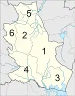
Provincial government
The province is divided into six districts (amphoe). The districts are further divided into 59 subdistricts (tambon) and 636 villages (muban).
Local government
As of 26 November 2019 there are:[9] one Nong Bua Lamphu Provincial Administration Organisation (ongkan borihan suan changwat) and 24 municipal (thesaban) areas in the province. Nong Bua Lamphu has town (thesaban mueang) status. Further 23 subdistrict municipalities (thesaban tambon). The non-municipal areas are administered by 43 Subdistrict Administrative Organisations - SAO (ongkan borihan suan tambon).[3]
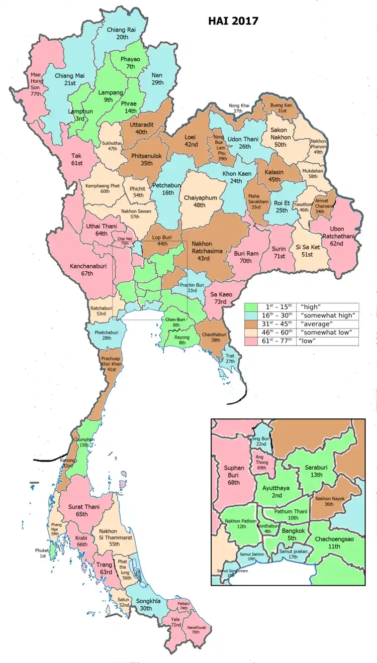
Human achievement index 2017
| Health | Education | Employment | Income |
| 51 | 74 | 33 | 53 |
| Housing | Family | Transport | Participation |
 |
 |
||
| 21 | 4 | 42 | 30 |
| Province Nong Bua Lamphu, with an HAI 2017 value of 0.5857 is "average", occupies place 39 in the ranking. | |||
Since 2003, United Nations Development Programme (UNDP) in Thailand has tracked progress on human development at sub-national level using the Human achievement index (HAI), a composite index covering all the eight key areas of human development. National Economic and Social Development Board (NESDB) has taken over this task since 2017.[4]
| Rank | Classification |
| 1 - 15 | "high" |
| 16 - 30 | "somewhat high" |
| 31 - 45 | "average" |
| 45 - 60 | "somewhat low" |
| 61 - 77 | "low" |
| Map with provinces and HAI 2017 rankings |
 |
Notes
Reports (data) from Thai government are "not copyrightable" (Public Domain), Copyright Act 2537 (1994), section 7.
References
- "ประกาศสำนักนายกรัฐมนตรี เรื่อง แต่งตั้งข้าราชการพลเรือนสามัญ" [Announcement of the Prime Minister's Office regarding the appointment of civil servants] (PDF). Royal Thai Government Gazette. 136 (Special 271 Ngor). 11. 1 November 2019. Retrieved 26 November 2019.
- Advancing Human Development through the ASEAN Community, Thailand Human Development Report 2014, table 0:Basic Data (PDF) (Report). United Nations Development Programme (UNDP) Thailand. pp. 134–135. ISBN 978-974-680-368-7. Retrieved 17 January 2016, Data has been supplied by Land Development Department, Ministry of Agriculture and Cooperatives, at Wayback Machine.
- "รายงานสถิติจำนวนประชากรและบ้านประจำปี พ.ศ.2561" [Statistics, population and house statistics for the year 2018]. Registration Office Department of the Interior, Ministry of the Interior (in Thai). 31 December 2018. Retrieved 20 June 2019.
- Human achievement index 2017 by National Economic and Social Development Board (NESDB), pages 1-40, maps 1-9, retrieved 14 September 2019, ISBN 978-974-9769-33-1
- Martin, J. E.; Lauprasert, K.; Buffetaut, E.; Liard, R.; Suteethorn, V. (2013). Angielczyk, Kenneth (ed.). "A large pholidosaurid in the Phu Kradung Formation of north-eastern Thailand". Palaeontology. 57: 757–769. doi:10.1111/pala.12086.
- Mayurī Ngaosīvat; Pheuiphanh Ngaosyvathn. "I. The Fabric of History. 1. Lao And Thai Contemporaries Of The Drama Speak Out". Paths to conflagration: fifty years of diplomacy and warfare in Laos, Thailand, and Vietnam, 1778–1828. Cornell University: Southeast Asia Program. ISBN 0877277230. Retrieved 24 June 2013.
Born to Siribunyasan (r. 1760-1779), the last independent king of Vientiane, and a princess from the principality of Nong Bua Lam Phu, Chao Anou eventually presided as monarch over both sides of the Mekong River
- "Over 90% of people's woes solved, PM claims". Bangkok Post. 23 March 2018. Retrieved 23 March 2018.
- Sunsuk, Donlawat (2016-07-29). "Sugarcane boom in Nong Bua Lamphu, a bitter pill for public health experts". The Isaan Record. Retrieved 19 November 2017.
- "Number of local government organizations by province". dla.go.th. Department of Local Administration (DLA). 26 November 2019. Retrieved 10 December 2019.
70 Nong Bua Lamphu: 1 PAO, 1 Town mun., 23 Subdistrict mun., 43 SAO.
External links
- Province page from the Tourist Authority of Thailand
- Website of province (Thai only)
- Nong Bua Lam Phu provincial map, coat of arms and postal stamp
Places adjacent to Nong Bua Lamphu Province | ||||||||||
|---|---|---|---|---|---|---|---|---|---|---|
| ||||||||||