Pilger, Nebraska
Pilger is a village in Stanton County, Nebraska, United States.[1] As of the 2010 census, the population was 352. It is located approximately 85 miles northwest of Omaha.
Pilger, Nebraska | |
|---|---|
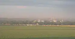 Pilger at sunrise, 2010 | |
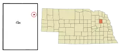 Location of Pilger within Stanton County and Nebraska | |
| Coordinates: 42°0′31″N 97°3′14″W[1] | |
| Country | United States |
| State | Nebraska |
| County | Stanton |
| Platted | 1880 |
| Incorporated | 1887 |
| Area | |
| • Total | 0.29 sq mi (0.76 km2) |
| • Land | 0.29 sq mi (0.76 km2) |
| • Water | 0.00 sq mi (0.00 km2) |
| Elevation | 1,407 ft (429 m) |
| Population | |
| • Total | 352 |
| • Estimate (2019)[4] | 358 |
| • Density | 1,213.56/sq mi (468.59/km2) |
| Time zone | UTC-6 (CST) |
| • Summer (DST) | UTC-5 (CDT) |
| ZIP code | 68768 |
| Area code | 402 |
| FIPS code | 31-39135 [1] |
| GNIS feature ID | 0832104 [1] |
| Website | pilgernebraska.net |
History
Pilger was platted in 1880 when the railroad was extended to that point.[5] It was named after Peter Pilger, the owner of the original townsite.[6] Pilger was incorporated as a village in 1887.[7] The Chicago & North Western ended railroad service in the spring of 1982; after flooding damaged many sections of the track & declining freight traffic volumes (which was ongoing since the mid-1970s) led to the track being abandoned. The track was removed a few years later.
2014 tornadoes
Shortly after 4 p.m. on June 16, 2014, the town was struck by an EF4 tornado. Two people, including a five-year-old girl were killed, and sixteen were critically injured. Another tornado, also rated EF4, passed just east of the town.[8] Pilger was left devastated, and it was later estimated that over half of the buildings were destroyed or severely damaged.[9][10][11]
Geography
Pilger is located at 42°0′31″N 97°3′14″W (42.0086158, -97.0539311).[1] According to the United States Census Bureau, the village has a total area of 0.30 square miles (0.78 km2), all land.[12]
Demographics
| Historical population | |||
|---|---|---|---|
| Census | Pop. | %± | |
| 1880 | 11 | — | |
| 1890 | 162 | 1,372.7% | |
| 1900 | 250 | 54.3% | |
| 1910 | 471 | 88.4% | |
| 1920 | 563 | 19.5% | |
| 1930 | 578 | 2.7% | |
| 1940 | 537 | −7.1% | |
| 1950 | 512 | −4.7% | |
| 1960 | 491 | −4.1% | |
| 1970 | 470 | −4.3% | |
| 1980 | 400 | −14.9% | |
| 1990 | 361 | −9.7% | |
| 2000 | 378 | 4.7% | |
| 2010 | 352 | −6.9% | |
| 2019 (est.) | 358 | [4] | 1.7% |
| U.S. Decennial Census[13] | |||
Pilger is part of the Norfolk, Nebraska Micropolitan Statistical Area.
2010 census
As of the census[3] of 2010, there were 352 people, 159 households, and 97 families residing in the village. The population density was 1,173.3 inhabitants per square mile (453.0/km2). There were 186 housing units at an average density of 620.0 per square mile (239.4/km2). The racial makeup of the village was 95.5% White, 0.6% Native American, 1.7% from other races, and 2.3% from two or more races. Hispanic or Latino of any race were 4.3% of the population.
There were 159 households, of which 26.4% had children under the age of 18 living with them, 47.2% were married couples living together, 7.5% had a female householder with no husband present, 6.3% had a male householder with no wife present, and 39.0% were non-families. 35.8% of all households were made up of individuals, and 20.1% had someone living alone who was 65 years of age or older. The average household size was 2.21 and the average family size was 2.85.
The median age in the village was 43.3 years. 23.9% of residents were under the age of 18; 5.1% were between the ages of 18 and 24; 23.3% were from 25 to 44; 25.6% were from 45 to 64; and 22.2% were 65 years of age or older. The gender makeup of the village was 49.7% male and 50.3% female.
2000 census
As of the census[14] of 2000, there were 378 people, 164 households, and 106 families residing in the village. The population density was 1,244.9 people per square mile (486.5/km2). There were 183 housing units at an average density of 602.7 per square mile (235.5/km2). The racial makeup of the village was 97.62% White, 0.53% Native American, 0.79% from other races, and 1.06% from two or more races. Hispanic or Latino of any race were 1.85% of the population.
There were 164 households, out of which 29.9% had children under the age of 18 living with them, 51.8% were married couples living together, 7.3% had a female householder with no husband present, and 34.8% were non-families. 30.5% of all households were made up of individuals, and 15.2% had someone living alone who was 65 years of age or older. The average household size was 2.30 and the average family size was 2.87.
In the village, the population was spread out, with 24.9% under the age of 18, 6.3% from 18 to 24, 25.9% from 25 to 44, 23.3% from 45 to 64, and 19.6% who were 65 years of age or older. The median age was 40 years. For every 100 females, there were 91.9 males. For every 100 females age 18 and over, there were 90.6 males.
As of 2000 the median income for a household in the village was $31,364, and the median income for a family was $41,500. Males had a median income of $27,273 versus $18,750 for females. The per capita income for the village was $18,178. About 3.8% of families and 7.4% of the population were below the poverty line, including 9.5% of those under age 18 and 13.1% of those age 65 or over.
Climate
This climatic region is typified by large seasonal temperature differences, with warm to hot (and often humid) summers and cold (sometimes severely cold) winters. According to the Köppen Climate Classification system, Pilger has a humid continental climate, abbreviated "Dfa" on climate maps.[15]
| Climate data for Pilger, Nebraska | |||||||||||||
|---|---|---|---|---|---|---|---|---|---|---|---|---|---|
| Month | Jan | Feb | Mar | Apr | May | Jun | Jul | Aug | Sep | Oct | Nov | Dec | Year |
| Average high °C (°F) | 0 (32) |
2 (36) |
9 (48) |
17 (63) |
23 (73) |
28 (82) |
31 (88) |
30 (86) |
25 (77) |
19 (66) |
9 (49) |
2 (35) |
16 (61) |
| Average low °C (°F) | −12 (10) |
−10 (14) |
−4 (25) |
3 (37) |
9 (48) |
14 (58) |
17 (63) |
16 (61) |
11 (51) |
4 (39) |
−4 (25) |
−9 (15) |
3 (37) |
| Average precipitation mm (inches) | 15 (0.6) |
20 (0.8) |
41 (1.6) |
64 (2.5) |
97 (3.8) |
110 (4.4) |
89 (3.5) |
76 (3) |
66 (2.6) |
41 (1.6) |
28 (1.1) |
20 (0.8) |
670 (26.4) |
| Source: Weatherbase [16] | |||||||||||||
Notable person
- Bud Tinning, major league baseball player who pitched four seasons, for the St. Louis Cardinals and Chicago Cubs, during the 1930s
See also
- Nebraska locations by per capita income
- Siouxland
- U.S. Route 275
References
- Geographic Names Information System (GNIS) details for Pilger Nebraska; United States Geological Survey (USGS); March 9, 1979.
- "2019 U.S. Gazetteer Files". United States Census Bureau. Retrieved July 26, 2020.
- "U.S. Census website". United States Census Bureau. Retrieved 2012-06-24.
- "Population and Housing Unit Estimates". United States Census Bureau. May 24, 2020. Retrieved May 27, 2020.
- "Pilger, Stanton County". Center for Advanced Land Management Information Technologies. University of Nebraska. Retrieved 23 August 2014.
- Maas, Mary L. (22 October 2008). Stanton County. Arcadia Publishing. p. 13. ISBN 978-1-4396-3676-3.
- "Stanton County" (Nebraska historical marker text). Nebraska State Historical Society. Retrieved 2014-06-17.
- "Preliminary NWS Damage Survey for 06/16/14 Tornado Event". National Weather Service Office in Omaha, Nebraska. Retrieved 18 June 2014.
- Pilger hit hard by tornado, child killed, numerous people injured, town evacuated; Omaha World-Herald; June 17, 2014.
- Twin Tornadoes Ransack Pilger; AccuWeather.com; June 17, 2014.
- Deadly US tornadoes strike Nebraska; BBC; June 16, 2014.
- "US Gazetteer files 2010". United States Census Bureau. Archived from the original on 2012-01-25. Retrieved 2012-06-24.
- U.S. Decennial Census; census.gov
- "U.S. Census website". United States Census Bureau. Retrieved 2008-01-31.
- Climate Summary for Pilger, Nebraska
- "Weatherbase.com". Weatherbase. 2013. Retrieved on October 9, 2013.
External links
Municipalities and communities of Stanton County, Nebraska, United States | ||
|---|---|---|
| City | 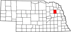 Map of Nebraska highlighting Stanton County | |
| Village | ||
| CDP | ||
| ||
| Authority control |
|---|