Piru, Indonesia
Piru is a small town and capital of the West Seram Regency on the southwestern coast of the Indonesian island of Seram.[1] On 21–22 August 1999 there was violent conflict in the area and other settlements such as Ariate, Loki, Laala and Wailissa, which resulted in 12 deaths in total on the island.[2]
Piru | |
|---|---|
Town | |
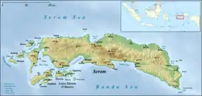 Piru Location in Seram Island | |
| Coordinates: 3°4′52″S 128°8′28″E | |
| Country | Indonesia |
| Province | Maluku |
| Regency | West Seram |
| Time zone | UTC+9 (WITA) |
Climate
Piru has a tropical rainforest climate (Af) with moderate rainfall in July and August and heavy rainfall in the remaining months.
| Climate data for Piru | |||||||||||||
|---|---|---|---|---|---|---|---|---|---|---|---|---|---|
| Month | Jan | Feb | Mar | Apr | May | Jun | Jul | Aug | Sep | Oct | Nov | Dec | Year |
| Average high °C (°F) | 30.8 (87.4) |
30.8 (87.4) |
30.7 (87.3) |
30.1 (86.2) |
29.4 (84.9) |
28.5 (83.3) |
27.6 (81.7) |
27.8 (82.0) |
28.9 (84.0) |
29.7 (85.5) |
30.9 (87.6) |
30.8 (87.4) |
29.7 (85.4) |
| Daily mean °C (°F) | 27.4 (81.3) |
27.3 (81.1) |
27.3 (81.1) |
26.9 (80.4) |
26.6 (79.9) |
26.0 (78.8) |
25.3 (77.5) |
25.4 (77.7) |
26.0 (78.8) |
26.4 (79.5) |
27.3 (81.1) |
27.3 (81.1) |
26.6 (79.9) |
| Average low °C (°F) | 24.0 (75.2) |
23.9 (75.0) |
23.9 (75.0) |
23.8 (74.8) |
23.8 (74.8) |
23.5 (74.3) |
23.1 (73.6) |
23.1 (73.6) |
23.2 (73.8) |
23.2 (73.8) |
23.8 (74.8) |
23.9 (75.0) |
23.6 (74.5) |
| Average rainfall mm (inches) | 214 (8.4) |
205 (8.1) |
211 (8.3) |
183 (7.2) |
184 (7.2) |
173 (6.8) |
107 (4.2) |
117 (4.6) |
139 (5.5) |
128 (5.0) |
197 (7.8) |
283 (11.1) |
2,141 (84.2) |
| Source: Climate-Data.org[3] | |||||||||||||
References
- "Seram Island (map)". Indonesiatravelingguide.com. Retrieved 8 June 2015.
- Summary of World Broadcasts: Asia, Pacific. BBC Monitoring. 1999.
- "Climate: Piru". Climate-Data.org. Retrieved 23 November 2020.
This article is issued from Wikipedia. The text is licensed under Creative Commons - Attribution - Sharealike. Additional terms may apply for the media files.
