Planada, California
Planada (formerly, Geneva and Whitton)[3] is a census-designated place (CDP) in Merced County, California, United States. Planada is located 9 miles (14 km) east of Merced,[3] at an elevation of 226 feet (69 m).[2] The population was 4,584 at the 2010 census, up from 4,369 at the 2000 census. It has a nickname called "Planet" which originated from its community.
Planada | |
|---|---|
 Location in Merced County and the state of California | |
 Planada Location in the United States | |
| Coordinates: 37°17′N 120°19′W | |
| Country | |
| State | |
| County | Merced |
| Area | |
| • Total | 1.577 sq mi (4.085 km2) |
| • Land | 1.577 sq mi (4.085 km2) |
| • Water | 0 sq mi (0 km2) 0% |
| Elevation | 226 ft (69 m) |
| Population | |
| • Total | 4,584 |
| • Density | 2,900/sq mi (1,100/km2) |
| Time zone | UTC-8 (Pacific) |
| • Summer (DST) | UTC-7 (PDT) |
| ZIP code | 95365 |
| Area code(s) | 209 |
| FIPS code | 06-57582 |
| GNIS feature ID | 1659784 |
Geography
Planada is located at 37°17′N 120°19′W.[2]
According to the United States Census Bureau, the CDP has a total area of 1.6 square miles (4.1 km2), all of it land.
Climate
According to the Köppen Climate Classification system, Planada has a warm-summer Mediterranean climate, abbreviated "Csa" on climate maps.[4]
History
Planada was originally named Whitton by railroad officials.[3] The area's first settlers was a group of white Swiss dairy farmers, who renamed the settlement Geneva.[3] The Geneva post office opened in 1896, closed in 1897, then reopened in 1898. In 1911, it held a contest to select a new name for the town, and Planada was the winning entry.[3]
Demographics
2010
At the 2010 census Planada had a population of 4,584. The population density was 2,906.6 people per square mile (1,122.2/km2). The racial makeup of Planada was 1,681 (36.7%) White, 22 (0.5%) African American, 23 (0.5%) Native American, 46 (1.0%) Asian, 1 (0.0%) Pacific Islander, 2,725 (59.4%) from other races, and 86 (1.9%) from two or more races. Hispanic or Latino of any race were 4,347 persons (94.8%).[5]
The whole population lived in households, no one lived in non-institutionalized group quarters and no one was institutionalized.
There were 1,115 households, 675 (60.5%) had children under the age of 18 living in them, 737 (66.1%) were opposite-sex married couples living together, 154 (13.8%) had a female householder with no husband present, 111 (10.0%) had a male householder with no wife present. There were 45 (4.0%) unmarried opposite-sex partnerships, and 9 (0.8%) same-sex married couples or partnerships. 95 households (8.5%) were one person and 35 (3.1%) had someone living alone who was 65 or older. The average household size was 4.11. There were 1,002 families (89.9% of households); the average family size was 4.30.
The age distribution was 1,552 people (33.9%) under the age of 18, 588 people (12.8%) aged 18 to 24, 1,201 people (26.2%) aged 25 to 44, 876 people (19.1%) aged 45 to 64, and 367 people (8.0%) who were 65 or older. The median age was 27.1 years. For every 100 females, there were 108.0 males. For every 100 females age 18 and over, there were 109.2 males.
There were 1,207 housing units at an average density of 765.3 per square mile, of the occupied units 649 (58.2%) were owner-occupied and 466 (41.8%) were rented. The homeowner vacancy rate was 3.4%; the rental vacancy rate was 7.3%. 2,638 people (57.5% of the population) lived in owner-occupied housing units and 1,946 people (42.5%) lived in rental housing units.
2000
At the 2000 census there were 4,369 people, 1,007 households, and 900 families in the CDP. The population density was 2,051.1 people per square mile (792.0/km2). There were 1,043 housing units at an average density of 489.6 per square mile (189.1/km2). The racial makeup of the CDP was 24.28% White, 0.69% African American, 1.81% Native American, 0.53% Asian, 0.02% Pacific Islander, 67.91% from other races, and 4.76% from two or more races. Hispanic or Latino of any race were 92.10%.[6]
Of the 1,007 households 58.1% had children under the age of 18 living with them, 66.4% were married couples living together, 15.4% had a female householder with no husband present, and 10.8% were non-families. 7.5% of households were one person and 3.3% were one person aged 65 or older. The average household size was 4.11 and the average family size was 4.28.
The age distribution was 38.8% under the age of 18, 12.2% from 18 to 24, 27.9% from 25 to 44, 14.3% from 45 to 64, and 6.8% 65 or older. The median age was 24 years. For every 100 females, there were 109.9 males. For every 100 females age 18 and over, there were 109.6 males.
The median household income was $24,286 and the median family income was $24,513. Males had a median income of $20,341 versus $20,446 for females. The per capita income for the CDP was $9,864. About 28.7% of families and 33.9% of the population were below the poverty line, including 38.4% of those under age 18 and 18.8% of those age 65 or over.
Politics
In the California State Legislature, Planada is located in the 12th Senate District, represented by Republican Anthony Cannella, and in the 21st Assembly District, represented by Democrat Adam Gray.[7]
In the United States House of Representatives, Planada is in California's 16th congressional district, represented by Democrat Jim Costa.[8]
References
- "2010 Census U.S. Gazetteer Files – Places – California". United States Census Bureau.
- U.S. Geological Survey Geographic Names Information System: Planada, California
- Durham, David L. (1998). California's Geographic Names: A Gazetteer of Historic and Modern Names of the State. Clovis, Calif.: Word Dancer Press. p. 816. ISBN 1-884995-14-4.
- Climate Summary for Planada, California
- "2010 Census Interactive Population Search: CA - Planada CDP". U.S. Census Bureau. Archived from the original on July 15, 2014. Retrieved July 12, 2014.
- "U.S. Census website". United States Census Bureau. Retrieved 2008-01-31.
- "Statewide Database". UC Regents. Archived from the original on February 1, 2015. Retrieved November 23, 2014.
- "California's 16th Congressional District - Representatives & District Map". Civic Impulse, LLC. Retrieved October 1, 2014.
Municipalities and communities of Merced County, California, United States | ||
|---|---|---|
| Cities | 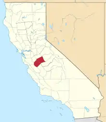 Merced County map | |
| CDPs | ||
| Unincorporated communities | ||
| Ghost towns | ||
| ||