Plympton–Wyoming
Plympton–Wyoming is a town in the Canadian province of Ontario, located in Lambton County immediately east of Sarnia. It is the seat of the Lambton County Council.[2]
Plympton-Wyoming | |
|---|---|
| Town of Plympton-Wyoming | |
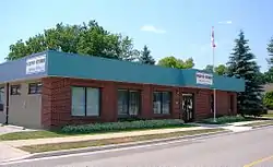 Plympton-Wyoming municipal office | |
| Nickname(s): The Hub of Lambton County | |
 Plympton-Wyoming | |
| Coordinates: 43°01′N 82°05′W | |
| Country | |
| Province | |
| County | Lambton |
| Formed | 2001 |
| Government | |
| • Mayor | Lonny Napper |
| • Federal riding | Sarnia—Lambton |
| • Prov. riding | Sarnia—Lambton |
| Area | |
| • Land | 318.78 km2 (123.08 sq mi) |
| Population (2016)[1] | |
| • Total | 7,576 |
| • Density | 23.8/km2 (62/sq mi) |
| Time zone | UTC-5 (EST) |
| • Summer (DST) | UTC-4 (EDT) |
| Postal code | N0N 1T0 |
| Area code(s) | 519 ,226 and 548 |
| Website | plympton-wyoming.com |
The town's first mayor was Patricia Davidson, who was elected to the House of Commons of Canada in the 2006 federal election as the Conservative Member of Parliament for Sarnia—Lambton. Davidson also served as mayor of the village of Wyoming for ten years prior to her election as mayor of the amalgamated town. Davidson was succeeded as mayor by former town councillor and deputy mayor Lonny Napper in March 2006. The township is governed by a seven-member Council, including a Mayor and Deputy Mayor.[3]
The name Wyoming derives from the Munsee name xwé:wamənk, meaning "at the big river flat." Plympton is named after Plympton in Devon, England.[4]
History
The town was created in 2001, amalgamating the Township of Plympton with the formerly independent Village of Wyoming.
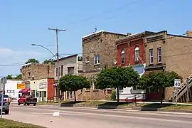
Communities
The main population centre is Wyoming. The town also comprises the communities of Aberarder, Beverly Glen, Blue Point, Blue Point Bay, Bonnie Doone, Camlachie, Errol, Gallimere Beach, Hillsborough Beach, Huron Heights, Kennedy Acres, Kertch, Mandaumin, Reece's Corners, Uttoxeter, Wanstead and Wellington Beach.
Demographics
| Canada census – Plympton–Wyoming community profile | |||
|---|---|---|---|
| 2016 | 2011 | 2006 | |
| Population: | 7,795 (+2.9% from 2011) | 7,576 (+0.9% from 2006) | 7,506 (+2.0% from 2001) |
| Land area: | 318.78 km2 (123.08 sq mi) | 318.76 km2 (123.07 sq mi) | 318.76 km2 (123.07 sq mi) |
| Population density: | 24.5/km2 (63/sq mi) | 23.8/km2 (62/sq mi) | 13.6/km2 (35/sq mi) |
| Median age: | 45.6 (M: 45.2, F: 46.1) | 44.1 (M: 43.4, F: 44.7) | |
| Total private dwellings: | 3,416 | 3,148 | 3,066 |
| Median household income: | $91,451 | ||
| References: 2016[5] 2011[6] 2006[7] earlier[8] | |||
| Year | Pop. | ±% |
|---|---|---|
| 1996 | 7,344 | — |
| 2001 | 7,359 | +0.2% |
| 2006 | 7,506 | +2.0% |
| 2011 | 7,576 | +0.9% |
| 2016 | 7,795 | +2.9% |
| [9][10][11] | ||
Populations prior to amalgamation (2001):
- Population total in 1996: 7,344
- Plympton (township): 5,247
- Wyoming (village): 2,131
- Population in 1991:
- Plympton (township): 5,275
- Wyoming (village): 2,071
References
- "Census Profile, 2016 Census: Plympton-Wyoming, Town". Statistics Canada. Retrieved June 17, 2019.
- "Contact Us - The Corporation of the County of Lambton". Archived from the original on 2006-11-16. Retrieved 2006-11-19.
- "Community Profile - Township of Plympton-Wyoming". Retrieved 2013-09-26.
- Rayburn, Alan (1997). Place names of Ontario. Toronto: University of Toronto Press. p. 273. ISBN 0-8020-7207-0. Retrieved 21 October 2017.
- "2016 Community Profiles". 2016 Canadian Census. Statistics Canada. February 21, 2017. Retrieved 2019-06-17.
- "2011 Community Profiles". 2011 Canadian Census. Statistics Canada. July 5, 2013. Retrieved 2019-06-17.
- "2006 Community Profiles". 2006 Canadian Census. Statistics Canada. March 30, 2011. Retrieved 2011-02-22.
- "2001 Community Profiles". 2001 Canadian Census. Statistics Canada. February 17, 2012.
- Statistics Canada: 1996, 2001, 2006 census
- "Plympton-Wyoming community profile". 2006 Census data. Statistics Canada. Retrieved 2011-02-22.
- "Plympton-Wyoming census profile". 2011 Census of Population. Statistics Canada. Retrieved 2012-08-03.
External links
| Wikimedia Commons has media related to Plympton–Wyoming. |
Places adjacent to Plympton–Wyoming | ||||||||||
|---|---|---|---|---|---|---|---|---|---|---|
| ||||||||||