Podpeč nad Marofom
Podpeč nad Marofom (pronounced [pɔtˈpeːtʃ nat ˈmaːɾɔfɔm]) is a small settlement west of Planina pri Sevnici in the Municipality of Šentjur, eastern Slovenia. The settlement, and the entire municipality, are included in the Savinja Statistical Region, which is in the Slovenian portion of the historical Duchy of Styria.[4]
Podpeč nad Marofom | |
|---|---|
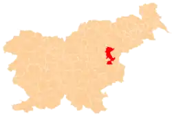
 Podpeč nad Marofom Location in Slovenia | |
| Coordinates: 46°6′21.84″N 15°22′51.88″E | |
| Country | |
| Traditional region | Styria |
| Statistical region | Savinja |
| Municipality | Šentjur |
| Area | |
| • Total | 1.58 km2 (0.61 sq mi) |
| Elevation | 581.7 m (1,908.5 ft) |
| Population | |
| • Total | 23 |
| • Density | 15/km2 (38/sq mi) |
| [3] | |
Name
The name of the settlement was changed from Podpeč to Podpeč nad Marofom in 1953.[5]
References
- Razpotnik, Barica (2020-06-08). "On 1 January 2020, 2,095,861 residents of Slovenia lived in 5,978 settlements; 57 settlements were unpopulated" (Press release). Ljubljana: Statistical Office of the Republic of Slovenia. Retrieved 2021-01-10.
final data (XLS attachment)
- Prebivalci po spolu, občine in naselja, Slovenija, 1. januar 2020 [Population by sex, municipalities and resorts, Slovenia, 1 January 2020]. Statistical Office of the Republic of Slovenia (XLS) (in Slovenian). Ljubljana. 2020-06-08. Retrieved 2021-01-10.
(note: for Šentjur, the municipality is at code 120, followed immediately by its settlements at codes 120001–120121)
- Statistical Office of the Republic of Slovenia
- Šentjur municipal site Archived 2011-01-15 at the Wayback Machine
- Spremembe naselij 1948–95. 1996. Database. Ljubljana: Geografski inštitut ZRC SAZU, DZS.
External links
This article is issued from Wikipedia. The text is licensed under Creative Commons - Attribution - Sharealike. Additional terms may apply for the media files.