Razbor, Šentjur
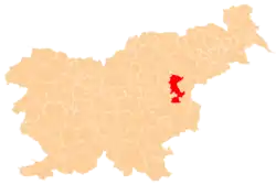
Razbor (pronounced [ˈɾaːzbɔɾ]) is a settlement in the Municipality of Šentjur, eastern Slovenia. It lies in the hills between Ponikva and Dramlje. The Slovenian A1 motorway runs along the northwestern edge of the settlement's territory. The settlement, and the entire municipality, are included in the Savinja Statistical Region, which is in the Slovenian portion of the historical Duchy of Styria.[4]
Razbor | |
|---|---|
 Razbor Location in Slovenia | |
| Coordinates: 46°15′55.7″N 15°24′54.96″E | |
| Country | |
| Traditional region | Styria |
| Statistical region | Savinja |
| Municipality | Šentjur |
| Area | |
| • Total | 2.69 km2 (1.04 sq mi) |
| Elevation | 326.8 m (1,072.2 ft) |
| Population | |
| • Total | 198 |
| • Density | 74/km2 (190/sq mi) |
| [3] | |
References
- Razpotnik, Barica (2020-06-08). "On 1 January 2020, 2,095,861 residents of Slovenia lived in 5,978 settlements; 57 settlements were unpopulated" (Press release). Ljubljana: Statistical Office of the Republic of Slovenia. Retrieved 2021-01-10.
final data (XLS attachment)
- Prebivalci po spolu, občine in naselja, Slovenija, 1. januar 2020 [Population by sex, municipalities and resorts, Slovenia, 1 January 2020]. Statistical Office of the Republic of Slovenia (XLS) (in Slovenian). Ljubljana. 2020-06-08. Retrieved 2021-01-10.
(note: for Šentjur, the municipality is at code 120, followed immediately by its settlements at codes 120001–120121)
- Statistical Office of the Republic of Slovenia
- Šentjur municipal site Archived 2011-01-15 at the Wayback Machine
External links
This article is issued from Wikipedia. The text is licensed under Creative Commons - Attribution - Sharealike. Additional terms may apply for the media files.