Pogal Paristan
Pogal Paristan is an tehsil located in the Ramban district, in the union territory of Jammu and Kashmir. The Tehsil headquarter is Ukhral village, which is 8 kilometres (5.0 mi) from National Highway 44 via Magarkote. It is located 35 kilometres (22 mi) from its district headquarters in Ramban and 23 kilometres (14 mi) from Banihal.[1]
Pogal Paristan | |
|---|---|
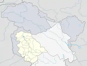
 Pogal Paristan Location in Jammu and Kashmir, India  Pogal Paristan Pogal Paristan (India) | |
| Coordinates: 33.313086°N 75.261806°E | |
| Country | |
| Union Territory | Jammu and Kashmir |
| District | Ramban |
| Established | 2014 |
| Languages | |
| • Official | Urdu |
| Local Languages | |
| • Spoken | Pogali, Kashmiri, Urdu, Gojri |
| Time zone | UTC+5:30 (IST) |
| Pincode | 182145 |
| Website | ramban |
Etymology
The name Pogal Paristan is derived from the names of two valleys, the Pogal and Paristan (or Peristan) Valleys. The name Paristan is derived from Muslim folklore. It means land of the peris.[2][3] Pogal is derived from two words 'pooh' a month in desi calander and 'Gul' means flower. A Local fauna called 'Chhraund' ژریونڈ blooms here in the month of 'pooh'(Dec).
Geography
The Pogal Valley lies on the southeast end of Tehsil Banihal, and a stream known as 'Sundari' or 'Pogal stream' runs through it. The Paristan Valley is a narrow valley situated at the southeast end of Tehsil Banihal that runs roughly east to west. Its south side is a forest-covered mountain range of considerable elevation, while the north is a range of mostly bare and stony hills. The path from Kishtwir to Kashmir, by the Nandmarg pass, crosses the Paristan Valley; it is used early in the season before the Brari Bal route becomes usable. A village in the valley named Peristan, , The valley contains no large villages, but does contain numerous hamlets and a considerable amount of agricultural cultivation .
The beautiful mountainious valley of Paristan is covered from all sides by sky touching mountains & some picturesque greenery. it's western side have beautiful tourist place called Sunaseri doodpawa .This boundar of Sunaseeri n Doodpawaa touches from one side Hansraaj top n other side with Suliman top.then while moving toward northward 'Margan top ' Moonal goath ' Tookra' Hinjan galli ' Doobdanada Sharwaa dhaar ' Kakar galli Hummar valley adds it's beauti.
The Doobhdandas posses carbonate rocks ' which gives signal of petroleum resources .then there "Tookra" rock formation which possess coal assemblages [2]
About
In 2014, Pogal Paristan Tehsil was carved out from Banihal Tehsil. There are nine revenue villages in the Tehsil; Pogal, Alinbass, Panchal, Paristan, Bingara, Dhanmasta, Sujmatna, Ramsu, and Senabhati. The area is quite hilly.
Economy
Inhabitants in Pogal Paristan are mostly agricultural, and grow crops such as Maize, Potatoes, and Pluses (Rajma).
Weather
The climate is described as pleasant in the summer and cold and harsh in the winter.[1]
Streams
The two major streams in Pogal Paristan are the 'Sundari' or 'Pogal Stream' and the Paristan (or Peristan) stream. The Paritsan (Peristan) stream flows west from its headwaters on a mountain at the north-east end of the valley, while the Sundari (Pogal Stream) flows southwest down the southern slopes of the Nandmarg Mountain, until the two unite upstream of the Paristan (Peristan) Stream's junction with the Bichlari River. The banks of the Paristan (Peristan) Stream are mostly high and steep, especially on its north side. It is bridged just west of the Village of Chiuli. A ford is located a short distance upstream of the bridge, and its possible that there are more in other parts of the river.[2]
References
- "Places of Interest". Ramban administration (Government of Jammu and Kashmir). Retrieved 3 August 2020.
- "Pogal Paristan : Land of Fairies". Travel The Himalayas. 16 July 2019. Retrieved 4 August 2020.
- "Paristan", Wikipedia, 2020-06-15, retrieved 2020-09-14