Pokuru, New Zealand
Pokuru is a rural community in the Waipa District and Waikato region of New Zealand's North Island.
Hautapu | |
|---|---|
Village | |
| |
| Coordinates: 38.056049°S 175.235353°E | |
| Country | New Zealand |
| Region | Waikato Region |
| District | Waipa District |
| Population (2018 census) | |
| • Territorial | 150 |
| Time zone | UTC+12 (NZST) |
| • Summer (DST) | UTC+13 (NZDT) |
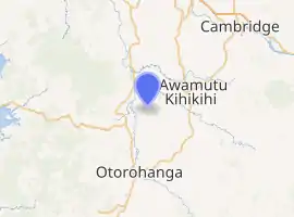
It is located southwest of Te Awamutu, southeast of Pirongia and north of Otorohanga, between State Highway 39 and State Highway 1.
It has two marae:
Demographics
| Year | Pop. | ±% p.a. |
|---|---|---|
| 2006 | 1,167 | — |
| 2013 | 1,263 | +1.14% |
| 2018 | 1,425 | +2.44% |
| Source: [3] | ||
The statistical area of Pokuru, which at 109 square kilometres is much larger than the community, had a population of 1,425 at the 2018 New Zealand census, an increase of 162 people (12.8%) since the 2013 census, and an increase of 258 people (22.1%) since the 2006 census. There were 489 households. There were 714 males and 708 females, giving a sex ratio of 1.01 males per female. The median age was 37.7 years (compared with 37.4 years nationally), with 336 people (23.6%) aged under 15 years, 240 (16.8%) aged 15 to 29, 648 (45.5%) aged 30 to 64, and 195 (13.7%) aged 65 or older.
Ethnicities were 89.7% European/Pākehā, 12.8% Māori, 0.8% Pacific peoples, 1.9% Asian, and 4.0% other ethnicities (totals add to more than 100% since people could identify with multiple ethnicities).
The proportion of people born overseas was 11.8%, compared with 27.1% nationally.
Although some people objected to giving their religion, 50.9% had no religion, 37.1% were Christian, 0.2% were Hindu, 0.0% were Muslim, 0.2% were Buddhist and 2.1% had other religions.
Of those at least 15 years old, 183 (16.8%) people had a bachelor or higher degree, and 204 (18.7%) people had no formal qualifications. The median income was $41,200, compared with $31,800 nationally. The employment status of those at least 15 was that 612 (56.2%) people were employed full-time, 183 (16.8%) were part-time, and 30 (2.8%) were unemployed.[3]
Pokuru locality is in meshblocks 0983500 and 0983600, which had a population of 150 people in the 2018 census.[4]
Education
Pokuru School is a co-educational state primary school,[5] with a roll of 156 as of March 2020.[6] The school opened as Kakepuku School in 1907, and became Pokuru School in 1926.[7][8]
References
- "Te Kāhui Māngai directory". tkm.govt.nz. Te Puni Kōkiri.
- "Māori Maps". maorimaps.com. Te Potiki National Trust.
- "Statistical area 1 dataset for 2018 Census". Statistics New Zealand. March 2020. Pokuru (182100). 2018 Census place summary: Pokuru
- "Meshblock Electoral Populations 2020 for proposed boundaries data". Statistics New Zealand. April 2020. Meshblocks 0983500 and 0983600.
- Education Counts: Pokuru School
- "Education Review Office Report". ero.govt.nz. Education Review Office.
- "Pokuru School". Te Awamutu Museum. Retrieved 3 November 2020.
- "Pokuru School and district diamond jubilee, 1907-1982 (collection record)". National Library. Retrieved 3 November 2020.