Pongakawa
Pongakawa is a rural community in the Bay of Plenty of New Zealand's North Island.[1] State Highway 2 runs through it.
Pongakawa | |
|---|---|
| |
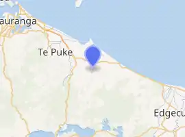
| Coordinates: 37.836741°S 176.476480°E | |
| Country | New Zealand |
| Region | Bay of Plenty |
| Territorial authority | Western Bay of Plenty District |
| Ward | Te Puke |
| Elevation | 27 m (89 ft) |
| Time zone | UTC+12 (NZST) |
| • Summer (DST) | UTC+13 (NZDT) |
| Postcode | 3189 |
| Area code(s) | 07 |
The local Tokerau Marae and Pikiao meeting house are a traditional meeting ground of the Ngāti Pikiao tribe.[2][3]
The name of the settlement comes from Māori terms meaning "Bitter ferns".[4]
Demographics
| Year | Pop. | ±% p.a. |
|---|---|---|
| 2006 | 2,700 | — |
| 2013 | 2,673 | −0.14% |
| 2018 | 3,081 | +2.88% |
| Source: [5] | ||
The statistical area of Pongakawa, which at 389 square kilometres is much larger than the settlement, had a population of 3,081 at the 2018 New Zealand census, an increase of 408 people (15.3%) since the 2013 census, and an increase of 381 people (14.1%) since the 2006 census. There were 1,080 households. There were 1,602 males and 1,476 females, giving a sex ratio of 1.09 males per female. The median age was 36.7 years (compared with 37.4 years nationally), with 741 people (24.1%) aged under 15 years, 522 (16.9%) aged 15 to 29, 1,464 (47.5%) aged 30 to 64, and 354 (11.5%) aged 65 or older.
Ethnicities were 83.3% European/Pākehā, 23.4% Māori, 1.9% Pacific peoples, 4.3% Asian, and 2.4% other ethnicities (totals add to more than 100% since people could identify with multiple ethnicities).
The proportion of people born overseas was 11.4%, compared with 27.1% nationally.
Although some people objected to giving their religion, 57.4% had no religion, 28.0% were Christian, 0.8% were Hindu, 0.2% were Muslim, 0.4% were Buddhist and 5.5% had other religions.
Of those at least 15 years old, 270 (11.5%) people had a bachelor or higher degree, and 519 (22.2%) people had no formal qualifications. The median income was $36,700, compared with $31,800 nationally. The employment status of those at least 15 was that 1,362 (58.2%) people were employed full-time, 399 (17.1%) were part-time, and 54 (2.3%) were unemployed.[5]
Education
Pongakawa School is a co-educational state primary school for Year 1 to 8 students,[6] with a roll of 321 as of March 2020.[7]
References
- NZTA: Tauranga Eastern Link - Frequently Asked Questions
- "Te Kāhui Māngai directory". tkm.govt.nz. Te Puni Kōkiri.
- "Māori Maps". maorimaps.com. Te Potiki National Trust.
- Reed, A.W. (1975). Place names of New Zealand. Wellington: A.H. & A.W. Reed. p. 333.
- "Statistical area 1 dataset for 2018 Census". Statistics New Zealand. March 2020. Pongakawa (192500). 2018 Census place summary: Pongakawa
- "Pongakawa School Ministry of Education School Profile". educationcounts.govt.nz. Ministry of Education.
- "Pongakawa School Education Review Office Report". ero.govt.nz. Education Review Office.