Port Nelson, New Zealand
Port Nelson, as its name suggests, is the main port area of Nelson, New Zealand.
Port Nelson | |
|---|---|
Suburb | |
 Nelson, with Port Nelson in the back left | |
| |
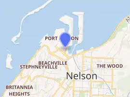
| Coordinates: 41°13′40″S 173°19′20″E | |
| Country | |
| Region | Nelson |
| Territorial authority | Nelson |
| Government | |
| • Nelson City Mayor | Rachel Reese |
| • Nelson MP | Rachel Boyack |
| • Te Tai Tonga MP | Rino Tirikatene |
| Area | |
| • Total | 1.01 km2 (0.39 sq mi) |
| • Land | 1.01 km2 (0.39 sq mi) |
| • Water | 0 km2 (0 sq mi) |
| Population (June 2020) | |
| • Total | 30[1] |
| Time zone | UTC+12 (NZST) |
| • Summer (DST) | UTC+13 (NZDT) |
| Postcode | 7010 |
| Area code(s) | 03 |
It lies to the northwest of Nelson city centre, to the north of Washington Valley, at the southern end of Nelson Haven. The harbour entrance lies at the southwestern end of Boulder Bank, immediately to the west of Port Nelson.[2]
Geography
Port Nelson covers a land area of 0.98 km².[3]
Nelson Marina, a marina owned by Nelson City Council, is located in the Port Nelson area.[4]
The council also owns Custom House Reserve, a small area of public reserve around the port's custom house.[4]
History
The estimated population of Port Nelson reached 40 in 1996.[5]
It reached 90 in 2001, 100 in 2006, and 60 in 2018.[5]
Demography
Port Nelson has an estimated population of 30. It has a population density of 30.65 people per km² as of 2019.[6]
As of the 2018 census, the median age was 38.9, the median income was $24,300, #VALUE! of people earned over $100,00, 14.3% had a Bachelor's Degree or higher, and 0.0% of the workforce was unemployed.[5]
Ethnically, the population was 81.8% New Zealand European and 18.2% Māori; 36.4% were born overseas.[5]
Transport
As of 2018, among those who commute to work, 44.4% drove a car, 11.1% rode in a car,11.1% use a bike, and 11.1% walk or run. No one took public transport.[5]
References
- "Population estimate tables - NZ.Stat". Statistics New Zealand. Retrieved 22 October 2019.
- Wise's Nelson-Blenheim "Easyread" Map ISBN 1 877402 50 8
- "Statistical Area 2 2018 (generalised) GIS" (Data table). stats.govt.nz. Statistics New Zealand.
- "Nelson Parks and Reserves". gdc.govt.nz. Gisborne District Council.
- "Place Summary – Port Nelson". Stats NZ. Statistics New Zealand.
- "Provisional Statistics". stats.govt.nz. Statistics New Zealand.