Portsmouth Parade Historic District
The Portsmouth Parade Historic District is an area in Portsmouth, New Hampshire, which was formerly listed in the National Register of Historic Places (NRHP). The district is known locally as "The Hill", a cluster of closely spaced historic houses bounded on the north by Deer Street and the east by High Street at the northern edge of downtown Portsmouth. The grouping was created by a road widening project,[lower-alpha 2] from houses originally located on or near Deer Street.
Portsmouth Parade Historic District | |
Formerly listed on the U.S. National Register of Historic Places | |
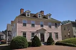 Hart-Rice House, located within the district | |
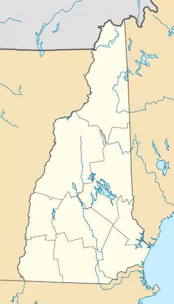  | |
| Location | Bounded by Deer St., High St., the former location of School St., and a line running parallel to High St., Portsmouth, NH[1]:5 |
|---|---|
| Coordinates | 43.07862°N 70.75997°W[lower-alpha 1] |
| Architectural style | Greek Revival, Late Victorian, Federal |
| NRHP reference No. | 72001570 |
| Significant dates | |
| Added to NRHP | March 24, 1972[1]:18 |
| Removed from NRHP | 1999 |
History
Documents with the National Archives and Records Administration show that the district was nominated for inclusion to the NRHP in February 1972, at which time local authorities were "submitting funding requests to HUD, for which National Register status is a criteria."[1]:14–15 The district was added to the NRHP on March 24, 1972.[1]:18 The district was described as "an artificial entity created by the relocation of all but four of its fourteen buildings."[1]:3
In June 1975, the nomination was returned by the Keeper of the Register, recommending that the buildings in the district be nominated individually.[1]:3–4 In December 1975, 13 of the 14 buildings were to be sold at auction, due to breach of mortgage conditions.[2] Although the "return" of the nomination occurred in June 1975, National Park Service records indicate a de-listing date of 1999.[3] A nearby retail and business complex was known as the Portsmouth Parade Office Center.[4]
Individually listed buildings
Multiple buildings in the district are individually listed in the NRHP:
| Building | Address | NRHP listing date |
|---|---|---|
| Samuel Beck House | 410 The Hill | April 3, 1973 |
| Jeremiah Hart House | The Hill | November 14, 1972 |
| John Hart House | 403 The Hill | November 14, 1972 |
| Phoebe Hart House | The Hill | April 2, 1973 |
| Hart-Rice House | 408 The Hill | August 7, 1972 |
| James Neal House | 74 Deer St. | August 7, 1972 |
| Nutter-Rymes House | 409 The Hill | November 3, 1972 |
| Daniel Pinkham House | 400 The Hill | November 3, 1972 |
| Henry Sherburne House | 62 Deer St. | August 7, 1972 |
| Simeon P. Smith House | 154 High St. | November 14, 1972 |
| Whidden-Ward House | 411 High St. | November 5, 1971 |
Notes
- Coordinates in archival documents—43°04′44″N 70°45′41″W—resolve 100 yards (91 m) west of the district.[1] :10
- Archival documents more generally refer to the Vaughn Street Area Urban Renewal Project.[1]:14–15
References
- "New Hampshire Portsmouth Parade Historic District: Withdrawn". archives.gov. National Archives and Records Administration. Retrieved January 12, 2021.
- "'The Hill' going under hammer". The Portsmouth Herald. Portsmouth, New Hampshire. December 9, 1975. p. 1. Retrieved January 10, 2021 – via newspapers.com.
- "Spreadsheet of Removed properties". NPS.gov. October 2019. Retrieved January 8, 2021.
- "Portsmouth Parade". The Boston Globe. October 29, 1978. p. I-5. Retrieved January 10, 2021 – via newspapers.com.