National Register of Historic Places listings in Rockingham County, New Hampshire
This is a list of the National Register of Historic Places listings in Rockingham County, New Hampshire.
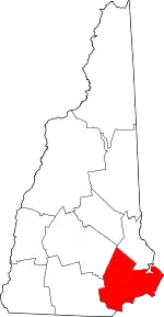
Location of Rockingham County in New Hampshire
This is intended to be a complete list of the properties and districts on the National Register of Historic Places in Rockingham County, New Hampshire, United States. Latitude and longitude coordinates are provided for many National Register properties and districts; these locations may be seen together in a map.[1]
There are 130 properties and districts listed on the National Register in the county, including 12 National Historic Landmarks.
| Belknap - Carroll - Cheshire - Coos - Grafton - Hillsborough - Merrimack - Rockingham - Strafford - Sullivan |
- This National Park Service list is complete through NPS recent listings posted January 29, 2021.[2]
Current listings
| [3] | Name on the Register[4] | Image | Date listed[5] | Location | City or town | Description |
|---|---|---|---|---|---|---|
| 1 | Adams Memorial Building |  Adams Memorial Building |
January 11, 1982 (#82001875) |
West Broadway 42°52′48″N 71°19′44″W |
Derry | |
| 2 | Armstrong Memorial Building | 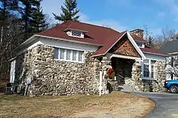 Armstrong Memorial Building |
September 11, 2018 (#100002974) |
3 N Lowell Rd. 42°48′19″N 71°17′58″W |
Windham | |
| 3 | Atkinson Academy School | 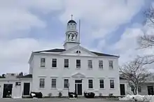 Atkinson Academy School |
August 26, 1980 (#80000297) |
Academy Ave. 42°50′23″N 71°08′49″W |
Atkinson | |
| 4 | Atlantic Heights Development | 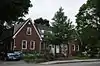 Atlantic Heights Development |
September 20, 2006 (#06000869) |
Concord, Crescent, Falkland, Kearsarge, Porpoise, Preble, Raleigh, and Saratoga Ways 43°05′33″N 70°46′22″W |
Portsmouth | |
| 5 | Josiah Bartlett House |  Josiah Bartlett House |
November 11, 1971 (#71000050) |
Main St. 42°56′11″N 71°03′18″W |
Kingston | |
| 6 | Bartlett-Cushman House |  Bartlett-Cushman House |
October 8, 2014 (#14000844) |
82 Portsmouth Ave. 43°00′44″N 70°55′02″W |
Stratham | |
| 7 | The Beach Club |  The Beach Club |
December 24, 2013 (#13000974) |
2450 Ocean Blvd. 42°58′41″N 70°45′55″W |
Rye | |
| 8 | Samuel Beck House |  Samuel Beck House |
April 3, 1973 (#73000167) |
410 The Hill 43°04′42″N 70°45′36″W |
Portsmouth | |
| 9 | Benedict House |  Benedict House |
May 11, 1973 (#73000168) |
30 Middle St. 43°04′31″N 70°45′41″W |
Portsmouth | |
| 10 | Centennial Hall | 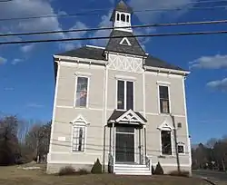 Centennial Hall |
April 5, 2016 (#16000144) |
105 Post Rd. 42°58′43″N 70°50′45″W |
North Hampton | |
| 11 | Chester Congregational Church | 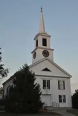 Chester Congregational Church |
June 5, 1986 (#86001231) |
4 Chester St. 42°57′28″N 71°15′27″W |
Chester | |
| 12 | Chester Village Cemetery | 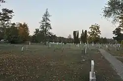 Chester Village Cemetery |
November 29, 1979 (#79000203) |
NH 102 and NH 121 42°57′27″N 71°15′22″W |
Chester | |
| 13 | John Crockett House | 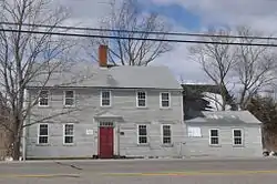 John Crockett House |
March 24, 1983 (#83001144) |
245 Portsmouth Ave. 43°02′26″N 70°53′59″W |
Stratham | |
| 14 | Capt. Jonathan Currier House | 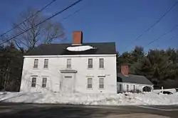 Capt. Jonathan Currier House |
April 11, 1983 (#83001145) |
Hilldale Ave. 42°52′34″N 71°00′08″W |
South Hampton | |
| 15 | Dame School | 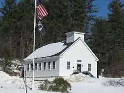 Dame School |
October 30, 1980 (#80000298) |
NH 152 43°07′14″N 71°06′10″W |
Nottingham | |
| 16 | Danville Meetinghouse | 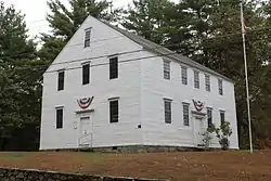 Danville Meetinghouse |
April 19, 1982 (#82001876) |
N. Main St. 42°56′14″N 71°07′08″W |
Danville | |
| 17 | Danville Town House | 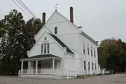 Danville Town House |
December 1, 2000 (#00001465) |
210 Main St., NH 111A 42°54′54″N 71°07′24″W |
Danville | |
| 18 | Deerfield Center Historic District |  Deerfield Center Historic District |
September 14, 2002 (#02000958) |
1 Candia Rd., 1-14 Old Center Road South 43°08′00″N 71°14′37″W |
Deerfield | Not to be confused with the Old Deerfield Center Historic District |
| 19 | Drake Farm |  Drake Farm |
September 20, 2016 (#16000645) |
148 Lafayette Rd. 42°59′22″N 70°49′20″W |
North Hampton | |
| 20 | Dudley House |  Dudley House |
June 21, 1971 (#71000051) |
14 Front St. 42°58′49″N 70°56′49″W |
Exeter | |
| 21 | East Derry Historic District |  East Derry Historic District |
August 10, 1982 (#82004991) |
Roughly bounded by Hampstead, Lane, and Cemetery Rds. 42°53′33″N 71°17′33″W |
East Derry | |
| 22 | John Elkins Farmstead |  John Elkins Farmstead |
August 30, 1996 (#96000955) |
155 Beach Plain Rd. 42°56′39″N 71°06′07″W |
Danville | Listed at 156 Beach Plain Rd. |
| 23 | Elm Farm |  Elm Farm |
January 22, 1988 (#88000191) |
599 Main St. 42°56′58″N 71°08′00″W |
Danville | |
| 24 | Emery Farm |  Emery Farm |
September 18, 2017 (#100001621) |
16 Emery Ln. 43°01′01″N 70°55′01″W |
Stratham | |
| 25 | Exeter Waterfront Commercial Historic District |  Exeter Waterfront Commercial Historic District |
December 3, 1980 (#80000299) |
Chestnut Hill Ave. and Water, Franklin, Pleasant, High, and Chestnut Sts. 42°58′57″N 70°56′49″W |
Exeter | Boundary Increase (added 1986-12-29): Chestnut St. |
| 26 | First Church | 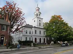 First Church |
September 10, 1971 (#71000052) |
21 Front St. 42°58′50″N 70°56′51″W |
Exeter | |
| 27 | First Universalist Church | 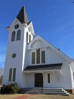 First Universalist Church |
December 26, 1979 (#79000204) |
Main St. 42°56′00″N 71°03′15″W |
Kingston | |
| 28 | Fort Constitution | 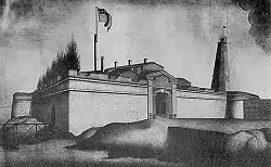 Fort Constitution |
July 9, 1973 (#73000169) |
Walbach St. 43°04′17″N 70°42′37″W |
New Castle | |
| 29 | Franklin Block | 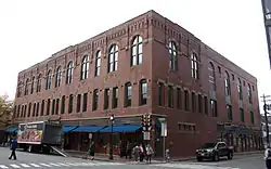 Franklin Block |
June 7, 1984 (#84003228) |
75 Congress St. 43°04′36″N 70°45′35″W |
Portsmouth | |
| 30 | Freewill Baptist Church-Peoples Baptist Church-New Hope Church | 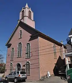 Freewill Baptist Church-Peoples Baptist Church-New Hope Church |
September 13, 2003 (#03000925) |
45 Pearl St. 43°04′32″N 70°45′49″W |
Portsmouth | |
| 31 | Fremont Meeting House | 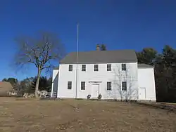 Fremont Meeting House |
May 27, 1993 (#93000461) |
464 Main St. 42°58′59″N 71°07′44″W |
Fremont | |
| 32 | Front Street Historic District | 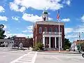 Front Street Historic District |
July 5, 1973 (#73000270) |
Front St. between its junctions with Spring and Water Sts. 42°58′45″N 70°57′04″W |
Exeter | |
| 33 | Robert Frost Homestead | 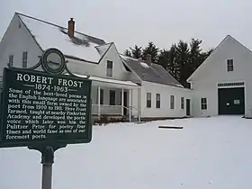 Robert Frost Homestead |
May 23, 1968 (#68000008) |
2 mi (3.2 km) southeast of Derry 42°52′18″N 71°17′40″W |
Derry | Home of poet Robert Frost |
| 34 | Gilman Garrison House | 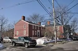 Gilman Garrison House |
September 27, 1976 (#76000131) |
12 Water St. 42°58′50″N 70°56′42″W |
Exeter | |
| 35 | Maj. John Gilman House | 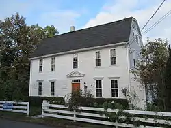 Maj. John Gilman House |
June 14, 1988 (#88000659) |
25 Cass St. 42°59′03″N 70°57′16″W |
Exeter | |
| 36 | Greeley House | 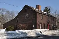 Greeley House |
June 16, 1980 (#80000300) |
East of East Kingston on NH 108 42°55′18″N 70°59′43″W |
East Kingston | |
| 37 | Hampstead Meetinghouse | 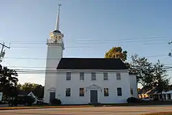 Hampstead Meetinghouse |
April 10, 1980 (#80000301) |
Emerson Ave. 42°52′32″N 71°10′48″W |
Hampstead | |
| 38 | Jeremiah Hart House | 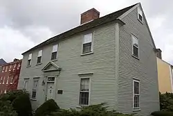 Jeremiah Hart House |
November 14, 1972 (#72000081) |
The Hill 43°04′43″N 70°45′36″W |
Portsmouth | |
| 39 | John Hart House | 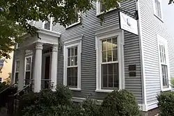 John Hart House |
November 14, 1972 (#72000082) |
403 The Hill 43°04′43″N 70°45′37″W |
Portsmouth | |
| 40 | Phoebe Hart House | 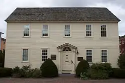 Phoebe Hart House |
April 2, 1973 (#73000170) |
The Hill 43°04′43″N 70°45′36″W |
Portsmouth | |
| 41 | Hart-Rice House | 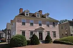 Hart-Rice House |
August 7, 1972 (#72000083) |
408 The Hill 43°04′43″N 70°45′36″W |
Portsmouth | |
| 42 | Haven-White House | 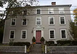 Haven-White House |
June 6, 1985 (#85001195) |
229 Pleasant St. 43°04′24″N 70°45′17″W |
Portsmouth | |
| 43 | Highland Road Historic District | 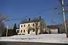 Highland Road Historic District |
April 11, 1983 (#83001146) |
Highland and Woodman Rds. 42°53′43″N 70°56′05″W |
South Hampton | |
| 44 | Isles of Shoals | 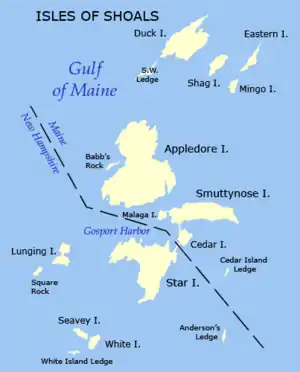 Isles of Shoals |
December 10, 1980 (#80000419) |
Off the coast 42°58′34″N 70°37′14″W |
Rye | Extends into Kittery, Maine |
| 45 | Richard Jackson House |  Richard Jackson House |
November 24, 1968 (#68000009) |
Northwest St. 43°04′51″N 70°45′59″W |
Portsmouth | Oldest surviving wooden house in New Hampshire, built 1664 |
| 46 | Benjamin James House | 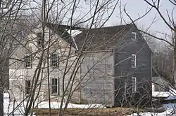 Benjamin James House |
March 13, 2002 (#02000168) |
186 Towle Farm Rd. 42°56′31″N 70°51′44″W |
Hampton | |
| 47 | Jewell Town District |  Jewell Town District |
April 11, 1983 (#83001147) |
W. Whitehall Rd. and Jewell St. 42°52′22″N 70°58′08″W |
South Hampton | |
| 48 | John Paul Jones House | 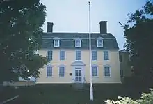 John Paul Jones House |
November 28, 1972 (#72000084) |
Middle and State Sts. 43°04′31″N 70°45′39″W |
Portsmouth | American Revolutionary War naval hero John Paul Jones boarded here in 1781-82, while supervising construction of a new battleship, the America. |
| 49 | Kensington Social Library | 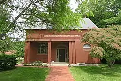 Kensington Social Library |
March 27, 2020 (#100005160) |
126 Amesbury Rd. 42°55′42″N 70°56′37″W |
Kensington | |
| 50 | Kensington Town House | 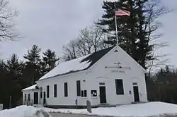 Kensington Town House |
April 9, 2013 (#13000155) |
95 Amesbury Rd. 42°55′54″N 70°56′43″W |
Kensington | |
| 51 | Ladd-Gilman House | 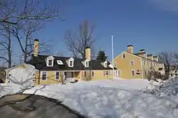 Ladd-Gilman House |
December 2, 1974 (#74002055) |
Governors Lane and Water St. 42°58′54″N 70°56′57″W |
Exeter | Now part of the American Independence Museum |
| 52 | Reuben Lamprey Homestead | 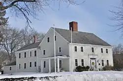 Reuben Lamprey Homestead |
November 9, 1982 (#82000624) |
416 Winnacunnet Rd. 42°55′51″N 70°48′46″W |
Hampton | |
| 53 | Deacon Samuel and Jabez Lane Homestead | 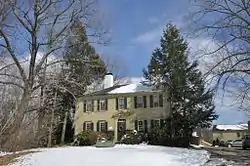 Deacon Samuel and Jabez Lane Homestead |
April 8, 1983 (#83001148) |
Portsmouth Ave. 43°01′22″N 70°55′00″W |
Stratham | |
| 54 | Gov. John Langdon Mansion | 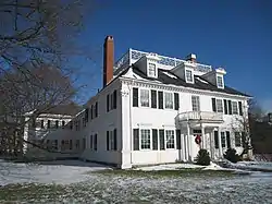 Gov. John Langdon Mansion |
December 2, 1974 (#74000197) |
143 Pleasant St. 43°04′31″N 70°45′23″W |
Portsmouth | Great Georgian house built in 1784, home of John Langdon |
| 55 | Larkin-Rice House | 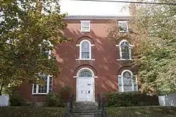 Larkin-Rice House |
November 29, 1979 (#79000205) |
180 Middle St. 43°04′24″N 70°45′43″W |
Portsmouth | |
| 56 | Little Boar's Head Historic District | 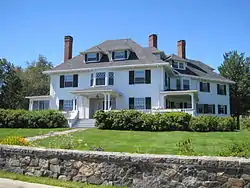 Little Boar's Head Historic District |
June 3, 1999 (#99000668) |
Parts of Atlantic Ave., Chapel Rd., Ocean Blvd., Sea Rd., and Willow Ave. 42°57′36″N 70°46′45″W |
North Hampton | |
| 57 | Elijah Locke House | 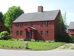 Elijah Locke House |
December 19, 1979 (#79000206) |
5 Grove Rd. 42°59′45″N 70°46′29″W |
Rye | |
| 58 | MacPheadris-Warner House | 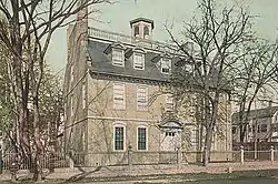 MacPheadris-Warner House |
October 15, 1966 (#66000028) |
Chapel and Daniel Sts. 43°04′41″N 70°45′18″W |
Portsmouth | |
| 59 | Richman Margeson Estate | 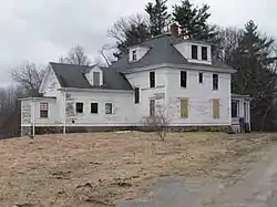 Richman Margeson Estate |
June 21, 1990 (#90000873) |
Long Point Rd. near Great Bay shore 43°04′45″N 70°51′29″W |
Newington | Now in the Great Bay National Wildlife Refuge; no public access as of 2012 |
| 60 | Moffatt-Ladd House | 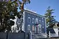 Moffatt-Ladd House |
November 24, 1968 (#68000010) |
154 Market St. 43°04′44″N 70°45′32″W |
Portsmouth | |
| 61 | Moses-Kent House | 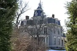 Moses-Kent House |
September 12, 1985 (#85002184) |
1 Pine St. 42°58′36″N 70°57′18″W |
Exeter | |
| 62 | James Neal House | 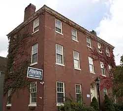 James Neal House |
August 7, 1972 (#72000112) |
74 Deer St. 43°04′44″N 70°45′37″W |
Portsmouth | |
| 63 | New Castle Congregational Church | 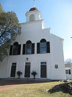 New Castle Congregational Church |
February 2, 2015 (#14001241) |
65 Main St. 43°04′16″N 70°42′59″W |
New Castle | |
| 64 | New Hampshire Bank Building | .JPG.webp) New Hampshire Bank Building |
September 10, 1979 (#79000207) |
22-26 Market Sq. 43°04′37″N 70°45′27″W |
Portsmouth | |
| 65 | Newington Center Historic District |  Newington Center Historic District |
November 30, 1987 (#87002106) |
272-336, 305-353 Nimble Hill Rd.; also Merrimac Drive, north of Short St. 43°05′58″N 70°50′00″W |
Newington | Second set of addresses represents a boundary increase |
| 66 | Newington Railroad Depot |  Newington Railroad Depot |
April 19, 2010 (#10000187) |
Bloody Point Rd. 43°07′00″N 70°49′15″W |
Newington | |
| 67 | Newmarket Industrial and Commercial Historic District |  Newmarket Industrial and Commercial Historic District |
December 1, 1980 (#80000302) |
NH 108 43°04′47″N 70°56′14″W |
Newmarket | |
| 68 | Nichols Memorial Library |  Nichols Memorial Library |
January 28, 1981 (#81000076) |
Main St. 42°56′12″N 71°03′12″W |
Kingston | |
| 69 | North Hampton Library |  North Hampton Library |
February 5, 2014 (#13001149) |
237 Atlantic Ave. 42°58′24″N 70°49′50″W |
North Hampton | |
| 70 | North Hampton Town Hall | 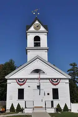 North Hampton Town Hall |
February 13, 2013 (#13000006) |
231 Atlantic Ave. 42°58′24″N 70°49′46″W |
North Hampton | |
| 71 | North School | 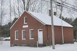 North School |
February 13, 2013 (#13000007) |
63 Amesbury Rd. 42°56′22″N 70°56′58″W |
Kensington | |
| 72 | Northwood Congregational Church | 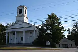 Northwood Congregational Church |
November 30, 1979 (#79000208) |
U.S. Route 4 43°13′02″N 71°12′32″W |
Northwood | |
| 73 | Nutter-Rymes House | 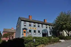 Nutter-Rymes House |
November 3, 1972 (#72000085) |
409 The Hill 43°04′42″N 70°45′36″W |
Portsmouth | |
| 74 | Old Deerfield Center Historic District | April 6, 2020 (#100005162) |
51, 58, 68, 70 Church St.; 23 Lang Rd.; 49, 51, 53 Meetinghouse Hill Rd.; 8, 20, 24, Mt. Delight Rd.; Cemetery, north side of Meetinghouse Hill Rd. 43°08′42″N 71°15′14″W |
Deerfield | Not to be confused with the Deerfield Center Historic District | |
| 75 | Old North Cemetery | 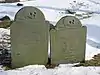 Old North Cemetery |
March 8, 1978 (#78000218) |
Maplewood Ave. 43°04′41″N 70°45′48″W |
Portsmouth | |
| 76 | Parsons Homestead | 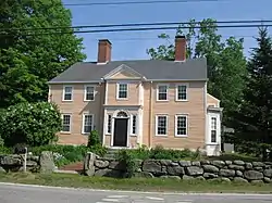 Parsons Homestead |
December 5, 1980 (#80000420) |
520 Washington Rd. 43°00′49″N 70°46′14″W |
Rye | |
| 77 | Daniel Pinkham House | 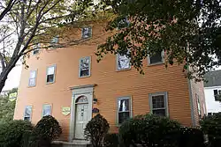 Daniel Pinkham House |
November 3, 1972 (#72000086) |
400 The Hill 43°04′43″N 70°45′38″W |
Portsmouth | |
| 78 | Plaistow Carhouse | 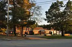 Plaistow Carhouse |
December 10, 1980 (#80000303) |
27 Elm St. 42°50′21″N 71°05′33″W |
Plaistow | Now houses Plaistow police and fire services |
| 79 | General Porter House | 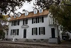 General Porter House |
October 11, 1985 (#85003359) |
32-34 Livermore St. 43°04′24″N 70°45′16″W |
Portsmouth | |
| 80 | Portsmouth Athenaeum | 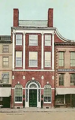 Portsmouth Athenaeum |
May 24, 1973 (#73000171) |
9 Market Sq. 43°04′37″N 70°45′29″W |
Portsmouth | |
| 81 | Portsmouth Cottage Hospital | 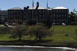 Portsmouth Cottage Hospital |
September 13, 1996 (#96000954) |
Junkins Ave., southern side of South Mill Pond 43°04′14″N 70°45′17″W |
Portsmouth | |
| 82 | Portsmouth Downtown Historic District | 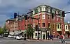 Portsmouth Downtown Historic District |
June 19, 2017 (#16000820) |
Downtown Portsmouth 43°04′37″N 70°45′27″W |
Portsmouth | |
| 83 | Portsmouth Harbor Light | 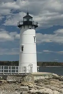 Portsmouth Harbor Light |
October 8, 2009 (#09000816) |
0.3 miles (0.48 km) east of the Route 1B junction with Wentworth Rd., at the southeastern corner of Fort Constitution 43°04′16″N 70°42′31″W |
New Castle | |
| 84 | Portsmouth Public Library | 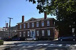 Portsmouth Public Library |
March 20, 1973 (#73000172) |
8 Islington St. 43°04′31″N 70°45′41″W |
Portsmouth | Listing is for old library building, formerly the Portsmouth Academy, now Discover Portsmouth |
| 85 | Benjamin Franklin Prescott House | 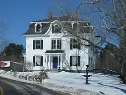 Benjamin Franklin Prescott House |
December 3, 1987 (#87002069) |
Prescott Rd. 43°03′02″N 71°05′55″W |
Epping | |
| 86 | Pulpit Rock Base-End Station (N. 142) | 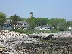 Pulpit Rock Base-End Station (N. 142) |
April 16, 2010 (#10000188) |
9 Davis Rd. 43°02′00″N 70°43′10″W |
Rye | |
| 87 | Raymond Boston and Maine Railroad Depot | 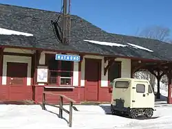 Raymond Boston and Maine Railroad Depot |
May 16, 1979 (#79000209) |
Main St. 43°02′09″N 71°10′53″W |
Raymond | |
| 88 | Rockingham Hotel | 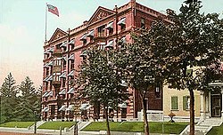 Rockingham Hotel |
March 11, 1982 (#82001693) |
401 State St. 43°04′31″N 70°45′34″W |
Portsmouth | |
| 89 | George Rogers House |  George Rogers House |
June 7, 1976 (#76000132) |
76 Northwest St. 43°04′53″N 70°46′00″W |
Portsmouth | |
| 90 | Rundlet-May House | 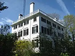 Rundlet-May House |
June 7, 1976 (#76000133) |
364 Middle St. 43°04′16″N 70°45′47″W |
Portsmouth | |
| 91 | Rye Town Hall | 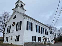 Rye Town Hall |
October 29, 2020 (#100005705) |
10 Central Rd. 43°00′37″N 70°46′25″W |
Rye | |
| 92 | St. Andrew's-by-the-Sea | .jpg.webp) St. Andrew's-by-the-Sea |
December 13, 2001 (#01001352) |
Church Rd., 0.2 mi (0.32 km) southwest of its junction with South Rd. and NH 1A 42°58′27″N 70°46′02″W |
Rye | |
| 93 | St. John's Church | 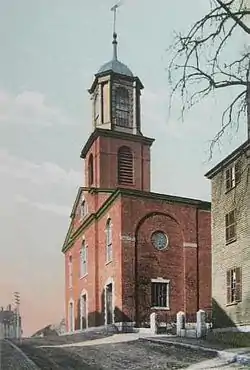 St. John's Church |
January 31, 1978 (#78000417) |
105 Chapel St. 43°04′42″N 70°45′20″W |
Portsmouth | |
| 94 | Salem Common Historic District | 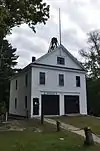 Salem Common Historic District |
April 15, 2011 (#11000190) |
304, 310, 312 Main St. 42°47′22″N 71°12′01″W |
Salem | |
| 95 | Sanborn Seminary | 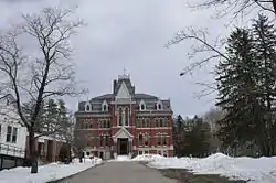 Sanborn Seminary |
March 15, 1984 (#84003233) |
178 Main St. 42°56′21″N 71°03′16″W |
Kingston | |
| 96 | Sandown Depot, Boston and Maine Railroad | 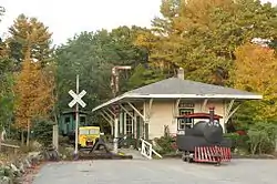 Sandown Depot, Boston and Maine Railroad |
September 4, 1986 (#86002167) |
Depot Rd. 42°55′46″N 71°11′08″W |
Sandown | |
| 97 | Sandown Old Meetinghouse | 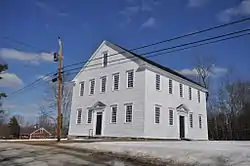 Sandown Old Meetinghouse |
August 9, 1978 (#78000219) |
Fremont Rd. 42°55′58″N 71°11′10″W |
Sandown | |
| 98 | Scamman Farm | 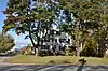 Scamman Farm |
April 4, 2019 (#100003597) |
69 Portsmouth Ave. 43°00′33″N 70°55′07″W |
Stratham | |
| 99 | Searles School and Chapel | 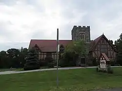 Searles School and Chapel |
January 11, 1982 (#82001694) |
Range and Searles Rds. 42°48′31″N 71°15′27″W |
Windham | |
| 100 | Edward Sewall Garrison | 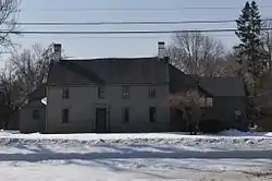 Edward Sewall Garrison |
January 11, 1980 (#80000304) |
16 Epping Rd. 42°59′02″N 70°57′37″W |
Exeter | |
| 101 | Shapley Town House | 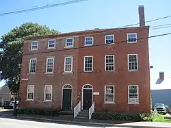 Shapley Town House |
February 28, 1973 (#73000173) |
454-456 Court St. 43°04′37″N 70°45′14″W |
Portsmouth | |
| 102 | Henry Sherburne House | 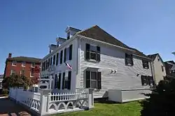 Henry Sherburne House |
August 7, 1972 (#72000087) |
62 Deer St., The Hill 43°04′43″N 70°45′37″W |
Portsmouth | |
| 103 | Smith's Corner Historic District | 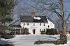 Smith's Corner Historic District |
April 11, 1983 (#83001149) |
Main Ave., South, Stagecoach, and Chase Rds. 42°53′28″N 70°59′30″W |
South Hampton | |
| 103 | Simeon P. Smith House | 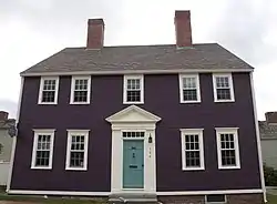 Simeon P. Smith House |
November 14, 1972 (#72000088) |
154 High St., The Hill 43°04′43″N 70°45′35″W |
Portsmouth | |
| 104 | Smyth Public Library | 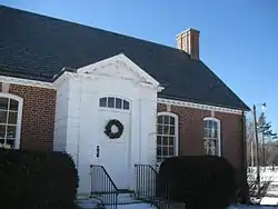 Smyth Public Library |
September 13, 2007 (#07000948) |
194 High St. 43°03′47″N 71°18′10″W |
Candia | |
| 105 | South Meetinghouse | 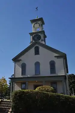 South Meetinghouse |
April 19, 1982 (#82001695) |
Marcy St. and Meeting House Hill 43°04′29″N 70°45′10″W |
Portsmouth | |
| 106 | South Parish | 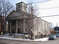 South Parish |
August 21, 1979 (#79000210) |
292 State St. 43°04′32″N 70°45′29″W |
Portsmouth | |
| 107 | Square Schoolhouse |  Square Schoolhouse |
April 17, 1980 (#80000305) |
NH 156 and Ledge Farm Rd. 43°06′11″N 71°06′34″W |
Nottingham | |
| 108 | Stevens Memorial Hall | 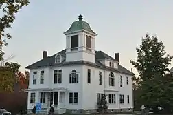 Stevens Memorial Hall |
September 10, 2004 (#04000963) |
Junction of NH 102 and NH 121 42°57′25″N 71°15′29″W |
Chester | |
| 109 | Stone School | 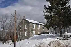 Stone School |
July 12, 1978 (#78000418) |
Granite St. 43°04′44″N 70°56′18″W |
Newmarket | Now houses the local historical society museum |
| 110 | Strawbery Banke Historic District | 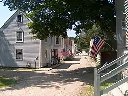 Strawbery Banke Historic District |
June 20, 1975 (#75000236) |
Bounded by Court and Marcy Sts. and both sides of Hancock and Washington Sts. 43°04′33″N 70°45′14″W |
Portsmouth | |
| 111 | Samuel Tenney House | 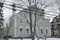 Samuel Tenney House |
November 25, 1980 (#80000306) |
65 High St. 42°58′49″N 70°56′23″W |
Exeter | |
| 112 | Matthew Thornton House | 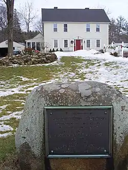 Matthew Thornton House |
November 11, 1971 (#71000053) |
2 Thornton St. 42°53′38″N 71°18′46″W |
Derry Village | |
| 113 | Town Center Historic District | Town Center Historic District |
April 11, 1983 (#83001150) |
Main and Hilldale Aves. and Jewell St. 42°52′52″N 70°57′47″W |
South Hampton | |
| 114 | Town House |  Town House |
April 17, 1980 (#80000307) |
Old Centre Rd. 43°07′59″N 71°14′37″W |
Deerfield | |
| 115 | Union Meetinghouse-Universalist Church |  Union Meetinghouse-Universalist Church |
February 13, 2013 (#13000008) |
97 Amesbury Rd. 42°55′53″N 70°56′43″W |
Kensington | |
| 116 | Unitarian Church |  Unitarian Church |
December 13, 1984 (#84000558) |
Exeter Rd. 42°56′00″N 70°53′23″W |
Hampton Falls | |
| 117 | USS ALBACORE | %252C_launching_1953.jpg.webp) USS ALBACORE |
April 11, 1989 (#89001077) |
Portsmouth Maritime Museum 43°04′58″N 70°46′00″W |
Portsmouth | |
| 118 | Watson Academy | 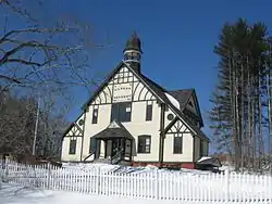 Watson Academy |
November 9, 1982 (#82000625) |
Academy St. 43°02′36″N 71°04′33″W |
Epping | |
| 119 | Gov. Meshech Weare House | 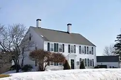 Gov. Meshech Weare House |
June 29, 1973 (#73000174) |
Exeter Rd. (NH 88) 42°55′02″N 70°52′00″W |
Hampton Falls | |
| 120 | Weeks House | 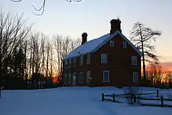 Weeks House |
June 20, 1975 (#75000131) |
Weeks Ave. off NH 33 43°02′16″N 70°50′26″W |
Greenland | |
| 121 | Gov. John Wentworth House | 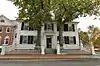 Gov. John Wentworth House |
June 29, 1973 (#73000175) |
346 Pleasant St. 43°04′25″N 70°45′14″W |
Portsmouth | Also known as the Mark Wentworth House |
| 122 | Wentworth-Coolidge Mansion | 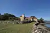 Wentworth-Coolidge Mansion |
November 24, 1968 (#68000011) |
2 mi (3.2 km) south of Portsmouth, off NH 1A 43°03′42″N 70°44′20″W |
Portsmouth | |
| 123 | Wentworth-Gardner and Tobias Lear Houses | 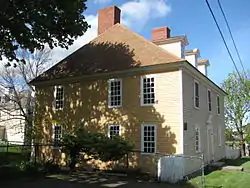 Wentworth-Gardner and Tobias Lear Houses |
October 30, 1979 (#79000319) |
Mechanic and Gardner Sts. 43°04′28″N 70°45′02″W |
Portsmouth | |
| 124 | Wentworth-Gardner House | 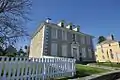 Wentworth-Gardner House |
November 24, 1968 (#68000012) |
140 Mechanic St. 43°04′28″N 70°45′02″W |
Portsmouth | |
| 125 | Whidden-Ward House | 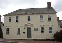 Whidden-Ward House |
November 5, 1971 (#71000077) |
411 High St. (The Hill) 43°04′43″N 70°45′34″W |
Portsmouth | |
| 126 | Wiggin Memorial Library | 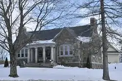 Wiggin Memorial Library |
December 10, 1993 (#93001381) |
158 Portsmouth Ave. 43°01′30″N 70°54′42″W |
Stratham | Now houses the Stratham Historical Society |
| 127 | Cornet Thomas Wiggin House | 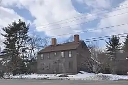 Cornet Thomas Wiggin House |
March 24, 1983 (#83001151) |
249 Portsmouth Ave. 43°02′27″N 70°53′56″W |
Stratham | |
| 128 | Woodman Road Historic District | 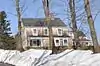 Woodman Road Historic District |
April 11, 1983 (#83001152) |
Woodman Rd. 42°53′11″N 70°56′21″W |
South Hampton | |
| 129 | Gen. Mason J. Young House | 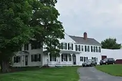 Gen. Mason J. Young House |
February 27, 1986 (#86000281) |
4 Young Rd. 42°50′41″N 71°21′56″W |
Londonderry |
Former listings
Two properties in the county have been de-listed from the register:[6]
| [3] | Name on the Register | Image | Date listed | Date removed | Location | City or town | Summary |
|---|---|---|---|---|---|---|---|
| 1 | Portsmouth Parade Historic District | Portsmouth Parade Historic District |
March 24, 1972[7] (#72001570) | 1999 | along Deer & High Sts. 43°04′43″N 70°45′36″W |
Portsmouth | Grouping of 14 structures, many of which are individually NRHP-listed, created during the Vaughn Street Area Urban Renewal Project |
| 2 | Joshua Wentworth House | Joshua Wentworth House |
July 2, 1971[8] (#71001097) | 1975 | 119 Hanover St. 43°04′39″N 70°45′37″W |
Portsmouth | Relocated in 1973 via barge to Hancock Street, during the Vaughn Street Area Urban Renewal Project |
See also
| Wikimedia Commons has media related to National Register of Historic Places in Rockingham County, New Hampshire. |
References
- The latitude and longitude information provided in this table was derived originally from the National Register Information System, which has been found to be fairly accurate for about 99% of listings. Some locations in this table may have been corrected to current GPS standards.
- "National Register of Historic Places: Weekly List Actions". National Park Service, United States Department of the Interior. Retrieved on January 29, 2021.
- Numbers represent an alphabetical ordering by significant words. Various colorings, defined here, differentiate National Historic Landmarks and historic districts from other NRHP buildings, structures, sites or objects.
- "National Register Information System". National Register of Historic Places. National Park Service. April 24, 2008.
- The eight-digit number below each date is the number assigned to each location in the National Register Information System database, which can be viewed by clicking the number.
- "Spreadsheet of Removed properties". NPS.gov. October 2019. Retrieved January 8, 2021.
- "New Hampshire Portsmouth Parade Historic District: Withdrawn". archives.gov. National Archives and Records Administration. p. 18. Retrieved January 12, 2021.
- "PHA Seeks Funds for House Move". The Portsmouth Herald. Portsmouth, New Hampshire. September 16, 1972. p. 15. Retrieved December 27, 2020 – via newspapers.com.
| Topics |  | |
|---|---|---|
| Lists by county | ||
| Other lists | ||
| ||
Municipalities and communities of Rockingham County, New Hampshire, United States | ||
|---|---|---|
| City | Map of New Hampshire highlighting Rockingham County | |
| Towns |
| |
| CDPs | ||
| Other villages | ||
| ||
This article is issued from Wikipedia. The text is licensed under Creative Commons - Attribution - Sharealike. Additional terms may apply for the media files.