Prepotto
Prepotto (Slovene: Prapotno; Friulian: Prapot) is a comune (municipality) in the Province of Udine in the Italian region Friuli-Venezia Giulia, located about 50 kilometres (31 mi) northwest of Trieste and about 20 kilometres (12 mi) east of Udine, on the border with Slovenia. As of 31 December 2004, it had a population of 894 and an area of 33.2 square kilometres (12.8 sq mi).[3]
Prepotto
| |
|---|---|
| Comune di Prepotto | |
 The monastery of Castelmonte (Stara Gora) in Prepotto municipality | |
Location of Prepotto 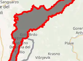
| |
 Prepotto Location of Prepotto in Italy 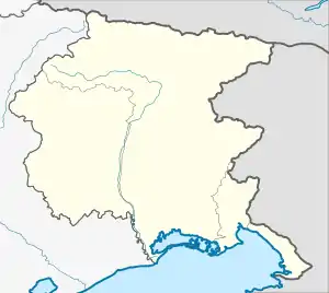 Prepotto Prepotto (Friuli-Venezia Giulia) | |
| Coordinates: 46°3′N 13°29′E | |
| Country | Italy |
| Region | Friuli-Venezia Giulia |
| Province | Province of Udine (UD) |
| Area | |
| • Total | 33.2 km2 (12.8 sq mi) |
| Population (Dec. 2004)[2] | |
| • Total | 894 |
| • Density | 27/km2 (70/sq mi) |
| Time zone | UTC+1 (CET) |
| • Summer (DST) | UTC+2 (CEST) |
| Postal code | 33040 |
| Dialing code | 0432 |
.jpg.webp)
Prepotto
Prepotto borders the following municipalities: Brda (Slovenia), Kanal ob Soči (Slovenia), Cividale del Friuli, Corno di Rosazzo, Dolegna del Collio, San Leonardo, San Pietro al Natisone, Stregna.
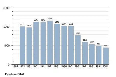
Demographic evolution
See also
References
- "Superficie di Comuni Province e Regioni italiane al 9 ottobre 2011". Istat. Retrieved 16 March 2019.
- "Popolazione Residente al 1° Gennaio 2018". Istat. Retrieved 16 March 2019.
- All demographics and other statistics: Italian statistical institute Istat.

This article is issued from Wikipedia. The text is licensed under Creative Commons - Attribution - Sharealike. Additional terms may apply for the media files.