Prewitt, New Mexico
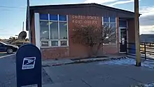
Prewitt is an unincorporated community in McKinley County, New Mexico, United States.[1] Prewitt is located along Interstate 40, 18.4 miles (29.6 km) northwest of Grants. Prewitt has a post office with ZIP code 87045.[2][3]
Prewitt, New Mexico | |
|---|---|
| Nickname(s): Baca | |
 Prewitt, New Mexico | |
| Coordinates: 35°21′46″N 108°02′38″W | |
| Country | United States |
| State | New Mexico |
| County | McKinley |
| Elevation | 6,827 ft (2,081 m) |
| Time zone | UTC-7 (Mountain (MST)) |
| • Summer (DST) | UTC-6 (MDT) |
| ZIP code | 87045 |
| Area code(s) | 505 |
| GNIS feature ID | 909850[1] |
Geography
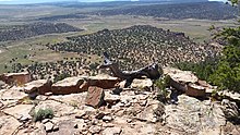
Prewitt is within the Baca/Prewitt (Kin Łigaaí) Chapter House boundary in the "Checkerboard Area" of the Navajo Nation.[4][5] This means that Prewitt lies within the external boundaries of the Navajo Nation, but contains a mix of tribal, BLM, state, and private lands. It is a part of the Zuni Uplift,[6] and is characterized by piñon/juniper woodland, red rock hoodoos, mesas, and desert grasslands.[7]
Demographics
| Estimate | Percent | |
|---|---|---|
| Total Population | 1572 | 100% |
| Male | 773 | 49.2% |
| Female | 799 | 50.8% |
| White | 25 | 1.6% |
| African American | 0 | 0% |
| American Indian | 1493 | 95% |
| Asian | 0 | 0% |
| Native Pacific Islander | 1 | <.1% |
| Some Other Race | 28 | 1.8% |
| Two or More Races | 25 | 1.6% |
| Hispanic of Any Race | 21 | 1.3% |
| Citizens of Voting Age | 1172 | 75% |
| Total Housing Units | 731 | -- |

Education
Prewitt is the home of Baca /Dlo'Ay Azhi Community School run by the Bureau of Indian Education. Baca /Dlo'Ay Azhi Community School serves grades K-6. The Associated Deputy Director for this school is Navajo Schools in Window Rock, AZ and the Education Resource Center is Crownpoint.[9]
Points of Interest
Notable People
- Paddy Martinez, prospector who discovered uranium at Haystack Mesa[10]
References
- "Prewitt". Geographic Names Information System. United States Geological Survey.
- United States Postal Service (2012). "USPS - Look Up a ZIP Code". Retrieved 2012-02-15.
- "Postmaster Finder - Post Offices by ZIP Code". United States Postal Service. Retrieved August 24, 2013.
- "Checkerboard Reservation, New Mexico | The Tony Hillerman Portal". ehillerman.unm.edu. Retrieved 2020-12-31.
- "Baca / Prewitt |". Retrieved 2021-01-01.
- Kelley, Vincent C. (1967). "Tectonics of the Zuni-Defiance Regiod, New Mexico and Arizona" (PDF). New Mexico Geological Society Publications. Retrieved 2020-01-17.
- Kelley, Vincent C. (1967). "Tectonics of the Zuni-Defiance region, New Mexico and Arizona" (PDF). Retrieved 2020-12-31.
- "American Community Survey Demographic and Housing Estimates". data.census.gov. Retrieved 2020-12-31.
- "U.S. Department of the Interior - Bureau of Indian Education". BIE Schools Directory | Bureau of Indian Education. Retrieved 2020-12-31.
- "Where it all started". www.navajotimes.com. Retrieved 2020-12-31.
Municipalities and communities of McKinley County, New Mexico, United States | ||
|---|---|---|
| City | 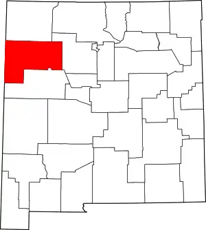 Map of New Mexico highlighting McKinley County | |
| CDPs | ||
| Unincorporated communities | ||
| Indian reservation | ||
| Footnotes | ‡This populated place also has portions in an adjacent county or counties | |
| ||
| Authority control |
|
|---|