Priestwood
Priestwood is a suburb of Bracknell, Berkshire about 1 mile (1.6 km) northwest of the town centre.
| Priestwood | |
|---|---|
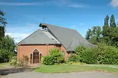
 St Andrew's parish church | |
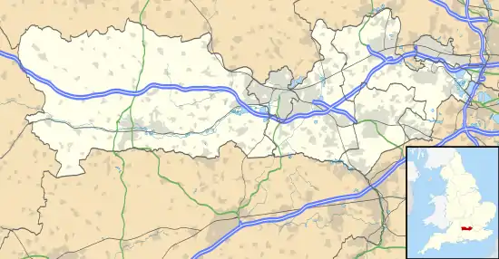
 Priestwood Location within Berkshire | |
| OS grid reference | SU861697 |
| Metropolitan borough | |
| Metropolitan county | |
| Region | |
| Country | England |
| Sovereign state | United Kingdom |
| Post town | Bracknell |
| Postcode district | RG42 |
| Dialling code | 01344 |
| Police | Thames Valley |
| Fire | Royal Berkshire |
| Ambulance | South Central |
| UK Parliament | |
Churches
The original Church of England parish church of Saint Andrew was simple Gothic Revival building designed by the architect H.G.W. Drinkwater and completed in 1888.[1] After its centenary the building was demolished and replaced with a new church that was consecrated in April 1990. St. Andrew's is now part of the Bracknell Team Ministry.[2]
Bracknell Methodist Church is also in Priestwood.[3]
Amenities
Meadow Vale Primary School is in the centre of Priestwood.[4] It has begun an expansion project to enable it to have three classes in each year.[5]
Blue Mountain Golf Club is near Priestwood.[6]
Priestwood has four local nature reserves, three of them Temple Copse, Jock's Copse & Tinkers Copse are known collectively as The Three Copses.[7][8][9][10] The other Nature reserve is called Piggy Wood.[11]
References
- Pevsner 1966, pp. 93–94.
- Bracknell Team Ministry Archived 2010-01-25 at the Wayback Machine
- Bracknell Methodist Church
- Meadow Vale Primary School
- "Meadow Vale Expansion Project". Meadow Vale Primary School. Archived from the original on 30 March 2012. Retrieved 30 August 2012.
- Blue Mountain Golf Club
- "The Three Copses: Parks to visit - Bracknell Forest Council". Bracknell-forest.gov.uk. Archived from the original on 27 April 2017. Retrieved 25 April 2017.
- "Magic Map Application - Tinkers copse". Magic.defra.gov.uk. Retrieved 26 April 2017.
- "Magic Map Application - Temple copse". Magic.defra.gov.uk. Retrieved 26 April 2017.
- "Magic Map Application - Jocks copse". Magic.defra.gov.uk. Retrieved 26 April 2017.
- Magic Map Application - Piggy Wood
Sources
- Pevsner, Nikolaus (1966). Berkshire. The Buildings of England. Harmondsworth: Penguin Books. pp. 93–94.
