Puerto Alegría
Puerto Alegría (Spanish pronunciation: [ˈpweɾto aleˈɣɾi.a]) is a town and municipality in the Colombian Department of Amazonas. Puerto Alegria was founded by Orlando Benjumea and Reinaldo Martínez, and officially recognized by the Colombian government as a municipality on January 1, 1981. The area contributes to Colombia's agricultural industry with its cultivation of yucca, corn, plantains, fruits, and avocado farms; it also produces livestock such as laying hens, cows, and pigs.[2] The town of Puerto Alegria has a population of 1,531 people, and has a population density of just 0.2/ km2 . Overall, it has a land area of 8,774.00 square kilometers (3,387.66 sq mi) and reaches an altitude of 156 meters above sea level. Ingrid Camacho Nini Stella is the town's mayor.[3]
Puerto Alegría | |
|---|---|
Municipality and town | |
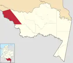 Location of the municipality and town of Puerto Alegría in the Amazonas Department of Colombia | |
 Puerto Alegría Location in Colombia | |
| Coordinates: 1°02′S 74°02′W | |
| Country | |
| Department | Amazonas Department |
| Population (2005) | |
| • Total | 1,277[1] |
| Time zone | UTC-5 (Colombia Standard Time) |
| Climate | Af |
Climate
Puerto Alegría has a tropical rainforest climate (Af) with heavy to very heavy rainfall year-round.
| Climate data for Puerto Alegría | |||||||||||||
|---|---|---|---|---|---|---|---|---|---|---|---|---|---|
| Month | Jan | Feb | Mar | Apr | May | Jun | Jul | Aug | Sep | Oct | Nov | Dec | Year |
| Average high °C (°F) | 31.7 (89.1) |
31.6 (88.9) |
31.4 (88.5) |
31.1 (88.0) |
30.9 (87.6) |
29.4 (84.9) |
29.1 (84.4) |
30.6 (87.1) |
31.1 (88.0) |
30.5 (86.9) |
31.3 (88.3) |
31.2 (88.2) |
30.8 (87.5) |
| Daily mean °C (°F) | 27.1 (80.8) |
26.7 (80.1) |
26.6 (79.9) |
26.5 (79.7) |
26.6 (79.9) |
25.4 (77.7) |
24.9 (76.8) |
25.6 (78.1) |
26.0 (78.8) |
26.3 (79.3) |
27.2 (81.0) |
26.5 (79.7) |
26.3 (79.3) |
| Average low °C (°F) | 22.5 (72.5) |
21.9 (71.4) |
21.9 (71.4) |
21.9 (71.4) |
22.4 (72.3) |
21.4 (70.5) |
20.8 (69.4) |
20.7 (69.3) |
21.0 (69.8) |
22.1 (71.8) |
23.1 (73.6) |
21.9 (71.4) |
21.8 (71.2) |
| Average rainfall mm (inches) | 188.6 (7.43) |
256.1 (10.08) |
314.7 (12.39) |
376.3 (14.81) |
398.7 (15.70) |
362.5 (14.27) |
337.5 (13.29) |
276.2 (10.87) |
281.6 (11.09) |
262.6 (10.34) |
263.3 (10.37) |
273.0 (10.75) |
3,591.1 (141.39) |
| Average rainy days | 12 | 13 | 16 | 17 | 20 | 19 | 17 | 15 | 15 | 14 | 14 | 13 | 185 |
| Source 1: IDEAM[4] | |||||||||||||
| Source 2: Climate-Data.org[5] | |||||||||||||
References
- "Population of Puerto Alegría". citypopulation.de. Retrieved 2020-08-20.
- "Nuestro Departamento". www.amazonas.gov.co. Retrieved 2015-11-29.
- "Puerto Alegría, Amazonas, Colombia - Ciudades y pueblos del mundo". es.db-city.com. Retrieved 2015-11-29.
- "Data". www.ideam.gov.co. Retrieved 2020-08-19.
- "Climate: Puerto Alegría". Climate-Data.org. Retrieved August 19, 2020.