Puerto Nariño
Puerto Nariño is the second municipality of the Amazonas department of Colombia, located on the shore of the Amazon River.
Puerto Nariño | |
|---|---|
Municipality and town | |
 | |
.svg.png.webp) Flag  Seal | |
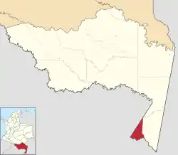 Location of the municipality and town of Puerto Nariño in the Amazonas Department of Colombia | |
 Puerto Nariño Location in Colombia | |
| Coordinates: 3°46′24″S 70°22′55″W | |
| Country | |
| Department | Amazonas Department |
| Area | |
| • Total | 1,876 km2 (724 sq mi) |
| Time zone | UTC-5 (Colombia Standard Time) |
| Climate | Af |
It has about 6,000 residents, most of them are indigenous (from the Ticuna tribe) and its specificity is that it is entirely pedestrian, no car or motorcycle being allowed, as an experiment in an ecological community. The traffic with the smaller communities along the river, and with Leticia, the only other Colombian municipality in the region, takes place by motorboats.
Its name comes from a famous Colombian general, Antonio Nariño, who took an active part in the independence war against the Spanish occupiers.

Geography
Puerto Nariño is the second municipality of the Amazonas department. It is on the edge of the River Loretoyaco, 87 km from Leticia and 1240 km from Bogota. The average temperature is 30°C.
History
The town was founded on 1961 August 18 by a doctor named Jose Humberto Espejo Hernandez.
Climate
Puerto Nariño has a tropical rainforest climate (Af) with heavy to very heavy rainfall year-round.
| Climate data for Puerto Nariño | |||||||||||||
|---|---|---|---|---|---|---|---|---|---|---|---|---|---|
| Month | Jan | Feb | Mar | Apr | May | Jun | Jul | Aug | Sep | Oct | Nov | Dec | Year |
| Average high °C (°F) | 30.7 (87.3) |
30.8 (87.4) |
30.7 (87.3) |
30.5 (86.9) |
30.1 (86.2) |
29.7 (85.5) |
29.9 (85.8) |
30.7 (87.3) |
31.0 (87.8) |
31.2 (88.2) |
31.2 (88.2) |
31.0 (87.8) |
30.6 (87.1) |
| Daily mean °C (°F) | 26.1 (79.0) |
26.1 (79.0) |
26.2 (79.2) |
25.9 (78.6) |
25.7 (78.3) |
25.3 (77.5) |
25.1 (77.2) |
25.7 (78.3) |
25.9 (78.6) |
26.3 (79.3) |
26.4 (79.5) |
26.2 (79.2) |
25.9 (78.6) |
| Average low °C (°F) | 21.5 (70.7) |
21.5 (70.7) |
21.7 (71.1) |
21.4 (70.5) |
21.4 (70.5) |
20.9 (69.6) |
20.3 (68.5) |
20.8 (69.4) |
20.9 (69.6) |
21.5 (70.7) |
21.7 (71.1) |
21.5 (70.7) |
21.3 (70.3) |
| Average rainfall mm (inches) | 349.7 (13.77) |
304.0 (11.97) |
300.9 (11.85) |
323.8 (12.75) |
290.7 (11.44) |
250.6 (9.87) |
151.8 (5.98) |
138.3 (5.44) |
193.2 (7.61) |
203.1 (8.00) |
193.2 (7.61) |
349.2 (13.75) |
3,048.5 (120.04) |
| Average rainy days | 19 | 17 | 15 | 16 | 17 | 15 | 10 | 9 | 12 | 13 | 12 | 19 | 174 |
| Source 1: IDEAM[1] | |||||||||||||
| Source 2: Climate-Data.org[2] | |||||||||||||
References
- "Data". www.ideam.gov.co. Retrieved 2020-08-21.
- "Climate: Puerto Nariño". Climate-Data.org. Retrieved August 21, 2020.
