Pukerimu
Pukerimu is a rural locality in the Waipa District and Waikato region of New Zealand's North Island.
Pukerimu | |
|---|---|
Village | |
| |
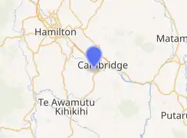
| Coordinates: 37.905°S 175.433°E | |
| Country | New Zealand |
| Region | Waikato Region |
| District | Waipa District |
| Population (2018 census) | |
| • Territorial | 204 |
| Time zone | UTC+12 (NZST) |
| • Summer (DST) | UTC+13 (NZDT) |
It is located southwest of Cambridge
The name is Māori and comes from a rimu tree on a small hill (puke), which was a landmark for travellers before European settlement.[1]
History
The area was densely populated and farmed by Māori before European settlement. The Waikato River allowed movement to other parts of the country. In 1864 as part of the Invasion of the Waikato, British forces landed at Pukerimu and built redoubts on each side of the river. From 1865, European settlers, some of them soldiers from the invasion, farmed the land.[1]
A church was built in 1871 and shared between Methodists and Presbyterians. It moved to Kaipaki in 1901, and in 1928, it was replaced with a new church which was also used by Anglicans.[1][2]
Demographics
| Year | Pop. | ±% p.a. |
|---|---|---|
| 2006 | 732 | — |
| 2013 | 870 | +2.50% |
| 2018 | 900 | +0.68% |
| Source: [5] | ||
The statistical area of Pukerimu, which at 77 square kilometres is much larger than the locality, extends southwest and southeast of Cambridge, and also includes the localities of Monavale and Pukekura. It had a population of 900 at the 2018 New Zealand census, an increase of 30 people (3.4%) since the 2013 census, and an increase of 168 people (23.0%) since the 2006 census. There were 318 households. There were 462 males and 438 females, giving a sex ratio of 1.05 males per female. The median age was 39.2 years (compared with 37.4 years nationally), with 192 people (21.3%) aged under 15 years, 171 (19.0%) aged 15 to 29, 426 (47.3%) aged 30 to 64, and 108 (12.0%) aged 65 or older.
Ethnicities were 95.3% European/Pākehā, 7.7% Māori, 1.7% Pacific peoples, 2.7% Asian, and 1.7% other ethnicities (totals add to more than 100% since people could identify with multiple ethnicities).
The proportion of people born overseas was 22.7%, compared with 27.1% nationally.
Although some people objected to giving their religion, 53.3% had no religion, 38.3% were Christian, 0.3% were Muslim, 0.3% were Buddhist and 1.0% had other religions.
Of those at least 15 years old, 156 (22.0%) people had a bachelor or higher degree, and 108 (15.3%) people had no formal qualifications. The median income was $41,500, compared with $31,800 nationally. The employment status of those at least 15 was that 426 (60.2%) people were employed full-time, 123 (17.4%) were part-time, and 24 (3.4%) were unemployed.[5]
Pukerimu locality is in meshblocks 4005297 and 4005303, which had a population of 204 people in the 2018 census.[6]
References
- Parker, Eris (2003). "Pukerimu – Kaipaki". Cambridge Museum.
- Wood, Jesse (10 September 2020). "The 'accidental' Pastor and the 800 per cent growth of a rural Waikato church". Te Awamutu Courier.
- Parker, Eris. "Pukerimu School". Cambridge Museum. Retrieved 6 November 2020.
- "About Us". Kaipaki School. Retrieved 6 November 2020.
- "Statistical area 1 dataset for 2018 Census". Statistics New Zealand. March 2020. Pukerimu (183100). 2018 Census place summary: Pukerimu
- "Meshblock Electoral Populations 2020 for proposed boundaries data". Statistics New Zealand. April 2020. Meshblocks 4005297 and 4005303.
