Putnam, Texas
Putnam is a town in Callahan County, Texas, United States. The population was 94 at the 2010 census.[5] It is part of the Abilene, Texas Metropolitan Statistical Area.
Putnam, Texas | |
|---|---|
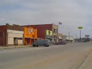 Downtown Putnam | |
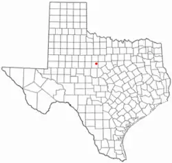 Location of Putnam, Texas | |
 | |
| Coordinates: 32°22′14″N 99°11′41″W | |
| Country | United States |
| State | Texas |
| County | Callahan |
| Area | |
| • Total | 1.01 sq mi (2.62 km2) |
| • Land | 1.01 sq mi (2.62 km2) |
| • Water | 0.00 sq mi (0.00 km2) |
| Elevation | 1,608 ft (490 m) |
| Population (2010) | |
| • Total | 94 |
| • Estimate (2019)[2] | 93 |
| • Density | 91.81/sq mi (35.45/km2) |
| Time zone | UTC-6 (Central (CST)) |
| • Summer (DST) | UTC-5 (CDT) |
| ZIP code | 76469 |
| Area code(s) | 325 |
| FIPS code | 48-59984[3] |
| GNIS feature ID | 1344639[4] |
Geography
Putnam is located in northeastern Callahan County at 32°22′14″N 99°11′41″W (32.370560, −99.194613).[6] Interstate 20 passes through the town, leading west 12 miles (19 km) to Baird, the county seat, and east 12 miles to Cisco.
According to the United States Census Bureau, the town has a total area of 1.0 square mile (2.6 km2), all of it land.[5]
Climate
The climate in this area is characterized by hot summers and generally mild to cool winters. According to the Köppen Climate Classification system, Putnam has a humid subtropical climate, abbreviated "Cfa" on climate maps.[7]
Demographics
| Historical population | |||
|---|---|---|---|
| Census | Pop. | %± | |
| 1930 | 601 | — | |
| 1940 | 487 | −19.0% | |
| 1950 | 289 | −40.7% | |
| 1960 | 203 | −29.8% | |
| 1970 | 134 | −34.0% | |
| 1980 | 116 | −13.4% | |
| 1990 | 103 | −11.2% | |
| 2000 | 88 | −14.6% | |
| 2010 | 94 | 6.8% | |
| 2019 (est.) | 93 | [2] | −1.1% |
| U.S. Decennial Census[8] | |||
As of the census[3] of 2000, there were 88 people, 39 households, and 23 families residing in the town. The population density was 86.9 people per square mile (33.6/km2). There were 56 housing units at an average density of 55.3 per square mile (21.4/km2). The racial makeup of the town was 96.59% White, 1.14% Asian, 2.27% from other races. Hispanic or Latino of any race were 3.41% of the population.
There were 39 households, out of which 17.9% had children under the age of 18 living with them, 59.0% were married couples living together, 2.6% had a female householder with no husband present, and 38.5% were non-families. 33.3% of all households were made up of individuals, and 17.9% had someone living alone who was 65 years of age or older. The average household size was 2.26 and the average family size was 2.79.
In the town, the population was spread out, with 15.9% under the age of 18, 11.4% from 18 to 24, 22.7% from 25 to 44, 33.0% from 45 to 64, and 17.0% who were 65 years of age or older. The median age was 45 years. For every 100 females, there were 95.6 males. For every 100 females age 18 and over, there were 94.7 males.
The median income for a household in the town was $21,875, and the median income for a family was $31,250. Males had a median income of $35,833 versus $17,917 for females. The per capita income for the town was $13,562. There were 21.7% of families and 28.0% of the population living below the poverty line, including 33.3% of under eighteens and 15.0% of those over 64.
Education
The town of Putnam is served by the Baird Independent School District.
Notable people
- Larry L. King, writer and playwright, author of The Best Little Whorehouse in Texas, was born in Putnam in 1929.
- Stan Williams, American football player.
References
- "2019 U.S. Gazetteer Files". United States Census Bureau. Retrieved August 7, 2020.
- "Population and Housing Unit Estimates". United States Census Bureau. May 24, 2020. Retrieved May 27, 2020.
- "U.S. Census website". United States Census Bureau. Retrieved 2008-01-31.
- "US Board on Geographic Names". United States Geological Survey. 2007-10-25. Retrieved 2008-01-31.
- "Geographic Identifiers: 2010 Census Summary File 1 (G001): Putnam town, Texas". U.S. Census Bureau, American Factfinder. Archived from the original on February 13, 2020. Retrieved July 8, 2015.
- "US Gazetteer files: 2010, 2000, and 1990". United States Census Bureau. 2011-02-12. Retrieved 2011-04-23.
- Climate Summary for Putnam, Texas
- "Census of Population and Housing". Census.gov. Retrieved June 4, 2015.
Municipalities and communities of Callahan County, Texas, United States | ||
|---|---|---|
| Cities | 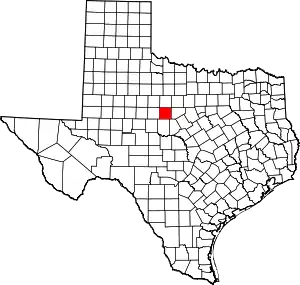 Callahan County map | |
| Towns | ||
| Unincorporated communities | ||
| Ghost towns | ||
| ||
| Authority control |
|---|
