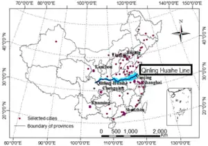
Qinling–Huaihe Line
The Qinling–Huaihe Line (Chinese: 秦岭淮河线; pinyin: Qínlǐng Huáihé Xiàn) is a reference line used by geographers to distinguish between northern and southern China, corresponding roughly to the 33rd parallel.[1][2] Qinling refers to the Qin Mountains, and Huaihe refers to the Huai River.[3] Running from Qin Mountain in the west to Huai River in the east, it divides eastern China into northern and southern regions that differ from each other in climate, culture, lifestyle, and cuisine.
Regions north of the Line tend to be temperate or continental, with snow being a regular feature in winter. Regions south of the Line tend to be subtropical or tropical. In general, the southern region is hotter and wetter than the northern region.
Historically, due to being the Cradle of Chinese Civilization, the North had always been more developed than the South, but much has changed in recent times. Currently, three of the four most developed Tier 1 cities in China are in the South. It was in the Ming dynasty that the economy of the South started to outpace the economy of the North.[1][4]
Nowadays, due to better transport infrastructure and increased economic activities between different Chinese regions, most Chinese people acknowledge that the differences within the Chinese society do not fall neatly into the traditional "north and south" divisions anymore.
History and use
The Qinling–Huaihe Line was first drawn by Chinese geographer Zhang Xiangwen in 1908, defining north China as anything above a line running along the Qinling Mountains in the west and the Huai River the east.[5]
In the 1950s, Premier Zhou Enlai used the line to create a subsidized district heating system only in the colder north, a system still in effect today.[6][7] This has also led to the north to suffer from heavy air pollution due to coal heating plants, but the south to suffer from lack of heating during the winter months.[8]
The line also represents the 800mm annual precipitation line of China.[9]
See also
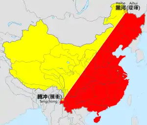
- Heihe–Tengchong Line, divides China in eastern and western halves
- Mason–Dixon line, North American counterpart
References
- Shuangshuang, LI; Saini, YANG; Xianfeng, LIU (10 September 2015). "Spatiotemporal variability of extreme precipitation in north and south of the Qinling-Huaihe region and influencing factors during 1960-2013". The Chinese Journal of Geography. 34 (3): 354–363. Retrieved 25 May 2017.
- Kemp, John (2014-05-22). "For 'dirty man of Asia,' Russian gas deal offers clean solution". The Japan Times Online. ISSN 0447-5763. Retrieved 2018-04-04.
- Xingzhong, Liu. "Fungal diversity in China". www.mycolab.org.cn/. State Key Laboratory of Mycology. Retrieved 25 May 2017.
- "Living Below China's Qinling-Huaihe Line Leaves Many Southerners in the Cold". www.journalism.hkbu.edu.hk. Hong Kong University. 30 August 2013. Retrieved 25 May 2017.
- "China's unlikely divide over home heat". The National. Retrieved 2018-04-04.
- Feng, Hao (2017-12-14). "Three-year cut to life expectancy from coal heating". Eco-Business. Retrieved 2018-04-04.
- hermesauto (2018-01-04). "Old central heating rule leaves old Shanghai neighbourhood shivering in winter". The Straits Times. Retrieved 2018-04-04.
- Huang, Zheping. "Northern China's dilemma—if you want heat in the winter, it comes with toxic air pollution — Quartz". qz.com. Retrieved 2018-04-04.
- S.S., Li; J.P., Yan; J, Wan (1 June 2012). "The characteristics of temperature change in Qinling Mountains". Scientia Geographica Sincia. 32 (7): 853–858.
