RAF Stenigot
RAF Stenigot is a former Second World War radar station situated at Stenigot, near Donington on Bain, Lincolnshire.
| RAF Stenigot | |
|---|---|
| Stenigot, Lincolnshire. in England | |
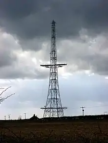 Chain Home Radar tower at RAF Stenigot | |
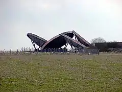 Abandoned Tropospheric scatter Dishes, once part of NATO ACE HIGH communication system, since removed for scrapping. | |
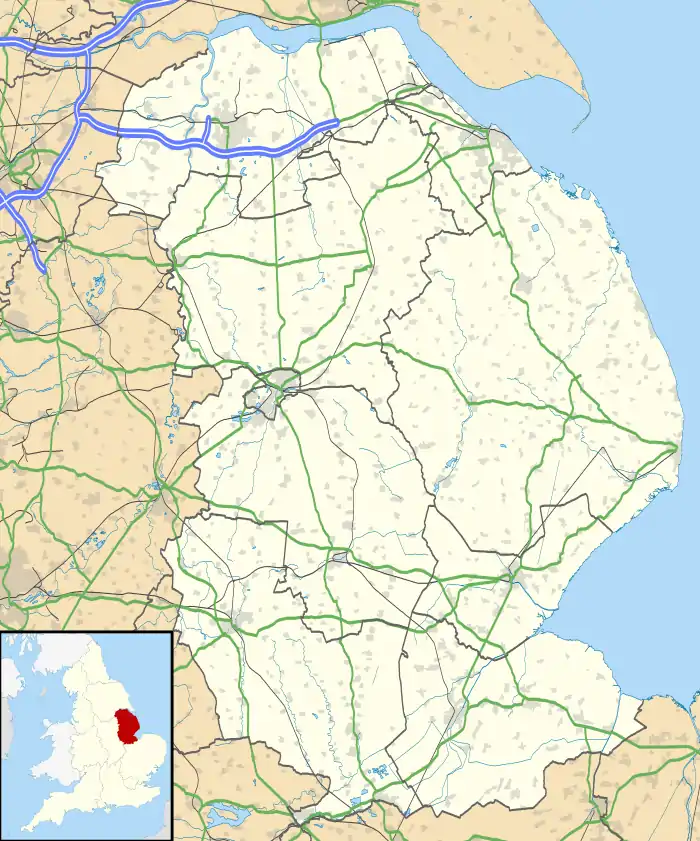 RAF Stenigot Shown within Lincolnshire | |
| Coordinates | 53.327°N 0.116°W |
| Site information | |
| Owner | Ministry of Defence |
| Operator | Royal Air Force |
| Site history | |
| Built | 1939 |
| In use | 1939-1996 |
| Battles/wars | Second World War Cold War |
It was part of the Chain Home radar network, intended to provide long range early warning for raids from Luftflotte 5 and the northern elements of Luftflotte 2 along the approaches to Sheffield and Nottingham and the central Midlands.[1]
After the Second World War, the site was retained as part of the Chain Home network. In 1959 it was upgraded to a communications relay site as part of the ACE High programme, which involved adding four tropospheric scatter dishes.[2]
The site was decommissioned in the late 1980s and was mostly demolished by 1996.
The radar tower is a Grade II listed structure and is now used by the RAF Aerial Erector School for selection tests for possible recruits, but this operation will be done elsewhere as part of MOD restructuring.
There is a memorial at the top to a former RAF aerial erector.
Demolition of three radar dishes (October 2018)
Three of four dishes on site were scrapped in the winter of 2018. A local construction firm admitted to scrapping three of the four dishes, the legality of this is disputed.[3] The first dish was removed from its supports sometime before 14 October,[4] with two more dishes being felled over the following days. The fourth and last remaining dish was removed in mid to end–November 2020.
References
- Historic England. "Stenigot (1309703)". PastScape. Retrieved 7 August 2011.
- Historic England. "Stenigot (1309788)". PastScape. Retrieved 7 August 2011.
- "Construction firm reveals what happened to three huge radar dishes removed from Lincolnshire Wolds". Retrieved 12 May 2020.
- "Photos of RAF Stenigot on 14th October 2018 (3 dishes, 1 partially demolished)". Retrieved 12 May 2020.
External links
- Site history and photographs
- Reminiscences from the 50s
- RAF Stenigot photos taken in 2007
- RAF Aerial Erector School
- RAF Stenigot - The day before the dishes fell (photos and history)
| Formations and units |
|  | ||||||
|---|---|---|---|---|---|---|---|---|
| Branches and components | ||||||||
| Reserve forces | ||||||||
| Associated civil organisations | ||||||||
| Equipment | ||||||||
| Personnel |
| |||||||
| Appointments | ||||||||
| Symbols and uniform | ||||||||
