Raesfeld
Raesfeld (German pronunciation: [ˈʁaːsfɛlt]) is a municipality in the district of Borken in the state of North Rhine-Westphalia, Germany. It is located approximately 10 km south of Borken and 30 km east of the Dutch border.
Raesfeld | |
|---|---|
 Flag  Coat of arms | |
Location of Raesfeld within Borken district 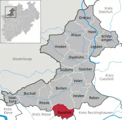 | |
 Raesfeld 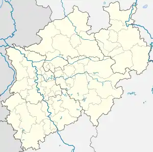 Raesfeld | |
| Coordinates: 51°46′N 6°50′E | |
| Country | Germany |
| State | North Rhine-Westphalia |
| Admin. region | Münster |
| District | Borken |
| Subdivisions | 10 |
| Government | |
| • Mayor | Andreas Grotendorst (CDU) |
| Area | |
| • Total | 57.81 km2 (22.32 sq mi) |
| Elevation | 59 m (194 ft) |
| Population (2019-12-31)[1] | |
| • Total | 11,431 |
| • Density | 200/km2 (510/sq mi) |
| Time zone | UTC+01:00 (CET) |
| • Summer (DST) | UTC+02:00 (CEST) |
| Postal codes | 46348 |
| Dialling codes | 0 28 65 |
| Vehicle registration | BOR |
| Website | www.gemeinde-raesfeld.de |
Raesfeld's landmark is the moated castle Schloss Raesfeld, originally built in the 13th century and extended and remodeled in Renaissance style in the 17th century. It is now primarily used by the state of North Rhine-Westphalia as a center for the teaching of crafts; the formal gardens have been lost, but the wildlife park has been restored and is part of the European Garden Heritage Network.
The municipality of Raesfeld includes Erle, a village within the Naturpark Hohe Mark that has an ancient oak, the Femeiche, thought to be 600–850 years old and named for Vehmic court sessions formerly held under it.
Gallery
.jpg.webp) Aerial view of Schloss Raesfeld on the outskirts of Raesfeld
Aerial view of Schloss Raesfeld on the outskirts of Raesfeld.jpg.webp) Schloss Raesfeld, east facade
Schloss Raesfeld, east facade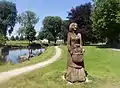 Kappes Anna (Cabbage Anna) sculpture
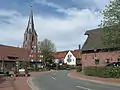 Erle, with church of St. Silvester
References
- "Bevölkerung der Gemeinden Nordrhein-Westfalens am 31. Dezember 2019" (in German). Landesbetrieb Information und Technik NRW. Retrieved 17 June 2020.
External links
- Site of the municipality (in German)
- History of the castle (in German)
- Gallery about Raesfeld in general, and the castle (in German)
- Gallery showing the castle
| Wikimedia Commons has media related to Raesfeld. |
Towns and municipalities in Borken (district) | ||
|---|---|---|
Coat of Arms of Borken district | ||
| Authority control |
|---|