Rahway River Parkway
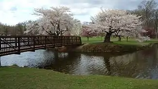
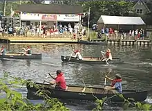
The Rahway River Parkway is a greenway of parkland along the banks the main stem Rahway River and its tributaries in Union County, New Jersey, United States. Created in the 1920s, it was one of the inaugural projects of the newly-created Union County Parks Commission. It was designed by the Olmsted Brothers firm, sons of landscape architect Frederick Law Olmsted. The Rahway River Greenway plan expands on the original design. Many of the crossings of the river are late 19th century or early 20th century bridges. The East Coast Greenway uses paths and roads along the parkway.
History

The idea for the Rahway River Parkway started in 1919 when Union County Sheriff, James E. Warner began a movement to "save" the river by writing to the local paper, The Cranford Citizen, and urging that the river be made into a memorial to the young men who had died in the recent World War I. This was followed by editorials of support in The Rahway Record, The Westfield Leader, The Cranford Citizen, and The Chronicle. On May 5, 1919, the Elizabeth Daily Journal, stated that the idea was "a duty rather than an opportunity.” The Rahway Women's Club sent a resolution of support to the Union County Board of Freeholders.[1]
The Elizabeth Chamber of Commerce had one of its members organize Union County Park Association to urge the creation of a park commission and April 1921, Superior Court Justice James J. Bergen was petitioned to appoint a temporary commission to study the feasibility of such a commission. On April 30, a temporary commission was named and given $10,000.00 and two years to complete the study. Within five months, the group finished the study and returned $8,391.00 of the funds. The emphasis of the report was to move quickly, before the available open space was gone. On the November 8, 1921, ballot, voters were asked to approve a permanent five-member Park Commission and $2.5 million to be spent at the commission's discretion.[1][2]
The Parkway was created between 1921–1929 following the design of the Olmsted Brothers, sons of landscape architect Frederick Law Olmsted.[3][4] Many of the crossings of the river are late 19th century or early 20th century bridges.[5]
Description
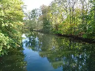
The Rahway River consists of four separate branches that converge in Rahway, from whence it flows as a single waterway to its mouth at the Arthur Kill. The longest, or West Branch, courses for 24 miles from Verona. The East Branch rises in West Orange/Montclair and joins the West Branch at Hobart Gap in Springfield forming the main stem of the river. The Nomahegan Brook and Black Brook enter soon thereafter. The original Rahway River Parkway was approximately seven miles.[6] The brooks and main stem through Union, Westfield, Springfield, Cranford, Kenilworth, Winfield, Clark, and Rahway (where it is joined by the Robinsons Branch and the South Branch)[7] The parkway comprises several county, municipal parks, and trails along the banks of the river.[8] some of which are part of the East Coast Greenway.[9][10][11] The river continues into Linden, Woodbridge and Carteret, which also have parks along it, which are part of the 21st century Rahway River Greenway Plan.[7]
Parks and features along the Rahway
Gallery
- Rahway River
 Lake Nomahegan
 Wildlife in Springfield
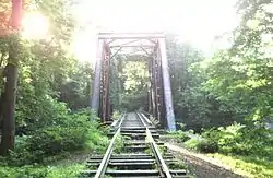 Rahway Valley Railroad Bridge
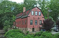 Droescher's Mill
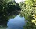 From footbridge in Cranford
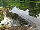 Dam in Union
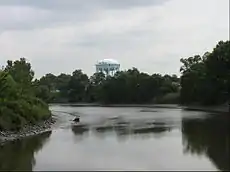 Rahway Water Tower
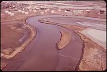 Tidal flats
See also
- Union County Park Commission Administration Buildings
- Elizabeth River Parkway
- Warinanco Park
- Watchung Reservation
- List of crossings of the Rahway River
- City Beautiful movement
- Houdaille Quarry
- Historic sites in Cranford, New Jersey
- List of bridges documented by the Historic American Engineering Record in New Jersey
References
- "The Inception of a Parkway". Friends of Rahway River Parkway. Retrieved January 11, 2017.
- It Takes a Village... and a park commission, Friends of the Rahway River Parkway. Accessed August 14, 2017.
- "A New Sports Facility Jeopardizes Rahway River Park - The Cultural Landscape Foundation". tclf.org. Retrieved January 14, 2018.
- "Percival Gallagher - The Cultural Landscape Foundation". tclf.org. Retrieved January 23, 2018.
- "Historic Bridge Survey Union County (1991-1994)" (PDF). NJDOT. 2001. Retrieved January 10, 2018.
- Federal Writers' Project, The WPA Guide to New Jersey: The Garden State (1939) ("Cranford is an old residential town spread along the Rahway River Parkway a link of nearly 7 miles joining a series of county parks and playgrounds. The name Nomahegan is a variation of Noluns Mohegans, as the New Jersey Indians were called in the treaty ending the Indian troubles in 1758. It is translated as women Mohegans or she-wolves and was applied to them in scorn by the fighting Iroquois.")
- Edward J. Bloustein School of Planning and Public Policy, Rutgers University (February 2009). Rahway River Greenway Plan (PDF) (Report). Rahway River Greenway Plan. Retrieved January 10, 2018.
- Rahway River, Union County, New Jersey. Accessed January 3, 2017.
- "New Jersey East Coast Greenway Multi-use Guide" (PDF). NJDOT. Retrieved January 14, 2018.
- "East Coast Greenway link to be completed in Union County". Retrieved January 23, 2018.
- New Jersey: Camden & Trenton to New York City
- "RVRR - Rahway River Bridge". Bridgehunter.com. Retrieved January 11, 2018.
- "Meisel Avenue Park" (PDF). Union County Department of Parks. Retrieved January 11, 2017.
- "Black Brook". Union County Department of Parks. Retrieved January 11, 2017.
- "Lenape Park" (PDF). Union County Department of Parks. Retrieved January 11, 2017.
- "Nomahegan". July 24, 2014. Retrieved January 25, 2018.
- "MacConnell Park" (PDF). Union County Department of Parks. Retrieved January 11, 2017.
- "Cranford Canoe Club". www.cranfordcanoeclub.com. Retrieved January 15, 2018.
- "Hanson Park Conservancy". Hanson Park Conservancy. Retrieved January 14, 2018.
- "Rahway River Parkway Cranford Section" (PDF). Union County Department of Parks. Retrieved January 11, 2017.
- "Rahway River Park Clark/Linden Section" (PDF). Union County Department of Parks. Retrieved January 11, 2017.
- D'Andrea, Michael Q.; Russo II, Lawrence M. (September 2016). "New Jersey's Oldest Felt Mill" (PDF). GardenStateLegacy.
- "Rahway River Park Clark Rahway" (PDF). Union County Department of Parks. Retrieved January 11, 2017.
- Yearby, Jean P. Rahway River Park, Swimming Pool, Historic American Engineering Record, Library of Congress. Accessed April 14, 2015.
- "Rahway River Park - The Cultural Landscape Foundation". tclf.org. Retrieved February 5, 2018.
- "Squires Island" (PDF). Union County Department of Parks. Retrieved January 11, 2017.
- "Rahway, NJ – Urban Floodplain Restoration – Louisiana Resiliency Assistance Program". resiliency.lsu.edu. Retrieved January 23, 2018.
- "New Park Named for Rahway Vet" (PDF). The Rahway Review. January 23, 2003.
- "NJDEP SRP - Essex Street Riverfront Park". www.nj.gov. Retrieved January 15, 2018.
- http://www.nj.com/news/local/index.ssf/2009/03/new_park_set_to_open_along_rah.html
- "Rahway Yacht Club". rahwayyachtclub.yolasite.com. Retrieved January 23, 2018.
- "Joseph Medwick Memorial Park". www.middlesexcountynj.gov. Retrieved January 23, 2018.
External links
- "History of the Union County Park System". Union County. Retrieved June 13, 2018.
- Paths, Trails and Greenways Union County
- Google: Along the Rahway River
- "Friends of Rahway River Parkway".
- Rahway River Association