Rajampet
Rajampet is a Municipality in YSR Kadapa district of the Indian state of Andhra Pradesh, located in the Rayalaseema Region. The town has an average elevation of 139 meters (456 ft). Rajampet was a Nagar panchayat[2] and upgraded as a Grade II Municipality[2] in 2019 and has an area of 35.38 square kilometres (13.66 sq mi). It consists of 20 election wards.
Rajampet
| |
|---|---|
 | |
| Nickname(s): Kuwait of India | |
| Motto(s): | |
| Anthem: "Maa Telugu Thalliki" | |
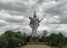
.svg.png.webp) Rajampet Location in Andhra Pradesh, India, Asia  Rajampet Rajampet (India) | |
| Coordinates: 14.195°N 79.158°E | |
| Country | |
| State | |
| Region | Rayalaseema |
| District | YSR Kadapa |
| Nagara Panchayathi | 2005 |
| Grade -II Municipality | 2019 |
| Government | |
| • Type | Municipality |
| • Body | Rajampet Municipality |
| • Chief Minister | Y. S. Jagan Mohan Reddy (YSRCP) |
| • MLA | Meda Venkata Mallikarjuna Reddy |
| • MP | P. V. Midhun Reddy |
| Area | |
| • Total | 35.38 km2 (13.66 sq mi) |
| Area rank | |
| Elevation | 139 m (456 ft) |
| Population (2011) | |
| • Total | 54,050[1] |
| • Rank | 7th place in district |
| Languages | |
| • Official | Telugu |
| • Regional | English, Hindi |
| Time zone | UTC+5:30 (IST) |
| PIN | 516115 |
| Telephone code | 08565 |
| Vehicle registration | AP-04, AP-39 |
| Currency | Indian Rupee , INR |
| Sex ratio | 742 |
| Literacy | 54.2% |
| International Airport | Tirupati Airport |
| Railway Station | Rajampet railway station |
| Police | Andhra Pradesh Police |
| Sea port | Krishnapatnam Port |
| Website | Rajampet Municipality |
Rajampet is an Assembly constituency, Lok Sabha constituency, Revenue division, and a Forest Division.[3] It is located in Rajampet mandal of Rajampeta revenue division.It is bordered by Chittoor district to the south, Nellore to the east, Ananthapur to the west, and Kurnool to the north.
Education
The primary and secondary school education is imparted by government, aided and private schools of the School Education Department of the state Government of Andhra Pradesh. The medium of instruction followed by different schools are English and Telugu. Rajampet has some of famous institution for ENGINEERING Annamacharya Institute of Technology & Sciences (AITS),[4] Narayanadri Institute of Science and Technology (NIST) [5]
Transport
Roadways
Rajampet is the entranceway to the pilgrimage site of Tirumala. National Highway NH 716 : Chennai-Kurnool Corridor, passes through the town and is well connected to all major national highways NH 40, NH 16, NH 75. The Andhra Pradesh State Road Transport Corporation operates bus services from Sri Annamayya Bus Station and from Town Old Bus Station to Major cities Kadapa, Tirupati, Nellore, Kurnool, Hyderabad, Chennai, Bengaluru, Anantapur, and to other towns and villages in the district.[6]
Railways
Rajampet has its own railway station, which is a major station in the district that comes under the South Central Railway Zone of Guntakal railway division.
Airways
Kadapa Domestic Airport, located in Kadapa city 54 kilometres (34 mi) away and, Tirupati International Airport, 90 kilometres (56 mi) away are the nearest airports to Rajampet. Local transport is available from the bus and railway stations to the airports.
Governance
Civil administration
Rajampet is a municipality of area 35.87 square kilometres (13.85 sq mi) in Kadapa District. Rajampet was a gram panchayat before 2005 and upgraded to Nagar Panchayat on 2 April 2005 up to an area of 20.60 km2 (7.95 sq mi) and in 2017 upgraded as municipality.[2][7] It consists of 20 election wards.[8] In 2019 this town was upgraded into a Grade II Municipality which is headed by a Municipal Chairman and governed by a Municipal Commissioner.
Politics
Rajampet is a Lok sabha constituency since 1957 and it is a Lok Sabha constituency of the twenty-five lok sabha constituencies from Andhra Pradesh in India. Currently P.V.Midhun Reddy Member of Parliament (India) of YSR Congress Party won from RAJAMPET LOKSABHA CONSTITUENCY from General elections which is held on 2019. Meda Venkata Mallikarjuna Reddy is the present Member of Legislative Assembly (MLA) of the Rajampet Assembly constituency for the YSR Congress Party.[9]
See also
- List of municipalities in Andhra Pradesh
References
- "Census of India Website : Office of the Registrar General & Census Commissioner, India". www.censusindia.gov.in.
- "Municipalities, Municipal Corporations & UDAs" (PDF). Directorate of Town and Country Planning. Government of Andhra Pradesh. Archived from the original (PDF) on 28 January 2016. Retrieved 29 January 2016.
- Forest division
- "Annamacharya Institute of Technology & Sciences - Rajampet". www.aitsrajampet.ac.in.
- http://www.nist.ac.in
- ""Bus Stations in Districts". Andhra Pradesh State Road Transport Corporation". Archived from the original on 22 March 2016.
- "Basic Information of Municipality". Commissioner & Director of Municipal Administration. Municipal Administration & Urban Development Department, Govt. of Andhra Pradesh. Retrieved 19 November 2014.
- "Brief about Municipality". Municipal Administration & Urban Development Department, Government of Andhra Pradesh. Retrieved 7 September 2014.
- "MLA". AP State Portal. Retrieved 13 October 2014.