Recetor
Recetor is a Colombian Municipality in the Department of Casanare, Colombia Its jurisdiction has an area of 182 square kilometers and a population of 4072. It is located on the eastern slope of the Colombian Andes, with an altitude of 800 meters. It has an average temperature of 22 degrees Celsius.
Recetor | |
|---|---|
Municipality and town | |
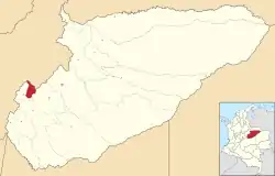 Location of the municipality and town of Recetor in the Casanare Department of Colombia. | |
| Country | |
| Department | Casanare Department |
| Time zone | UTC-5 (Colombia Standard Time) |
History
Recetor Was founded on March 17 1740 be Jesuit Missionaries, and was officially made into a municipality in 1925. The first colonists arrived from the department of Boyacá, coming mostly from the Municipalities of Miraflores, Berbeo, Paez, and Campohermosa.
Geography
Recetor has an area of 182 square kilometers, of that .5 square kilometers are urban and 181.5 square kilometers are rural. Recetor borders the department of Boyacá, to the east by the municipality of Aguazul, to the south by the municipality of Tauramena and to the southeast by the municipality of Chameza
Economy
The main economic activity is the subsistence farming, basic salt mining from wells adjacent to the Recetoreno River, coal mining, and Cattle Breeding.
