Orocué
Orocué is a town and municipality in the Department of Casanare, Colombia, located on the shore of the Meta River. Historically, it went by the name San Miguel del Macuco.[3]
Orocué | |
|---|---|
Municipality and town | |
.svg.png.webp) Flag | |
| Nickname(s): San Miguel del Macuco, Caño San Miguel | |
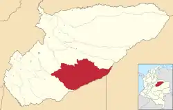 Location of the municipality and town of Orocue in the Casanare Department of Colombia | |
| Coordinates: 1°48′34″N 72°45′37″W | |
| Country | |
| Region | Orinoquía Region |
| Department | Casanare Department |
| Area | |
| • Municipality and town | 41.777 km2 (16.130 sq mi) |
| • Urban | 8.24 km2 (3.18 sq mi) |
| Elevation | 187 m (614 ft) |
| Population (2012) | |
| • Municipality and town | 8,102 |
| Time zone | UTC-5 (Colombia Standard Time) |
| Website | http://www.orocue-casanare.gov.co |
| [1][2] | |
Climate
Orocué has a tropical savanna climate (Aw) with moderate to little rainfall from December to March and heavy rainfall from April to November.
| Climate data for Orocué | |||||||||||||
|---|---|---|---|---|---|---|---|---|---|---|---|---|---|
| Month | Jan | Feb | Mar | Apr | May | Jun | Jul | Aug | Sep | Oct | Nov | Dec | Year |
| Average high °C (°F) | 32.9 (91.2) |
34.2 (93.6) |
33.8 (92.8) |
32.0 (89.6) |
30.7 (87.3) |
29.3 (84.7) |
29.2 (84.6) |
30.0 (86.0) |
30.6 (87.1) |
31.3 (88.3) |
31.6 (88.9) |
31.7 (89.1) |
31.4 (88.6) |
| Daily mean °C (°F) | 27.3 (81.1) |
28.3 (82.9) |
28.4 (83.1) |
27.3 (81.1) |
26.6 (79.9) |
25.6 (78.1) |
25.3 (77.5) |
25.8 (78.4) |
26.2 (79.2) |
26.8 (80.2) |
27.1 (80.8) |
26.9 (80.4) |
26.8 (80.2) |
| Average low °C (°F) | 21.8 (71.2) |
22.4 (72.3) |
23.0 (73.4) |
22.7 (72.9) |
22.5 (72.5) |
21.9 (71.4) |
21.5 (70.7) |
21.7 (71.1) |
21.9 (71.4) |
22.3 (72.1) |
22.6 (72.7) |
22.2 (72.0) |
22.2 (72.0) |
| Average rainfall mm (inches) | 12.5 (0.49) |
37.8 (1.49) |
76.8 (3.02) |
196.9 (7.75) |
285.1 (11.22) |
320.8 (12.63) |
253.7 (9.99) |
211.6 (8.33) |
214.7 (8.45) |
208.9 (8.22) |
138.1 (5.44) |
47.7 (1.88) |
2,004.6 (78.91) |
| Average rainy days | 1 | 3 | 6 | 13 | 18 | 19 | 19 | 18 | 15 | 13 | 10 | 4 | 139 |
| Source 1: IDEAM[5] | |||||||||||||
| Source 2: Climate-Data.org[6] | |||||||||||||
See also
References
- Municipio de Orocué
- "Orocue Map". Colombia Google Satellite Maps. Retrieved 2014-05-24.
- "A Study of the Saliba Language". World Digital Library. Retrieved 24 April 2013.
- Municipio de Orocué
- "Data". www.ideam.gov.co. Retrieved 2020-08-26.
- "Climate: Orocué". Climate-Data.org. Retrieved August 26, 2020.
External links
- Municipio de Orocué - Official website
This article is issued from Wikipedia. The text is licensed under Creative Commons - Attribution - Sharealike. Additional terms may apply for the media files.
