Redvale, Colorado
Redvale is an unincorporated town, a post office, and a census-designated place (CDP) located in Montrose County, Colorado, United States. The Redvale post office has the ZIP Code 81431.[3] At the United States Census 2010, the population of the Redvale CDP was 236, while the population of the 81431 ZIP Code Tabulation Area was 460 including adjacent areas.[4] Montrose County governs the unincorporated town.
Redvale, Colorado | |
|---|---|
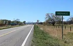 Entering Redvale from the northwest on Colorado State Highway 145. | |
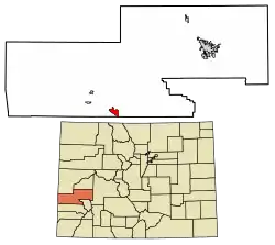 Location of the Redvale CDP in Montrose County, Colorado. | |
 Redvale Location of the Redvale CDP in the United States. | |
| Coordinates: 38°10′34″N 108°24′45″W[1] | |
| Country | |
| State | |
| County | Montrose County |
| Government | |
| • Type | unincorporated community |
| Area | |
| • Total | 4.680 sq mi (12.121 km2) |
| • Land | 4.680 sq mi (12.121 km2) |
| • Water | 0.000 sq mi (0.000 km2) |
| Population (2010) | |
| • Total | 236 |
| • Density | 50/sq mi (19/km2) |
| Time zone | UTC-7 (MST) |
| • Summer (DST) | UTC-6 (MDT) |
| ZIP Code[3] | 81431 |
| Area code(s) | 970 |
| GNIS feature[2] | Redvale CDP |
Geography
The Redvale CDP has an area of 2,995 acres (12.121 km2), all land.[1]
Demographics
The United States Census Bureau initially defined the Redvale CDP for the United States Census 2010.
| Year | Pop. | ±% |
|---|---|---|
| 2010 | 236 | — |
| 2020 | — | |
| Source: United States Census Bureau | ||
See also
- Outline of Colorado
- State of Colorado
- Colorado cities and towns
- Colorado counties
- Colorado metropolitan areas
References
- "State of Colorado Census Designated Places - BAS20 - Data as of January 1, 2020". United States Census Bureau. Retrieved December 24, 2020.
- "U.S. Board on Geographic Names: Domestic Names". United States Geological Survey. Retrieved December 24, 2020.
- "Look Up a ZIP Code". United States Postal Service. Retrieved December 24, 2020.
- "2010: DEC Summary File 1". United States Census Bureau. Retrieved December 24, 2020.
External links
- Redvale @ Colorado.com
- Redvale @ UncoverColorado.com
- Redvale, Colorado Mining Claims And Mines
- Montrose County website
Municipalities and communities of Montrose County, Colorado, United States | ||
|---|---|---|
| City | 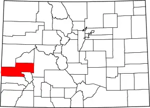 Map of Colorado highlighting Montrose County | |
| Towns | ||
| CDP | ||
| Unincorporated communities | ||
| Ghost town | ||
| ||
This article is issued from Wikipedia. The text is licensed under Creative Commons - Attribution - Sharealike. Additional terms may apply for the media files.